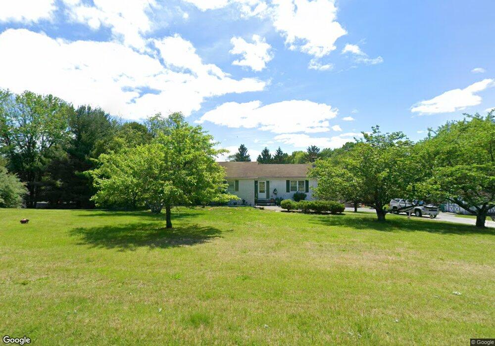
14 Upper Hill Rd Newton, NJ 07860
Estimated Value: $406,616 - $501,000
--
Bed
--
Bath
1,397
Sq Ft
$335/Sq Ft
Est. Value
About This Home
This home is located at 14 Upper Hill Rd, Newton, NJ 07860 and is currently estimated at $467,904, approximately $334 per square foot. 14 Upper Hill Rd is a home located in Sussex County with nearby schools including Fredon Township School, Kittatinny Regional High School, and Lakeland Andover School.
Ownership History
Date
Name
Owned For
Owner Type
Purchase Details
Closed on
Dec 18, 2002
Sold by
Baram Martin S and Baram Deborah A
Bought by
Ciccotelli James T and Ciccotelli Patricia
Current Estimated Value
Home Financials for this Owner
Home Financials are based on the most recent Mortgage that was taken out on this home.
Original Mortgage
$190,000
Outstanding Balance
$81,320
Interest Rate
6.19%
Mortgage Type
Purchase Money Mortgage
Estimated Equity
$386,584
Purchase Details
Closed on
Aug 28, 1998
Sold by
Trogani Stanley and Trogani Marie Elena
Bought by
Baram Martin and Baram Deborah
Home Financials for this Owner
Home Financials are based on the most recent Mortgage that was taken out on this home.
Original Mortgage
$148,400
Interest Rate
6.9%
Create a Home Valuation Report for This Property
The Home Valuation Report is an in-depth analysis detailing your home's value as well as a comparison with similar homes in the area
Home Values in the Area
Average Home Value in this Area
Purchase History
| Date | Buyer | Sale Price | Title Company |
|---|---|---|---|
| Ciccotelli James T | $258,000 | -- | |
| Baram Martin | $186,000 | -- |
Source: Public Records
Mortgage History
| Date | Status | Borrower | Loan Amount |
|---|---|---|---|
| Open | Ciccotelli James T | $190,000 | |
| Previous Owner | Baram Martin | $148,400 |
Source: Public Records
Tax History Compared to Growth
Tax History
| Year | Tax Paid | Tax Assessment Tax Assessment Total Assessment is a certain percentage of the fair market value that is determined by local assessors to be the total taxable value of land and additions on the property. | Land | Improvement |
|---|---|---|---|---|
| 2025 | $8,522 | $273,400 | $105,300 | $168,100 |
| 2024 | $8,161 | $273,400 | $105,300 | $168,100 |
| 2023 | $8,161 | $273,400 | $105,300 | $168,100 |
| 2022 | $7,997 | $273,400 | $105,300 | $168,100 |
| 2021 | $8,177 | $273,400 | $105,300 | $168,100 |
| 2020 | $8,134 | $273,400 | $105,300 | $168,100 |
| 2019 | $8,032 | $273,400 | $105,300 | $168,100 |
| 2018 | $7,896 | $273,400 | $105,300 | $168,100 |
| 2017 | $7,929 | $273,400 | $105,300 | $168,100 |
| 2016 | $7,858 | $273,400 | $105,300 | $168,100 |
| 2015 | $7,609 | $273,400 | $105,300 | $168,100 |
| 2014 | $7,480 | $273,400 | $105,300 | $168,100 |
Source: Public Records
Map
Nearby Homes
- 5 Scenic Dr
- 208 Willows Rd
- 11 Betony Ct
- 5 Augusta Ct
- 516 Ridge Rd
- 520 Ridge Rd
- 63 Van Horn Rd
- 17 Youngs Rd
- 51 Paulinskill Lake Rd
- 285 Stickles Pond Rd
- 20 Anderson Hill Rd
- 3 Roy Rd
- 5 Babbitt Ct
- 219 Woodside Ave
- 15 Bernard Dr
- 903 Cedar Dr
- 0 Martin St
- 21 Carriage Ln Unit 21
- 7 Martin St
- 40 Carriage Ln Unit 40
- 16 Upper Hill Rd
- 15 Lower Hill Rd
- 15 Upper Hill Rd
- 11 Lower Hill Rd
- 17 Lower Hill Rd
- 3 Scenic Dr
- 17 Upper Hill Rd
- 18 Upper Hill Rd
- 6 Scenic Dr
- 19 Lower Hill Rd
- 437 Ridge Rd
- 14 Lower Hill Rd
- 19 Upper Hill Rd
- 9 Lower Hill Rd
- 9 Upper Hill Rd
- 9 Scenic Dr
- 439 Ridge Rd
- 435 Ridge Rd
- 16 Lower Hill Rd
- 2 Scenic Dr