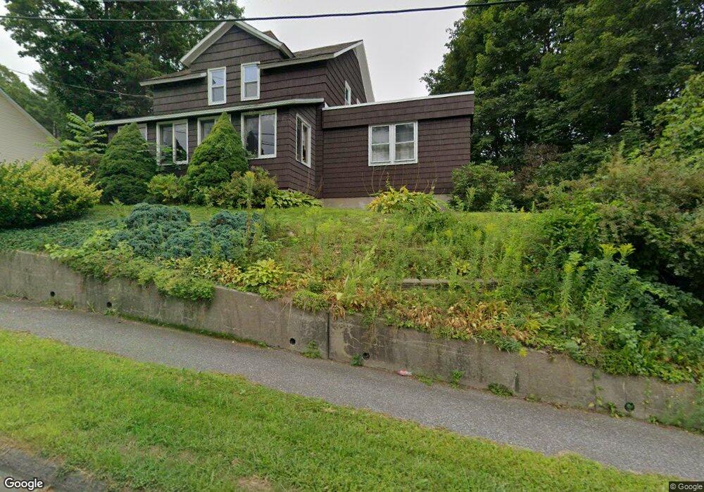
14 W Shaft Rd North Adams, MA 01247
Estimated Value: $242,000 - $318,000
2
Beds
1
Bath
1,667
Sq Ft
$160/Sq Ft
Est. Value
About This Home
This home is located at 14 W Shaft Rd, North Adams, MA 01247 and is currently estimated at $266,216, approximately $159 per square foot. 14 W Shaft Rd is a home located in Berkshire County with nearby schools including Brayton Elementary School, Drury High School, and Berkshire Arts & Technology Charter Public School.
Ownership History
Date
Name
Owned For
Owner Type
Purchase Details
Closed on
Dec 4, 2023
Sold by
Vallieres Donna L
Bought by
Vallieres Kyle D and Vareschi Mandy
Current Estimated Value
Purchase Details
Closed on
Mar 31, 2017
Sold by
Pontier Robert J and Pontier Marion P
Bought by
Pontier Ft and Pontier
Purchase Details
Closed on
May 31, 1968
Bought by
Pontier Robert J and Pontier Marion P
Create a Home Valuation Report for This Property
The Home Valuation Report is an in-depth analysis detailing your home's value as well as a comparison with similar homes in the area
Home Values in the Area
Average Home Value in this Area
Purchase History
| Date | Buyer | Sale Price | Title Company |
|---|---|---|---|
| Vallieres Kyle D | -- | None Available | |
| Vallieres Kyle D | -- | None Available | |
| Pontier Ft | -- | -- | |
| Pontier Robert J | -- | -- | |
| Pontier Ft | -- | -- |
Source: Public Records
Mortgage History
| Date | Status | Borrower | Loan Amount |
|---|---|---|---|
| Previous Owner | Pontier Robert J | $20,000 |
Source: Public Records
Tax History Compared to Growth
Tax History
| Year | Tax Paid | Tax Assessment Tax Assessment Total Assessment is a certain percentage of the fair market value that is determined by local assessors to be the total taxable value of land and additions on the property. | Land | Improvement |
|---|---|---|---|---|
| 2025 | $3,730 | $223,200 | $33,500 | $189,700 |
| 2024 | $3,503 | $204,400 | $30,600 | $173,800 |
| 2023 | $3,416 | $193,300 | $30,600 | $162,700 |
| 2022 | $1,837 | $166,200 | $30,600 | $135,600 |
| 2021 | $2,866 | $154,000 | $28,400 | $125,600 |
| 2020 | $2,758 | $148,100 | $28,200 | $119,900 |
| 2019 | $2,641 | $138,200 | $28,200 | $110,000 |
| 2018 | $2,533 | $137,800 | $29,700 | $108,100 |
| 2017 | $2,412 | $136,500 | $29,400 | $107,100 |
| 2016 | $2,337 | $134,400 | $29,400 | $105,000 |
| 2015 | $2,457 | $147,200 | $30,400 | $116,800 |
Source: Public Records
Map
Nearby Homes
- 17 A St
- 1320 Church St
- 1268 Curran Hwy
- 12 Aztec Dr
- 0 Ashland St Unit 245228
- 209 Corinth St
- 26 Bradford St
- 8 Apache Dr
- 54 Pine Hill Terrace
- 100 Autumn Dr
- 360 Mohawk Trail
- 33 Gattuso Dr
- 921 Mohawk Trail
- 350 Mohawk Trail
- 336 Walnut St
- 0 Oak Hill Unit 237953
- 30 Dover St
- 31 Dover St
- 11-15 Perry St
- 74 Washington Ave