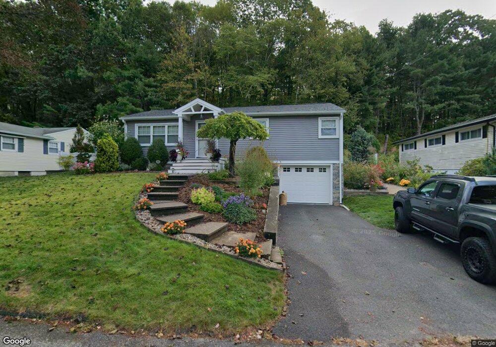
14 Wayne Ct Holyoke, MA 01040
Estimated Value: $310,344 - $353,000
3
Beds
1
Bath
1,200
Sq Ft
$279/Sq Ft
Est. Value
About This Home
This home is located at 14 Wayne Ct, Holyoke, MA 01040 and is currently estimated at $335,086, approximately $279 per square foot. 14 Wayne Ct is a home located in Hampden County with nearby schools including Lt. Elmer J. McMahon Elementary School, Lt. Clayre Sullivan Elementary School, and Holyoke High School.
Ownership History
Date
Name
Owned For
Owner Type
Purchase Details
Closed on
Nov 11, 2020
Sold by
David Adam B and Zwinski Peter Z
Bought by
David Adam B and Zwinski Peter Z
Current Estimated Value
Purchase Details
Closed on
Mar 1, 2006
Sold by
Gauthier Helen L and Gauthier Allan L
Bought by
David Adam B and Zwinski Peter Z
Home Financials for this Owner
Home Financials are based on the most recent Mortgage that was taken out on this home.
Original Mortgage
$142,400
Interest Rate
6.16%
Mortgage Type
Purchase Money Mortgage
Create a Home Valuation Report for This Property
The Home Valuation Report is an in-depth analysis detailing your home's value as well as a comparison with similar homes in the area
Home Values in the Area
Average Home Value in this Area
Purchase History
| Date | Buyer | Sale Price | Title Company |
|---|---|---|---|
| David Adam B | -- | None Available | |
| David Adam B | $178,000 | -- |
Source: Public Records
Mortgage History
| Date | Status | Borrower | Loan Amount |
|---|---|---|---|
| Previous Owner | David Adam B | $142,400 | |
| Previous Owner | David Adam B | $17,800 |
Source: Public Records
Tax History
| Year | Tax Paid | Tax Assessment Tax Assessment Total Assessment is a certain percentage of the fair market value that is determined by local assessors to be the total taxable value of land and additions on the property. | Land | Improvement |
|---|---|---|---|---|
| 2025 | $4,712 | $269,900 | $62,500 | $207,400 |
| 2024 | $4,377 | $231,000 | $59,600 | $171,400 |
| 2023 | $4,193 | $223,500 | $59,600 | $163,900 |
| 2022 | $4,041 | $209,800 | $59,600 | $150,200 |
| 2021 | $3,860 | $200,300 | $57,000 | $143,300 |
| 2020 | $4,014 | $189,700 | $57,000 | $132,700 |
| 2019 | $2,960 | $171,500 | $57,000 | $114,500 |
| 2018 | $3,185 | $165,500 | $57,000 | $108,500 |
| 2017 | $3,173 | $165,500 | $57,000 | $108,500 |
| 2016 | $3,147 | $164,600 | $58,800 | $105,800 |
| 2015 | $3,134 | $164,600 | $58,800 | $105,800 |
Source: Public Records
Map
Nearby Homes
- 28 Old Jarvis Ave
- 21 Francis Ave
- 1705-1707 Northampton St
- 1684 Northampton St
- 1225 Hampden St
- 15 Maple Crest Cir Unit D
- 41 Lynwood Ave
- 165 Lincoln St
- 151 Lincoln St
- 68 Fairfield Ave
- 141 Saint Jerome Ave
- 129 Morgan St
- 104 Lincoln St
- 72 Allyn St
- 154 Madison Ave
- 140 Sycamore St
- 76 Nonotuck St
- 301-303 Linden St
- 1137 Dwight St Unit C
- 391 Pleasant St
Your Personal Tour Guide
Ask me questions while you tour the home.