Estimated Value: $1,372,000 - $1,881,000
5
Beds
3
Baths
3,318
Sq Ft
$483/Sq Ft
Est. Value
About This Home
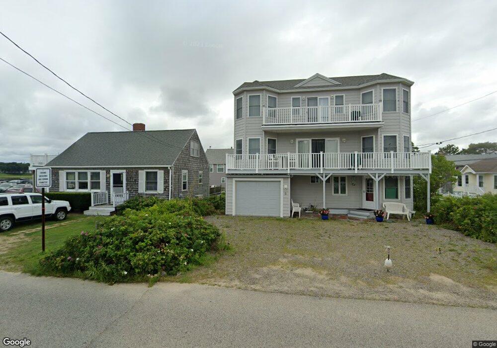
This home is located at 14 White Cap Ln, Wells, ME 04090 and is currently estimated at $1,601,579, approximately $482 per square foot. 14 White Cap Ln is a home located in York County with nearby schools including Wells Junior High School, Wells Elementary School, and Wells High School.
Ownership History
Date
Name
Owned For
Owner Type
Purchase Details
Closed on
Jan 10, 2025
Sold by
Scire Jacqueline
Bought by
Jacqueline Scire T T and Jacqueline Scire
Current Estimated Value
Create a Home Valuation Report for This Property
The Home Valuation Report is an in-depth analysis detailing your home's value as well as a comparison with similar homes in the area
Home Values in the Area
Average Home Value in this Area
Purchase History
| Date | Buyer | Sale Price | Title Company |
|---|---|---|---|
| Jacqueline Scire T T | -- | None Available | |
| Jacqueline Scire T T | -- | None Available | |
| Robert C Scire T Under T C | -- | None Available | |
| Robert C Scire T Under T C | -- | None Available | |
| Scire Robert C | -- | None Available | |
| Scire Robert C | -- | None Available | |
| Robert C Scire T Under T C | -- | None Available | |
| Robert C Scire T Under T C | -- | None Available | |
| Jacqueline Scire T T | -- | None Available | |
| Robert C Scire T Under T C | -- | None Available | |
| Scire Robert C | -- | None Available | |
| Robert C Scire T Under T C | -- | None Available |
Source: Public Records
Tax History Compared to Growth
Tax History
| Year | Tax Paid | Tax Assessment Tax Assessment Total Assessment is a certain percentage of the fair market value that is determined by local assessors to be the total taxable value of land and additions on the property. | Land | Improvement |
|---|---|---|---|---|
| 2024 | $8,635 | $1,420,230 | $940,450 | $479,780 |
| 2023 | $8,465 | $1,420,230 | $940,450 | $479,780 |
| 2022 | $7,119 | $680,610 | $445,100 | $235,510 |
| 2021 | $7,160 | $680,610 | $445,100 | $235,510 |
| 2020 | $7,133 | $680,610 | $445,100 | $235,510 |
| 2019 | $7,090 | $680,410 | $445,100 | $235,310 |
| 2018 | $6,894 | $680,410 | $445,100 | $235,310 |
| 2017 | $6,908 | $679,960 | $445,100 | $234,860 |
| 2016 | $6,840 | $679,960 | $445,100 | $234,860 |
| 2015 | $6,766 | $679,960 | $445,100 | $234,860 |
| 2013 | $6,201 | $679,960 | $445,100 | $234,860 |
Source: Public Records
Map
Nearby Homes
- 168 Ocean Ave
- 718 Main St Unit A3
- 9 Bourne Ave Unit B6
- 9 Bourne Ave Unit P-22
- 32 Tatnic Rd
- 76 Post Rd Unit 17M &18M
- 314 Ocean Ave
- 32 Queens Way
- 56 Kings Hwy
- 12 Whiporwill Dr
- Lot 2 Maling Ln
- 64 Old Kings Hwy
- 31 Rebecca Rd
- 390 Ocean Ave
- 1 Old County Rd Unit 702
- 1 Old County Rd Unit 165
- 1 Old County Rd Unit 132
- 404 Ocean Ave Unit 7
- 53 Spinnaker Ridge Dr Unit 8
- 15 Blanchard St
- 6 Ocean Ave
- 10 White Cap Ln
- 2 Ocean Ave
- 00 Oceans Edge Unit 234
- 0 Oceans Edge Unit 305 760550
- 00 Oceans Edge Unit 118
- 00 Oceans Edge Unit 251
- 00 Oceans Edge
- 0 Oceans Edge Unit 219
- 00 Ocean
- 000 Ocean Ave
- 24 White Cap Ln
- 14 Ocean Ave
- #5 Perkins Cove Village Oceans Dr E Unit 5
- 7 Ocean Ave
- 3 Ocean Ave
- 15 White Cap Ln
- 00 Ocean Ave Unit 110
- 11 White Cap Ln
- 103 Ocean Ave