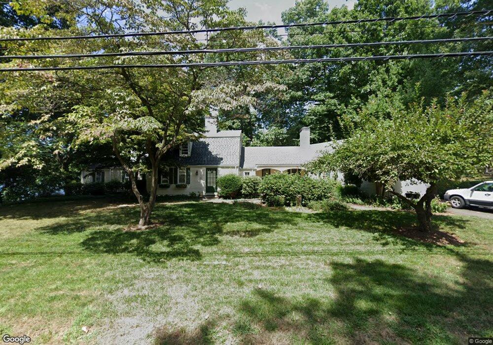
14 Woodpond Rd West Hartford, CT 06107
Estimated Value: $923,000 - $1,216,000
3
Beds
6
Baths
2,731
Sq Ft
$390/Sq Ft
Est. Value
About This Home
This home is located at 14 Woodpond Rd, West Hartford, CT 06107 and is currently estimated at $1,064,665, approximately $389 per square foot. 14 Woodpond Rd is a home located in Hartford County with nearby schools including Wolcott School, Sedgwick Middle School, and Conard High School.
Ownership History
Date
Name
Owned For
Owner Type
Purchase Details
Closed on
Jul 18, 1996
Sold by
Thayer Barbara
Bought by
Garrett Christopher and Garrett Suzanne
Current Estimated Value
Home Financials for this Owner
Home Financials are based on the most recent Mortgage that was taken out on this home.
Original Mortgage
$323,000
Interest Rate
8.28%
Mortgage Type
Unknown
Purchase Details
Closed on
Jul 23, 1992
Sold by
Johnson Thomas
Bought by
Thayer Barbara
Create a Home Valuation Report for This Property
The Home Valuation Report is an in-depth analysis detailing your home's value as well as a comparison with similar homes in the area
Home Values in the Area
Average Home Value in this Area
Purchase History
| Date | Buyer | Sale Price | Title Company |
|---|---|---|---|
| Garrett Christopher | $403,960 | -- | |
| Thayer Barbara | $442,000 | -- |
Source: Public Records
Mortgage History
| Date | Status | Borrower | Loan Amount |
|---|---|---|---|
| Open | Thayer Barbara | $390,000 | |
| Closed | Thayer Barbara | $318,500 | |
| Closed | Thayer Barbara | $323,000 | |
| Previous Owner | Thayer Barbara | $200,000 |
Source: Public Records
Tax History Compared to Growth
Tax History
| Year | Tax Paid | Tax Assessment Tax Assessment Total Assessment is a certain percentage of the fair market value that is determined by local assessors to be the total taxable value of land and additions on the property. | Land | Improvement |
|---|---|---|---|---|
| 2025 | $24,835 | $554,590 | $332,200 | $222,390 |
| 2024 | $23,487 | $554,590 | $332,200 | $222,390 |
| 2023 | $22,694 | $554,590 | $332,200 | $222,390 |
| 2022 | $22,561 | $554,590 | $332,200 | $222,390 |
| 2021 | $22,363 | $527,170 | $319,400 | $207,770 |
| 2020 | $22,036 | $527,170 | $328,500 | $198,670 |
| 2019 | $22,036 | $527,170 | $328,510 | $198,660 |
| 2018 | $21,614 | $527,170 | $328,510 | $198,660 |
| 2017 | $21,635 | $527,170 | $328,510 | $198,660 |
| 2016 | $18,895 | $478,240 | $284,550 | $193,690 |
| 2015 | $18,321 | $478,240 | $284,550 | $193,690 |
| 2014 | $17,872 | $478,240 | $284,550 | $193,690 |
Source: Public Records
Map
Nearby Homes
- 32 Miles Standish Dr
- 34 Sandhurst Dr
- 61 Waterside Ln
- 1 Valley Crest Dr
- 24 Thorne Rd Unit 24
- 25 Fowler Dr
- 43 Burnham Dr
- 29 Fairwood Farms Dr
- 281 South Rd
- 11 Fairwood Farms Dr
- 479 S Main St
- 422 S Main St
- 371 Middle Rd
- 39 Pheasant Hill Dr
- 00 Old Farm Dr
- 43 Spring Ln
- 18 Federal St
- 96 Bentwood Rd
- 50 Tunxis Rd
- 107 Westgate St
- 8 Woodpond Rd
- 339 Ridgewood Rd
- 335 Ridgewood Rd
- 15 Woodpond Rd
- 345 Ridgewood Rd
- 19 Woodpond Rd
- 331 Ridgewood Rd
- 349 Ridgewood Rd
- 23 Woodpond Rd
- 327 Ridgewood Rd
- 351 Ridgewood Rd
- 2 Wood Pond Rd
- 16 Steep Hollow Ln
- 323 Ridgewood Rd
- 14 Woodridge Cir
- 33 Woodpond Rd
- 338 Ridgewood Rd
- 336 Ridgewood Rd
- 344 Ridgewood Rd
- 22 Steep Hollow Ln