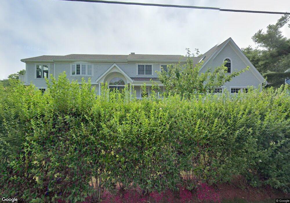
140 Brandt Island Rd Mattapoisett, MA 02739
Estimated Value: $1,256,000 - $1,511,000
4
Beds
3
Baths
3,986
Sq Ft
$347/Sq Ft
Est. Value
About This Home
This home is located at 140 Brandt Island Rd, Mattapoisett, MA 02739 and is currently estimated at $1,382,818, approximately $346 per square foot. 140 Brandt Island Rd is a home located in Plymouth County with nearby schools including Center School, Old Hammondtown Elementary, and Old Rochester Regional High School.
Ownership History
Date
Name
Owned For
Owner Type
Purchase Details
Closed on
Oct 31, 2013
Sold by
Tyliszczak Stanley A and Woods Lucinda A
Bought by
Ogden Ash Ret and Tyliszczak
Current Estimated Value
Purchase Details
Closed on
Sep 30, 1999
Sold by
Nichols Wayne E and Nichols Valerie
Bought by
Tyliszcczak Stanley A and Woods Lucinda A
Create a Home Valuation Report for This Property
The Home Valuation Report is an in-depth analysis detailing your home's value as well as a comparison with similar homes in the area
Home Values in the Area
Average Home Value in this Area
Purchase History
| Date | Buyer | Sale Price | Title Company |
|---|---|---|---|
| Ogden Ash Ret | -- | -- | |
| Ogden Ash Ret | -- | -- | |
| Tyliszcczak Stanley A | $255,000 | -- | |
| Tyliszcczak Stanley A | $255,000 | -- |
Source: Public Records
Mortgage History
| Date | Status | Borrower | Loan Amount |
|---|---|---|---|
| Previous Owner | Tyliszcczak Stanley A | $100,000 | |
| Previous Owner | Tyliszcczak Stanley A | $120,000 |
Source: Public Records
Tax History Compared to Growth
Tax History
| Year | Tax Paid | Tax Assessment Tax Assessment Total Assessment is a certain percentage of the fair market value that is determined by local assessors to be the total taxable value of land and additions on the property. | Land | Improvement |
|---|---|---|---|---|
| 2025 | $12,501 | $1,161,800 | $473,100 | $688,700 |
| 2024 | $12,032 | $1,144,800 | $473,100 | $671,700 |
| 2023 | $12,393 | $1,101,567 | $403,467 | $698,100 |
| 2022 | $11,857 | $956,243 | $336,443 | $619,800 |
| 2021 | $11,678 | $901,058 | $305,858 | $595,200 |
| 2020 | $11,960 | $886,578 | $291,378 | $595,200 |
| 2019 | $12,153 | $920,000 | $291,500 | $628,500 |
| 2018 | $9,566 | $734,700 | $261,800 | $472,900 |
| 2017 | $9,945 | $760,900 | $288,000 | $472,900 |
| 2016 | $9,871 | $747,800 | $274,900 | $472,900 |
| 2015 | $9,823 | $755,600 | $282,700 | $472,900 |
| 2014 | $8,973 | $705,400 | $282,700 | $422,700 |
Source: Public Records
Map
Nearby Homes
- 0 Marina Dr Unit 72497908
- 0 Marina Dr Unit 72497877
- 6 Meadowbrook Ln
- 28 Brandt Beach Ave
- 41 Starboard Way
- 1 Starboard Way
- 0 Whalers Way
- 7 Mattakiset Rd
- 0 Harbor Acres Ln - Lot B
- 20 Forestview Dr
- 3 Brandt Island Rd
- 83 Fairhaven Rd
- 421 Huttleston Ave
- 14 Summit Dr
- 47 Fairhaven Rd
- 7 Pearl St
- 12 Cannon St
- 389 Sconticut Neck Rd
- 11 Captains Ln
- 8 Captains Ln
- 138 Brandt Island Rd
- 149 Brandt Island Rd
- 136 Brandt Island Rd
- 20 Marina Dr
- 22 Marina Dr
- 145 Brandt Island Rd
- 145 Brandt Island Rd Unit 1
- 143 Brandt Island Rd
- 19 Marina Dr
- 21 Marina Dr
- 0 Marina Dr Unit 70047834
- 000 Marina Dr
- 0.0 Marina Dr
- 0 Marina Dr Unit 73000333
- lot 43 Marina Dr
- 0 Marina Dr Unit 72883187
- 0 Marina Dr Unit 72863949
- 0 Marina Dr
- 14 Marina Dr
- 15 Marina Dr