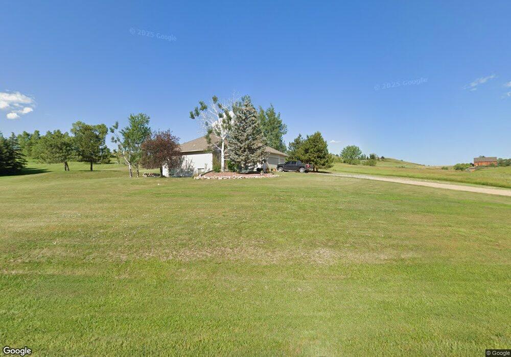
140 Canvasback Rd Sheridan, WY 82801
Estimated Value: $680,000 - $788,000
3
Beds
2
Baths
1,500
Sq Ft
$499/Sq Ft
Est. Value
About This Home
This home is located at 140 Canvasback Rd, Sheridan, WY 82801 and is currently estimated at $748,042, approximately $498 per square foot. 140 Canvasback Rd is a home with nearby schools including Sheridan High School.
Ownership History
Date
Name
Owned For
Owner Type
Purchase Details
Closed on
Aug 10, 2006
Sold by
Roberts Gwen Kay
Bought by
Carlson Paul W and Carlson Gail J
Current Estimated Value
Home Financials for this Owner
Home Financials are based on the most recent Mortgage that was taken out on this home.
Original Mortgage
$282,000
Outstanding Balance
$166,904
Interest Rate
6.5%
Mortgage Type
Adjustable Rate Mortgage/ARM
Estimated Equity
$581,138
Create a Home Valuation Report for This Property
The Home Valuation Report is an in-depth analysis detailing your home's value as well as a comparison with similar homes in the area
Home Values in the Area
Average Home Value in this Area
Purchase History
| Date | Buyer | Sale Price | Title Company |
|---|---|---|---|
| Carlson Paul W | -- | None Available |
Source: Public Records
Mortgage History
| Date | Status | Borrower | Loan Amount |
|---|---|---|---|
| Open | Carlson Paul W | $282,000 |
Source: Public Records
Tax History Compared to Growth
Tax History
| Year | Tax Paid | Tax Assessment Tax Assessment Total Assessment is a certain percentage of the fair market value that is determined by local assessors to be the total taxable value of land and additions on the property. | Land | Improvement |
|---|---|---|---|---|
| 2025 | $3,877 | $45,147 | $16,431 | $28,716 |
| 2024 | $3,877 | $58,294 | $21,479 | $36,815 |
| 2023 | $3,782 | $56,878 | $21,479 | $35,399 |
| 2022 | $3,141 | $47,227 | $18,615 | $28,612 |
| 2021 | $2,708 | $40,719 | $14,319 | $26,400 |
| 2020 | $2,463 | $37,038 | $10,739 | $26,299 |
| 2019 | $2,383 | $35,831 | $10,739 | $25,092 |
| 2018 | $2,278 | $34,261 | $9,737 | $24,524 |
| 2017 | $2,274 | $34,192 | $9,730 | $24,462 |
| 2015 | $2,233 | $33,583 | $9,158 | $24,425 |
| 2014 | $2,237 | $33,641 | $8,586 | $25,055 |
| 2013 | -- | $32,690 | $8,586 | $24,104 |
Source: Public Records
Map
Nearby Homes
- TBD Mccormick Rd Unit Lot 2
- TBD Mccormick Rd Unit Lot 1
- 40 Mallard Rd
- 1 Deer Haven Dr
- 96 Canvasback Rd
- 21 Eagle Ridge Dr
- 4 Mallard Rd
- TBD Wagon Wheel Ct Unit F10
- TBD Wagon Wheel Ct Unit F11
- TBD Wagon Wheel Ct Unit Lot 1
- TBD Wagon Wheel Ct Unit Lot 2
- Tbd Wagon Wheel Court Lot F11
- Tbd Wagon Wheel Ct Lot F10 & F11
- TBD Eagle Ridge Dr Unit H-7
- 3 Mallard Rd
- 7 Mallard Rd
- TBD Powder Horn Rd
- TBD Powder Horn Rd Unit MNR 24 Lot 1
- 8 Buckskin Dr
- 18 Circle 8 Dr
- 150 Canvasback Rd
- 134 Canvasback Rd
- 147 Canvasback Rd
- 133 Canvasback Rd
- 128 Canvasback Rd
- 26 Goldeneye Dr
- 123 Canvasback Rd
- 120 Mccormick Rd
- 19 Goldeneye Dr
- 114 Mccormick Rd
- 20 Goldeneye Dr
- 8 Pintail Rd
- TBD Goldeneye Dr Unit Lots 40 and 41
- 120 Canvasback Rd
- 6 Widgeon Dr
- 10 Pintail Rd
- 8 Widgeon Dr
- 9 Goldeneye Dr
- 10 Goldeneye Dr
- 12 Pintail Rd