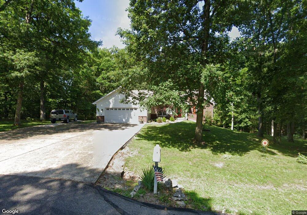
140 Clarks Pointe Dr Hawk Point, MO 63349
Estimated Value: $364,000 - $450,000
3
Beds
2
Baths
1,839
Sq Ft
$228/Sq Ft
Est. Value
About This Home
This home is located at 140 Clarks Pointe Dr, Hawk Point, MO 63349 and is currently estimated at $419,301, approximately $228 per square foot. 140 Clarks Pointe Dr is a home located in Lincoln County with nearby schools including Lincoln Elementary School, Troy South Middle School, and Troy Buchanan High School.
Ownership History
Date
Name
Owned For
Owner Type
Purchase Details
Closed on
Aug 25, 2011
Sold by
Us Bank National Assn
Bought by
Lepage Charlie L
Current Estimated Value
Home Financials for this Owner
Home Financials are based on the most recent Mortgage that was taken out on this home.
Original Mortgage
$120,000
Outstanding Balance
$82,970
Interest Rate
4.54%
Mortgage Type
New Conventional
Estimated Equity
$336,331
Purchase Details
Closed on
Dec 6, 2010
Sold by
Badock Robert A and Badock Penny J
Bought by
Us Bank National Assn
Create a Home Valuation Report for This Property
The Home Valuation Report is an in-depth analysis detailing your home's value as well as a comparison with similar homes in the area
Home Values in the Area
Average Home Value in this Area
Purchase History
| Date | Buyer | Sale Price | Title Company |
|---|---|---|---|
| Lepage Charlie L | -- | None Available | |
| Us Bank National Assn | $144,500 | None Available |
Source: Public Records
Mortgage History
| Date | Status | Borrower | Loan Amount |
|---|---|---|---|
| Open | Lepage Charlie L | $120,000 |
Source: Public Records
Tax History Compared to Growth
Tax History
| Year | Tax Paid | Tax Assessment Tax Assessment Total Assessment is a certain percentage of the fair market value that is determined by local assessors to be the total taxable value of land and additions on the property. | Land | Improvement |
|---|---|---|---|---|
| 2025 | $2,867 | $49,172 | $7,771 | $41,401 |
| 2024 | $2,814 | $45,598 | $6,479 | $39,119 |
| 2023 | $2,799 | $45,598 | $6,479 | $39,119 |
| 2022 | $2,637 | $43,252 | $6,479 | $36,773 |
| 2021 | $2,650 | $227,640 | $0 | $0 |
| 2020 | $2,306 | $201,530 | $0 | $0 |
| 2019 | $2,309 | $201,530 | $0 | $0 |
| 2018 | $2,359 | $38,618 | $0 | $0 |
| 2017 | $2,366 | $38,618 | $0 | $0 |
| 2016 | $1,854 | $29,638 | $0 | $0 |
| 2015 | $1,859 | $29,638 | $0 | $0 |
| 2014 | $1,877 | $29,881 | $0 | $0 |
| 2013 | -- | $29,881 | $0 | $0 |
Source: Public Records
Map
Nearby Homes
- 290 Shumard Oak Dr
- 335 Shumard Oak Dr
- 70 Summers Dr
- 697 Linns Mill Rd
- 0 Linns Mill Road Lot#wp002
- 130 Bristol Ridge Dr
- 270 Derek Dr
- 456 Westridge Dr
- 0 Westborough Estates (Lot 60)
- 432 Westridge Dr
- 0 Westborough Estates (Lot 5)
- 0 Westborough Estates (Lot 58)
- 0 Westborough Estates (Lot 57)
- 0
- 0 Linns Mill Rd Unit LOt WP002 23395939
- 0 Linns Mill Rd
- 310 Red Wing Ct
- 55 Sunny Hill Dr
- 4 Ashley Ln
- 145 Southview Dr
- 141 Clarks Pointe Dr
- 150 Clarks Pointe Dr
- 151 Clarks Pointe Dr
- 130 Clarks Pointe Dr
- 131 Clarks Pointe Dr
- 161 Clarks Pointe Dr
- 160 Clarks Pointe Dr
- 0Lot 52 Shumard Oak Dr
- 200 Shumard Oak Dr
- 120 Clarks Pointe Dr
- 190 Shumard Oak Dr
- 210 Shumard Oak Dr
- 220 Shumard Oak Dr
- 121 Clarks Pointe Dr
- 180 Shumard Oak Dr
- 230 Shumard Oak Dr
- 171 Clarks Pointe Dr
- 240 Shumard Oak Dr
- 105 Chinkapin Ct
- 170 Shumard Oak Dr