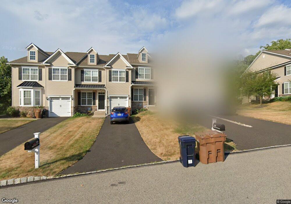
140 High Point Ave Unit LOT 11 Dresher, PA 19025
Estimated Value: $629,944 - $691,000
3
Beds
4
Baths
2,697
Sq Ft
$244/Sq Ft
Est. Value
About This Home
This home is located at 140 High Point Ave Unit LOT 11, Dresher, PA 19025 and is currently estimated at $657,486, approximately $243 per square foot. 140 High Point Ave Unit LOT 11 is a home located in Montgomery County with nearby schools including Thomas Fitzwater Elementary School, Sandy Run Middle School, and Upper Dublin High School.
Ownership History
Date
Name
Owned For
Owner Type
Purchase Details
Closed on
Aug 10, 2018
Sold by
Chughtai Osman and Chughtai Svetlana Chepeleva
Bought by
Longs Tracey
Current Estimated Value
Home Financials for this Owner
Home Financials are based on the most recent Mortgage that was taken out on this home.
Original Mortgage
$374,000
Outstanding Balance
$324,804
Interest Rate
4.5%
Mortgage Type
New Conventional
Estimated Equity
$332,682
Purchase Details
Closed on
Mar 7, 2016
Sold by
Dresher Properties Lp
Bought by
Chughtai Osman and Chughtai Svetlana Chepeleva
Home Financials for this Owner
Home Financials are based on the most recent Mortgage that was taken out on this home.
Original Mortgage
$318,000
Interest Rate
3.72%
Mortgage Type
New Conventional
Create a Home Valuation Report for This Property
The Home Valuation Report is an in-depth analysis detailing your home's value as well as a comparison with similar homes in the area
Home Values in the Area
Average Home Value in this Area
Purchase History
| Date | Buyer | Sale Price | Title Company |
|---|---|---|---|
| Longs Tracey | -- | None Available | |
| Chughtai Osman | $432,500 | None Available |
Source: Public Records
Mortgage History
| Date | Status | Borrower | Loan Amount |
|---|---|---|---|
| Open | Longs Tracey | $374,000 | |
| Previous Owner | Chughtai Osman | $318,000 |
Source: Public Records
Tax History Compared to Growth
Tax History
| Year | Tax Paid | Tax Assessment Tax Assessment Total Assessment is a certain percentage of the fair market value that is determined by local assessors to be the total taxable value of land and additions on the property. | Land | Improvement |
|---|---|---|---|---|
| 2025 | $11,561 | $237,080 | -- | -- |
| 2024 | $11,561 | $237,080 | -- | -- |
| 2023 | $11,291 | $237,080 | $0 | $0 |
| 2022 | $11,045 | $237,080 | $0 | $0 |
| 2021 | $10,770 | $237,080 | $0 | $0 |
| 2020 | $10,459 | $237,080 | $0 | $0 |
| 2019 | $10,284 | $237,080 | $0 | $0 |
| 2018 | $10,283 | $237,080 | $0 | $0 |
| 2017 | $9,909 | $237,080 | $0 | $0 |
| 2016 | $9,816 | $18,900 | $0 | $0 |
| 2015 | $763 | $18,900 | $0 | $0 |
| 2014 | $739 | $18,900 | $0 | $0 |
Source: Public Records
Map
Nearby Homes
- 3225 Burn Brae Dr
- 536 Cardinal Dr
- 541 Cardinal Dr
- 309 Woodside Cir
- 1212 Duncan Dr
- 501 Martin Ln
- 1300 Kirks Ln
- 1380 Harris Rd
- 2933 Susquehanna Rd
- 3012 Lincoln Ave
- 25 Northview Dr
- 1371 Fitzwatertown Rd
- 1423 Southwind Way
- 1525 Limekiln Pike
- 743 Penn Ave
- 1404 Cinnamon Cir
- 1485 Mundock Rd
- 2806 Anzac Ave
- 623 Penn Ave
- 411 Leah Dr
- 136 High Point Ave Unit LOT 10
- 136 High Point Ave
- 140 High Point Ave
- 132 High Point Ave
- 144 High Point Ave
- 128 High Point Ave
- 148 High Point Ave
- 124 High Point Ave
- 152 High Point Ave
- 120 High Point Ave
- 156 High Point Ave
- 160 High Point Ave
- 168 High Point Ave
- 112 High Point Ave
- 104 High Point Ave
- 3348 Susquehanna Rd
- 100 High Point Ave
- 11 High Point Ave
- 3342 Susquehanna Rd
- 1115 Camp Hill Ave