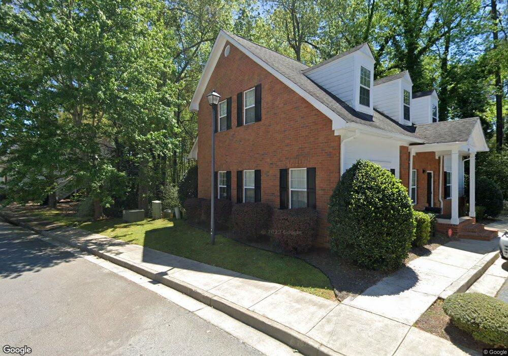
140 Howard Ln Fayetteville, GA 30215
Estimated Value: $377,489
--
Bed
--
Bath
2,746
Sq Ft
$137/Sq Ft
Est. Value
About This Home
This home is located at 140 Howard Ln, Fayetteville, GA 30215 and is currently estimated at $377,489, approximately $137 per square foot. 140 Howard Ln is a home located in Fayette County with nearby schools including Cleveland Elementary School, Bennett's Mill Middle School, and Fayette County High School.
Ownership History
Date
Name
Owned For
Owner Type
Purchase Details
Closed on
Oct 20, 2023
Sold by
Kanuga Properties Llc
Bought by
Clemons Robert L
Current Estimated Value
Home Financials for this Owner
Home Financials are based on the most recent Mortgage that was taken out on this home.
Original Mortgage
$293,600
Outstanding Balance
$252,205
Interest Rate
7.12%
Mortgage Type
New Conventional
Estimated Equity
$125,284
Purchase Details
Closed on
Feb 20, 2017
Sold by
Rsd Properties Llc
Bought by
Kanuga Properties Llc
Purchase Details
Closed on
Jul 8, 2002
Sold by
Oakenshield Properties
Bought by
Crane James E
Create a Home Valuation Report for This Property
The Home Valuation Report is an in-depth analysis detailing your home's value as well as a comparison with similar homes in the area
Home Values in the Area
Average Home Value in this Area
Purchase History
| Date | Buyer | Sale Price | Title Company |
|---|---|---|---|
| Clemons Robert L | $367,000 | None Listed On Document | |
| Kanuga Properties Llc | -- | -- | |
| Crane James E | $85,000 | -- |
Source: Public Records
Mortgage History
| Date | Status | Borrower | Loan Amount |
|---|---|---|---|
| Open | Clemons Robert L | $293,600 |
Source: Public Records
Tax History Compared to Growth
Tax History
| Year | Tax Paid | Tax Assessment Tax Assessment Total Assessment is a certain percentage of the fair market value that is determined by local assessors to be the total taxable value of land and additions on the property. | Land | Improvement |
|---|---|---|---|---|
| 2024 | $4,330 | $145,712 | $13,592 | $132,120 |
| 2023 | $4,698 | $154,332 | $11,212 | $143,120 |
| 2022 | $4,431 | $145,792 | $10,192 | $135,600 |
| 2021 | $3,788 | $123,072 | $10,192 | $112,880 |
| 2020 | $2,796 | $90,420 | $10,192 | $80,228 |
| 2019 | $2,709 | $86,772 | $10,192 | $76,580 |
| 2018 | $2,476 | $106,912 | $10,192 | $96,720 |
| 2017 | $2,281 | $76,276 | $10,192 | $66,084 |
| 2016 | $2,331 | $76,276 | $12,836 | $63,440 |
| 2015 | $3,455 | $130,664 | $33,024 | $97,640 |
| 2014 | $2,648 | $83,568 | $33,024 | $50,544 |
| 2013 | -- | $83,568 | $0 | $0 |
Source: Public Records
Map
Nearby Homes
- 0 Hwy 54 West of Yorktown Dr Unit 10463188
- 220 Rehobeth Way
- 105 Rehobeth Way
- 265 Rehobeth Way
- 275 Rehobeth Way
- 155 Butterton Ct
- 2051 Forest Dr
- 120 Deep Forest Ln Unit 1
- 1305 & 1307 Highway 54
- 405 415 Chase Dr
- 257 Ravenhurst Ln
- 247 Ravenhurst Ln
- 125 W Pier Way
- 175 Honey Ln
- 165 Honey Ln
- 140 Rockglen Ct
- 230 High St
- 322 Hambrick Park
- 105 Hollis St
- 115 Climbing Ivy Cir
- 0 Burch Rd
- 0 Burch Rd Unit 20140593
- 0 Burch Rd Unit 8708433
- 0 Burch Rd Unit 8437360
- 0 Burch Rd Unit 8865826
- 0 Burch Rd Unit 8694815
- 0 Burch Rd Unit 8677261
- 0 Burch Rd Unit 8757962
- 0 Burch Rd Unit 8410253
- 0 Burch Rd Unit 8469202
- 0 Burch Rd Unit 8337640
- 0 Burch Rd Unit 7015170
- 0 Burch Rd Unit 8975613
- 0 Burch Rd Unit 9012412
- 0 Burch Rd Unit 9058885
- 0 Burch Rd Unit 8738807
- 0 Burch Rd Unit 8745576
- 0 Burch Rd Unit 8768106
- 0 Burch Rd Unit 8790867
- 0 Burch Rd Unit 8453289