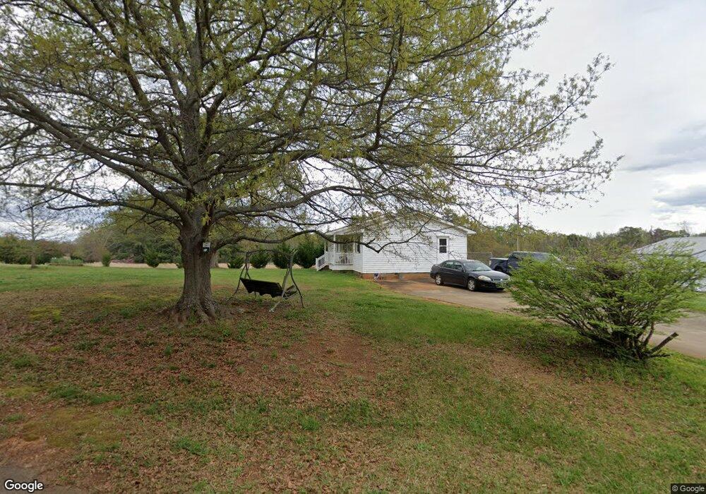
140 Mcdowell Rd Chesnee, SC 29323
Estimated Value: $202,000 - $261,000
3
Beds
1
Bath
1,560
Sq Ft
$151/Sq Ft
Est. Value
About This Home
This home is located at 140 Mcdowell Rd, Chesnee, SC 29323 and is currently estimated at $235,861, approximately $151 per square foot. 140 Mcdowell Rd is a home located in Spartanburg County with nearby schools including Chesnee Elementary School, Chesnee Middle School, and Chesnee High School.
Ownership History
Date
Name
Owned For
Owner Type
Purchase Details
Closed on
Mar 23, 2021
Sold by
Mcdowell Joyce and Mcdowell Joyce M
Bought by
Mcdowell Jerry W and Mcdowell Joyce M
Current Estimated Value
Home Financials for this Owner
Home Financials are based on the most recent Mortgage that was taken out on this home.
Original Mortgage
$217,500
Outstanding Balance
$68,465
Interest Rate
2.6%
Mortgage Type
Reverse Mortgage Home Equity Conversion Mortgage
Estimated Equity
$167,396
Purchase Details
Closed on
Jan 23, 2004
Sold by
Mcdowell Jerry W
Bought by
Mcdowell Joyce
Create a Home Valuation Report for This Property
The Home Valuation Report is an in-depth analysis detailing your home's value as well as a comparison with similar homes in the area
Home Values in the Area
Average Home Value in this Area
Purchase History
| Date | Buyer | Sale Price | Title Company |
|---|---|---|---|
| Mcdowell Jerry W | $5,769 | Fnc Title Services | |
| Mcdowell Joyce | -- | -- |
Source: Public Records
Mortgage History
| Date | Status | Borrower | Loan Amount |
|---|---|---|---|
| Open | Mcdowell Jerry W | $217,500 | |
| Closed | Mcdowell Jerry W | $217,500 |
Source: Public Records
Tax History
| Year | Tax Paid | Tax Assessment Tax Assessment Total Assessment is a certain percentage of the fair market value that is determined by local assessors to be the total taxable value of land and additions on the property. | Land | Improvement |
|---|---|---|---|---|
| 2025 | $538 | $5,100 | $405 | $4,695 |
| 2024 | $538 | $5,100 | $405 | $4,695 |
| 2023 | $538 | $5,100 | $405 | $4,695 |
Source: Public Records
Map
Nearby Homes
- 202 Arrowood Branch Rd
- 244 Arrowood Branch Rd
- 515 State Road S-42-1879
- 519 State Road S-42-1879
- 537 State Road S-42-1879
- 545 State Road S-42-1879
- 549 State Road S-42-1879
- 291 Robbins Rd
- 553 State Road S-42-1879
- 0 Cantrell Dr
- 561 State Road S-42-1879
- 565 State Road S-42-1879
- 140 Manor House Ln
- 1543 Highway 11 W
- 351 Smith Wall Rd
- 1145 Turkey Farm Rd
- 107 Brooklyn Church Rd
- 812 Old Island Ford Rd
- 905 Henderson Rd
- 0A Parris Bridge Rd
- 00 Mc Dowell Rd
- 190 Arrowood Branch Rd
- 166 Mcdowell Rd
- 228 Arrowood Branch Rd
- 187 Arrowood Branch Rd
- 177 Arrowood Branch Rd
- 232 Arrowood Branch Rd
- 180 Mcdowell Rd
- 190 Mcdowell Rd
- 8094 Parris Bridge Rd
- 118 Arrowood Branch Rd
- 122 Arrowood Branch Rd
- 128 Arrowood Branch Rd
- 126 Cooley Ridge Dr
- 236 Arrowood Branch Rd
- 155 Arrowood Branch Rd
- 8090 Parris Bridge Rd
- 00 Mcdowell Rd
- 240 Arrowood Branch Rd
- 136 Arrowood Branch Rd Unit 140
Your Personal Tour Guide
Ask me questions while you tour the home.