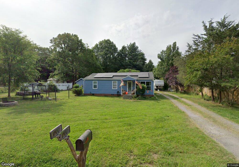
140 Mitchum Rd Rock Hill, SC 29730
Estimated Value: $147,000 - $258,000
--
Bed
--
Bath
1,008
Sq Ft
$202/Sq Ft
Est. Value
About This Home
This home is located at 140 Mitchum Rd, Rock Hill, SC 29730 and is currently estimated at $203,798, approximately $202 per square foot. 140 Mitchum Rd is a home located in York County with nearby schools including Independence Elementary School, Castle Heights Middle School, and Rock Hill High School.
Ownership History
Date
Name
Owned For
Owner Type
Purchase Details
Closed on
Dec 16, 2016
Sold by
Heuser Frederick A and Hyatt Mary B
Bought by
Dillon Kenneth
Current Estimated Value
Home Financials for this Owner
Home Financials are based on the most recent Mortgage that was taken out on this home.
Original Mortgage
$62,200
Outstanding Balance
$40,022
Interest Rate
3.54%
Mortgage Type
New Conventional
Estimated Equity
$163,776
Purchase Details
Closed on
May 7, 2012
Sold by
Estate Of Joseph D Mitchum Sr
Bought by
Mitchum Evelyn Floyce W
Create a Home Valuation Report for This Property
The Home Valuation Report is an in-depth analysis detailing your home's value as well as a comparison with similar homes in the area
Home Values in the Area
Average Home Value in this Area
Purchase History
| Date | Buyer | Sale Price | Title Company |
|---|---|---|---|
| Dillon Kenneth | $60,000 | None Available | |
| Mitchum Evelyn Floyce W | -- | -- |
Source: Public Records
Mortgage History
| Date | Status | Borrower | Loan Amount |
|---|---|---|---|
| Open | Dillon Kenneth | $62,200 |
Source: Public Records
Tax History Compared to Growth
Tax History
| Year | Tax Paid | Tax Assessment Tax Assessment Total Assessment is a certain percentage of the fair market value that is determined by local assessors to be the total taxable value of land and additions on the property. | Land | Improvement |
|---|---|---|---|---|
| 2024 | $478 | $3,404 | $1,018 | $2,386 |
| 2023 | $490 | $3,404 | $1,018 | $2,386 |
| 2022 | $492 | $3,404 | $1,018 | $2,386 |
| 2021 | -- | $3,404 | $1,018 | $2,386 |
| 2020 | $490 | $3,404 | $0 | $0 |
| 2019 | $447 | $2,960 | $0 | $0 |
| 2018 | $443 | $2,960 | $0 | $0 |
| 2017 | $1,441 | $4,440 | $0 | $0 |
| 2016 | $1,377 | $4,380 | $0 | $0 |
| 2014 | $100 | $4,380 | $1,320 | $3,060 |
| 2013 | $100 | $4,380 | $1,320 | $3,060 |
Source: Public Records
Map
Nearby Homes
- 161 Billy Claude Cir
- 141 Edenvale Rd
- 1580 Anderson Rd S
- 281 Schoolside Dr
- 172 Neely Store Rd
- 2510 Firetower Rd
- 508 Bridgestone Ln
- 2488 Catawba Church Rd
- 2003 Capel Ct
- 3339 Lesslie Hwy Unit 2
- 631 Anderson Rd S
- 611 Pondway Downs
- 111 Emily Crest Ln
- 1903 Manning Place
- 623 Neelys Creek Rd
- 356 Emma Wood Ln
- 1034 Neely Store Rd
- 2999 Starnes Dr
- 1104 Neely Store Rd
- 3943 Walker Rd
- 170 Mitchum Rd
- 181 Mitchum Rd
- 2881 Lesslie Hwy
- 2869 Lesslie Hwy
- 2867 Lesslie Hwy
- 190 Mitchum Rd
- 111 Branham Rd Unit 6
- 111 Branham Rd Unit 5
- 111 Branham Rd Unit 3
- 111 Branham Rd Unit 2
- 111 Branham Rd Unit 1
- 2909 Lesslie Hwy
- 208 Branham Rd
- 419 Dixie Ln
- 2823 Lesslie Hwy
- 201 Branham Rd
- 425 Dixie Ln
- 2963 Lesslie Hwy
- 2807 Lesslie Hwy
- 2965 Lesslie Hwy