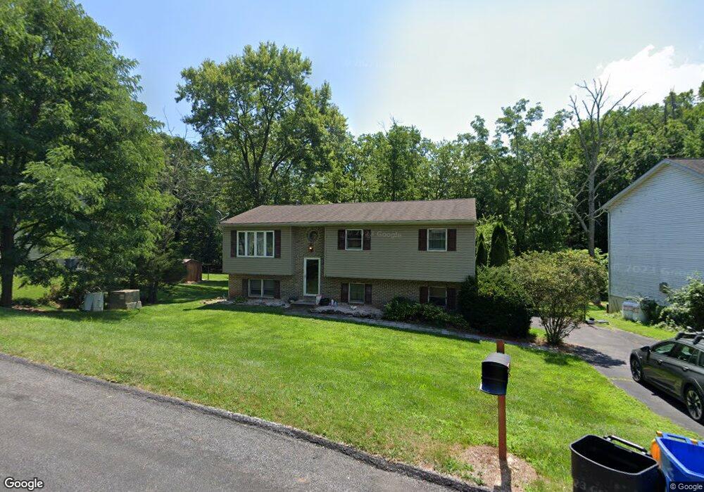
140 Mulligan Dr Etters, PA 17319
Estimated Value: $287,900 - $339,000
3
Beds
1
Bath
1,754
Sq Ft
$174/Sq Ft
Est. Value
About This Home
This home is located at 140 Mulligan Dr, Etters, PA 17319 and is currently estimated at $305,225, approximately $174 per square foot. 140 Mulligan Dr is a home located in York County with nearby schools including Red Mill Elementary School, Crossroads Middle School, and Red Land Senior High School.
Ownership History
Date
Name
Owned For
Owner Type
Purchase Details
Closed on
Sep 29, 2005
Sold by
Gardner Jonathan A and Gardner Margarita E
Bought by
Rensel Rex E and Harvey Mary M
Current Estimated Value
Home Financials for this Owner
Home Financials are based on the most recent Mortgage that was taken out on this home.
Original Mortgage
$149,700
Outstanding Balance
$80,227
Interest Rate
5.78%
Mortgage Type
FHA
Estimated Equity
$224,998
Purchase Details
Closed on
Nov 21, 2003
Sold by
Gardner Jonathan A
Bought by
Gardner Jonathan A and Gardner Margarita E
Home Financials for this Owner
Home Financials are based on the most recent Mortgage that was taken out on this home.
Original Mortgage
$36,500
Interest Rate
5.67%
Mortgage Type
New Conventional
Purchase Details
Closed on
Oct 12, 2000
Sold by
Opfer Scott D and Opfer Karen M
Bought by
Gardner Jonathan A
Home Financials for this Owner
Home Financials are based on the most recent Mortgage that was taken out on this home.
Original Mortgage
$117,150
Interest Rate
7.89%
Mortgage Type
VA
Purchase Details
Closed on
May 21, 1999
Sold by
Norwest Bank Minnesota Na
Bought by
Opfer Scott D and Opfer Karen M
Home Financials for this Owner
Home Financials are based on the most recent Mortgage that was taken out on this home.
Original Mortgage
$72,000
Interest Rate
6.85%
Purchase Details
Closed on
Feb 12, 1999
Sold by
Barnes Patricia J and Fetrow Debra K
Bought by
Norwest Bank Minnesota Na
Create a Home Valuation Report for This Property
The Home Valuation Report is an in-depth analysis detailing your home's value as well as a comparison with similar homes in the area
Home Values in the Area
Average Home Value in this Area
Purchase History
| Date | Buyer | Sale Price | Title Company |
|---|---|---|---|
| Rensel Rex E | $150,900 | None Available | |
| Gardner Jonathan A | -- | Docu File Inc Title & Escrow | |
| Gardner Jonathan A | $114,900 | First American Title Ins Co | |
| Opfer Scott D | $80,000 | -- | |
| Norwest Bank Minnesota Na | $1,205 | -- |
Source: Public Records
Mortgage History
| Date | Status | Borrower | Loan Amount |
|---|---|---|---|
| Open | Rensel Rex E | $149,700 | |
| Previous Owner | Gardner Jonathan A | $36,500 | |
| Previous Owner | Gardner Jonathan A | $117,150 | |
| Previous Owner | Opfer Scott D | $72,000 |
Source: Public Records
Tax History Compared to Growth
Tax History
| Year | Tax Paid | Tax Assessment Tax Assessment Total Assessment is a certain percentage of the fair market value that is determined by local assessors to be the total taxable value of land and additions on the property. | Land | Improvement |
|---|---|---|---|---|
| 2025 | $3,305 | $119,310 | $35,250 | $84,060 |
| 2024 | $4,320 | $119,310 | $35,250 | $84,060 |
| 2023 | $2,954 | $119,310 | $35,250 | $84,060 |
| 2022 | $2,945 | $119,310 | $35,250 | $84,060 |
| 2021 | $2,776 | $119,310 | $35,250 | $84,060 |
| 2020 | $2,743 | $119,310 | $35,250 | $84,060 |
| 2019 | $2,673 | $119,310 | $35,250 | $84,060 |
| 2018 | $2,652 | $119,310 | $35,250 | $84,060 |
| 2017 | $2,580 | $119,310 | $35,250 | $84,060 |
| 2016 | $0 | $119,310 | $35,250 | $84,060 |
| 2015 | -- | $119,310 | $35,250 | $84,060 |
| 2014 | -- | $119,310 | $35,250 | $84,060 |
Source: Public Records
Map
Nearby Homes
- 25 Mulligan Dr
- 60 S Ben Hogan Dr
- 10 Fargreen Ct Unit 1E
- 30 Highland Cir
- 15 Winterberry Ln
- Lot 48 Scarlet Oak Dr
- Lot 29 Scarlet Oak Dr
- Lot 50 Scarlet Oak Dr
- Lot 49 Scarlet Oak Dr
- Lot 47 Scarlet Oak Dr
- Lot 46 Scarlet Oak Dr
- Lot 45 Scarlet Oak Dr
- 5 Winterberry Ln
- 300 Juniper Dr
- 25 Killinger Rd
- 321 Juniper Dr
- 244 Juniper Dr
- 200 Juniper Dr
- 209 Church Rd
- 55 Ashton Dr
- 150 Mulligan Dr
- 130 Mulligan Dr
- 125 Mulligan Dr
- 115 Mulligan Dr
- 155 Mulligan Dr
- 135 Mulligan Dr
- 280 Cartref Rd
- 120 Mulligan Dr
- 85 Bunker Ln
- 145 Mulligan Dr
- 71 Bunker Ln
- 110 Mulligan Dr
- 160 Mulligan Dr
- 265 Cartref Rd
- 75 Bunker Ln
- 98 Bunker Ln
- 100 Mulligan Dr
- 110 Sam Snead Cir
- 85 Mulligan Dr
- 120 Sam Snead Cir