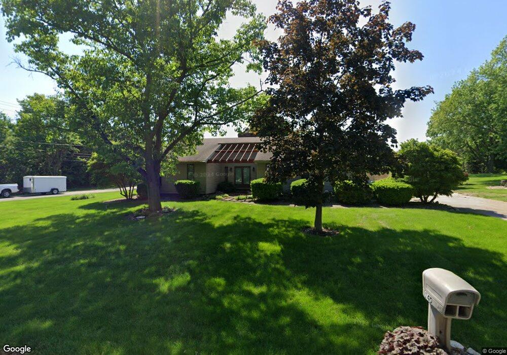
140 N Hickory Ridge Dr Port Clinton, OH 43452
Estimated Value: $384,994 - $539,000
3
Beds
2
Baths
1,817
Sq Ft
$259/Sq Ft
Est. Value
About This Home
This home is located at 140 N Hickory Ridge Dr, Port Clinton, OH 43452 and is currently estimated at $470,749, approximately $259 per square foot. 140 N Hickory Ridge Dr is a home located in Ottawa County with nearby schools including Bataan Memorial Primary School, Bataan Memorial Intermediate School, and Port Clinton Middle School.
Ownership History
Date
Name
Owned For
Owner Type
Purchase Details
Closed on
Mar 6, 2018
Sold by
Hayes Michael J and Hayes Patricia A
Bought by
Hayes Heather N and Hayes Michael
Current Estimated Value
Purchase Details
Closed on
Jul 9, 2003
Sold by
Hoffman James J
Bought by
Hayes Et Al Michael J
Home Financials for this Owner
Home Financials are based on the most recent Mortgage that was taken out on this home.
Original Mortgage
$176,000
Interest Rate
5.36%
Mortgage Type
Purchase Money Mortgage
Purchase Details
Closed on
Feb 3, 1995
Sold by
Kolhoff Judith A
Bought by
Hoffman James J
Home Financials for this Owner
Home Financials are based on the most recent Mortgage that was taken out on this home.
Original Mortgage
$100,000
Interest Rate
9.24%
Mortgage Type
New Conventional
Create a Home Valuation Report for This Property
The Home Valuation Report is an in-depth analysis detailing your home's value as well as a comparison with similar homes in the area
Home Values in the Area
Average Home Value in this Area
Purchase History
| Date | Buyer | Sale Price | Title Company |
|---|---|---|---|
| Hayes Heather N | -- | None Available | |
| Hayes Michael J | -- | None Available | |
| Hayes Et Al Michael J | $220,000 | -- | |
| Hayes Michael J | $220,000 | -- | |
| Hoffman James J | $138,000 | -- |
Source: Public Records
Mortgage History
| Date | Status | Borrower | Loan Amount |
|---|---|---|---|
| Closed | Hayes Michael J | $176,000 | |
| Previous Owner | Hoffman James J | $100,000 |
Source: Public Records
Tax History Compared to Growth
Tax History
| Year | Tax Paid | Tax Assessment Tax Assessment Total Assessment is a certain percentage of the fair market value that is determined by local assessors to be the total taxable value of land and additions on the property. | Land | Improvement |
|---|---|---|---|---|
| 2024 | $2,985 | $104,356 | $19,838 | $84,518 |
| 2023 | $2,985 | $75,334 | $11,018 | $64,316 |
| 2022 | $2,309 | $75,334 | $11,018 | $64,316 |
| 2021 | $2,305 | $75,330 | $11,020 | $64,310 |
| 2020 | $2,318 | $73,140 | $10,700 | $62,440 |
| 2019 | $2,294 | $73,140 | $10,700 | $62,440 |
| 2018 | $2,492 | $73,140 | $10,700 | $62,440 |
| 2017 | $2,528 | $73,210 | $10,700 | $62,510 |
| 2016 | $2,534 | $73,210 | $10,700 | $62,510 |
| 2015 | $2,548 | $73,210 | $10,700 | $62,510 |
| 2014 | $1,247 | $73,210 | $10,700 | $62,510 |
| 2013 | $2,500 | $73,210 | $10,700 | $62,510 |
Source: Public Records
Map
Nearby Homes
- 3500 Woodhill Dr
- 146 N Harbors End Dr Unit 21A
- 2817 E Harbor Rd
- 3571 E Eagle Beach Cir
- 3638 E Rock Cliff Dr
- 2656 E Harbor Rd Unit D-3
- 2656 E Harbor Rd Unit D-1
- 2656 E Harbor Rd Unit D-2
- 3776 E Pine Dr
- 3720 E Aqua Aire Dr Unit 138
- 1217 NE Catawba Rd
- 1217 NE Catawba Rd Unit 15
- 1217 NE Catawba Rd Unit 13
- 1217 NE Catawba Rd Unit 14
- 1217 NE Catawba Rd Unit 16
- 764 SE Catawba Rd Unit 115
- 764 SE Catawba Rd Unit 196
- 764 SE Catawba Rd Unit 109
- 764 SE Catawba Rd Unit 98
- 164 N Hickory Ridge Dr
- 106 W Catawba Rd Unit B
- 106 W Catawba Rd Unit A
- 106 W Catawba Rd
- 106 W Catawba Rd Unit C
- 0 W Catawba Rd Unit 6114289
- 0 W Catawba Rd Unit 20231678
- 0 W Catawba Rd Unit 20220418
- 0 W Catawba Rd Unit 20213417
- 0 W Catawba Rd Unit 20211905
- 0 W Catawba Rd Unit Lot 1 6114289
- 0 W Catawba Rd Unit 20220116
- 188 N Hickory Ridge Dr
- 111 NW Catawba Rd
- 171 N Hickory Ridge Dr
- 106 NW Catawba Rd Unit B
- 106 NW Catawba Rd Unit A
- 106 NW Catawba Rd Unit C
- 106 NW Catawba Rd
- 107 NW Catawba Rd