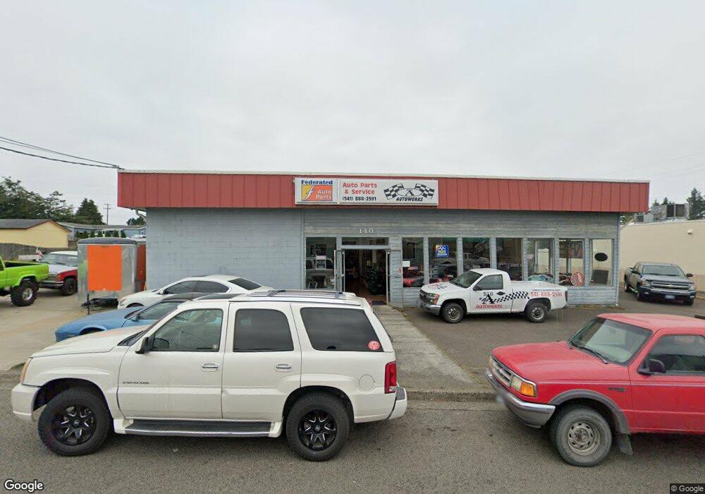
140 S Shoneman Unit 1 Coosbay, OR 97420
Estimated Value: $742,339
--
Bed
--
Bath
5,500
Sq Ft
$135/Sq Ft
Est. Value
About This Home
This home is located at 140 S Shoneman Unit 1, Coosbay, OR 97420 and is currently estimated at $742,339, approximately $134 per square foot. 140 S Shoneman Unit 1 is a home located in Coos County with nearby schools including Sunset School, Madison Elementary School, and Marshfield Senior High School.
Ownership History
Date
Name
Owned For
Owner Type
Purchase Details
Closed on
Jul 25, 2014
Sold by
Henson Charles Preston and Henson Jody Marie
Bought by
North Bend Towing Llc
Current Estimated Value
Home Financials for this Owner
Home Financials are based on the most recent Mortgage that was taken out on this home.
Original Mortgage
$223,222
Interest Rate
4.16%
Mortgage Type
Commercial
Purchase Details
Closed on
Nov 22, 2005
Sold by
Mcinerney Charles E and Mcinerney Janice K
Bought by
Henson Charles Preston and Henson Jody Marie
Home Financials for this Owner
Home Financials are based on the most recent Mortgage that was taken out on this home.
Original Mortgage
$168,500
Interest Rate
5.97%
Mortgage Type
Seller Take Back
Create a Home Valuation Report for This Property
The Home Valuation Report is an in-depth analysis detailing your home's value as well as a comparison with similar homes in the area
Home Values in the Area
Average Home Value in this Area
Purchase History
| Date | Buyer | Sale Price | Title Company |
|---|---|---|---|
| North Bend Towing Llc | $270,000 | Ticor Title Company | |
| Henson Charles Preston | $168,500 | Ticor Title Insurance |
Source: Public Records
Mortgage History
| Date | Status | Borrower | Loan Amount |
|---|---|---|---|
| Closed | North Bend Towing Llc | $223,222 | |
| Previous Owner | Henson Charles Preston | $168,500 |
Source: Public Records
Tax History Compared to Growth
Tax History
| Year | Tax Paid | Tax Assessment Tax Assessment Total Assessment is a certain percentage of the fair market value that is determined by local assessors to be the total taxable value of land and additions on the property. | Land | Improvement |
|---|---|---|---|---|
| 2024 | $3,807 | $219,020 | -- | -- |
| 2023 | $3,692 | $212,650 | $0 | $0 |
| 2022 | $3,631 | $206,460 | $0 | $0 |
| 2021 | $3,537 | $200,450 | $0 | $0 |
| 2020 | $3,438 | $200,450 | $0 | $0 |
| 2019 | $3,300 | $188,960 | $0 | $0 |
| 2018 | $2,736 | $158,340 | $0 | $0 |
| 2017 | $2,487 | $158,340 | $0 | $0 |
| 2016 | $2,338 | $150,800 | $0 | $0 |
| 2015 | $2,883 | $162,150 | $0 | $0 |
| 2014 | $2,883 | $174,360 | $0 | $0 |
Source: Public Records
Map
Nearby Homes
- 1088 Newmark Ave
- 1022 Newmark Ave
- 993 Salmon Ave
- 01500 Cape Arago Hwy
- 245/247 Ackerman Ave
- 283 N Main St
- 274 N Cammann St
- 715 Jackson Ave
- 242 N Wasson St
- 340 Radar Rd
- 0 N Cammann St
- 235 N Wall St
- 1060 Pacific Ave
- 507 Puerto Vista Dr
- 0 2185800 Unit 225689067
- 437 N Wasson St
- 0 Newmark Ave Unit 24289444
- 1435 Ventana Ct
- 293 N Empire Blvd
- 0 N Morrison St
- 140 S Schoneman St
- 1095 Salmon Ave
- 1075 Salmon Ave
- 1055 Salmon
- 1059 Salmon Ave
- 1005 Newmark Ave
- 1047 Salmon Ave
- 1155 Newmark Ave Unit 1
- 1155 Newmark Ave
- 1070 Michigan Ave
- 1056 Michigan Ave
- 1031 Salmon Ave
- 1129 Salmon Ave
- 1129 Salmon Ave
- 1044 Michigan Ave
- 1038 Michigan Ave
- 1110 Michigan Ave
- 1024 Michigan Ave
- 1126 Michigan Ave
- 1022 Newmark St