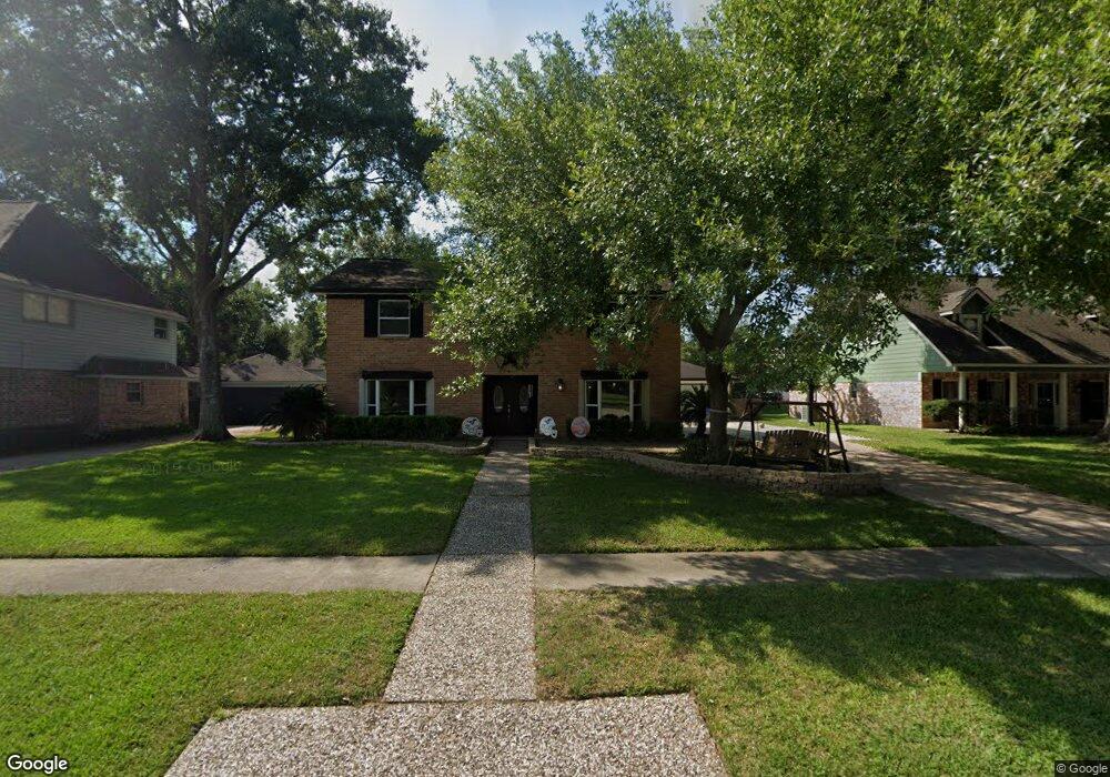
140 Saint Andrews Dr Friendswood, TX 77546
Estimated Value: $353,166 - $387,000
4
Beds
3
Baths
2,424
Sq Ft
$154/Sq Ft
Est. Value
About This Home
This home is located at 140 Saint Andrews Dr, Friendswood, TX 77546 and is currently estimated at $374,042, approximately $154 per square foot. 140 Saint Andrews Dr is a home located in Galveston County with nearby schools including C.W. Cline Elementary School, Windsong Elementary School, and Friendswood Junior High School.
Ownership History
Date
Name
Owned For
Owner Type
Purchase Details
Closed on
Sep 9, 2008
Sold by
Cartus Financial Corp
Bought by
Parks David and Parks Chris Marie
Current Estimated Value
Home Financials for this Owner
Home Financials are based on the most recent Mortgage that was taken out on this home.
Original Mortgage
$153,122
Outstanding Balance
$101,945
Interest Rate
6.54%
Mortgage Type
VA
Estimated Equity
$272,097
Purchase Details
Closed on
Feb 20, 1998
Sold by
Garza Roy J
Bought by
Mosley Terry D and Mosley Virginia G
Home Financials for this Owner
Home Financials are based on the most recent Mortgage that was taken out on this home.
Original Mortgage
$78,000
Interest Rate
6.91%
Mortgage Type
Assumption
Create a Home Valuation Report for This Property
The Home Valuation Report is an in-depth analysis detailing your home's value as well as a comparison with similar homes in the area
Home Values in the Area
Average Home Value in this Area
Purchase History
| Date | Buyer | Sale Price | Title Company |
|---|---|---|---|
| Parks David | -- | Southland Title Company | |
| Cartus Financial Corp | -- | Southland Title Company | |
| Mosley Terry D | -- | -- |
Source: Public Records
Mortgage History
| Date | Status | Borrower | Loan Amount |
|---|---|---|---|
| Open | Parks David | $153,122 | |
| Previous Owner | Mosley Terry D | $78,000 |
Source: Public Records
Tax History Compared to Growth
Tax History
| Year | Tax Paid | Tax Assessment Tax Assessment Total Assessment is a certain percentage of the fair market value that is determined by local assessors to be the total taxable value of land and additions on the property. | Land | Improvement |
|---|---|---|---|---|
| 2025 | $5,099 | $339,280 | $52,200 | $287,080 |
| 2024 | $5,099 | $337,510 | $52,200 | $285,310 |
| 2023 | $5,099 | $313,567 | $0 | $0 |
| 2022 | $6,279 | $285,061 | $0 | $0 |
| 2021 | $6,053 | $300,270 | $52,200 | $248,070 |
| 2020 | $5,676 | $251,610 | $52,200 | $199,410 |
| 2019 | $5,438 | $214,170 | $28,050 | $186,120 |
| 2018 | $5,275 | $216,420 | $28,050 | $188,370 |
| 2017 | $4,875 | $218,620 | $28,050 | $190,570 |
| 2016 | $4,196 | $184,160 | $28,050 | $156,110 |
| 2015 | $1,334 | $168,120 | $28,050 | $140,070 |
| 2014 | $1,256 | $133,530 | $28,050 | $105,480 |
Source: Public Records
Map
Nearby Homes
- 251 Saint Cloud Dr
- 110 Dorado Dr
- Amalfi Plan at Friendswood Trails
- Portofino Plan at Friendswood Trails
- Postiano Plan at Friendswood Trails
- Capri Plan at Friendswood Trails
- Ravello Plan at Friendswood Trails
- 2512 Ravenna Ct
- 1508 Harvest Vine Ct
- 2829 Fairway Dr
- 2904 Bridle Path Ln
- 2871 Love Ln
- 601 E Castle Harbour Dr
- 40 Windsong Ln
- 644 E Castle Harbour Dr
- 2847 Everett Dr
- 2605 S Mission Cir
- 1804 San Jose St
- 2082 Wilderness Trail
- 2211 S Mission Cir
- 136 Saint Andrews Dr
- 144 Saint Andrews Dr
- 132 Saint Andrews Dr
- 148 Saint Andrews Dr
- 225 Saint Cloud Dr
- 229 Saint Cloud Dr
- 221 Saint Cloud Dr
- 137 Saint Andrews Dr
- 141 Saint Andrews Dr
- 128 Saint Andrews Dr
- 133 Saint Andrews Dr
- 233 Saint Cloud Dr
- 145 Saint Andrews Dr
- 217 Saint Cloud Dr
- 129 Saint Andrews Dr
- 124 Saint Andrews Dr
- 213 Saint Cloud Dr
- 237 Saint Cloud Dr
- 226 Saint Cloud Dr
- 222 Saint Cloud Dr