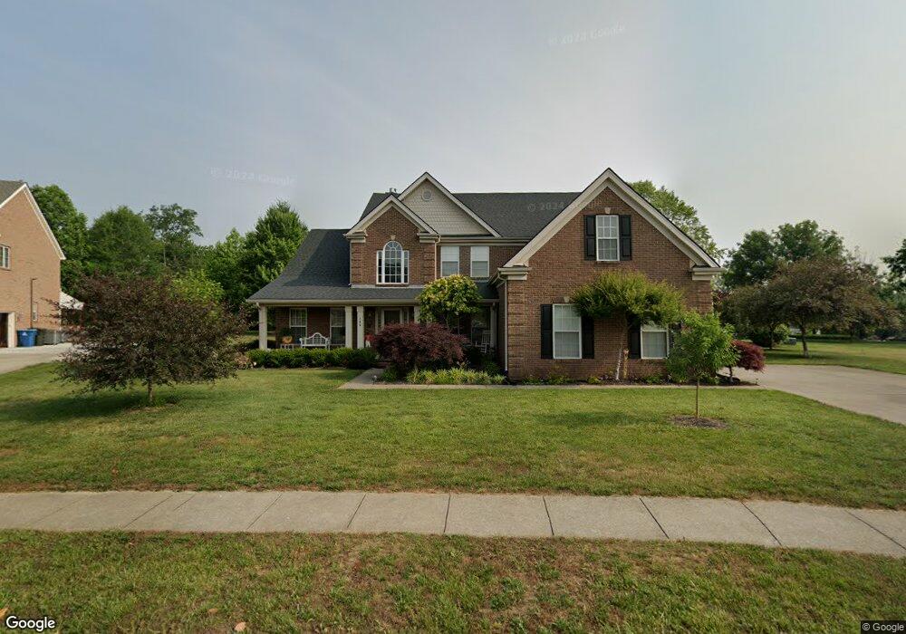
140 Saint Andrews Way Georgetown, KY 40324
Estimated Value: $496,197 - $552,000
5
Beds
3
Baths
2,873
Sq Ft
$183/Sq Ft
Est. Value
About This Home
This home is located at 140 Saint Andrews Way, Georgetown, KY 40324 and is currently estimated at $526,549, approximately $183 per square foot. 140 Saint Andrews Way is a home located in Scott County with nearby schools including Western Elementary School, Creekside Elementary School, and Royal Spring Middle School.
Ownership History
Date
Name
Owned For
Owner Type
Purchase Details
Closed on
Jan 27, 2005
Sold by
Canewood Inc
Bought by
Lanza Anthony and Lanza Roseanne
Current Estimated Value
Home Financials for this Owner
Home Financials are based on the most recent Mortgage that was taken out on this home.
Original Mortgage
$52,220
Interest Rate
5.72%
Mortgage Type
Credit Line Revolving
Create a Home Valuation Report for This Property
The Home Valuation Report is an in-depth analysis detailing your home's value as well as a comparison with similar homes in the area
Home Values in the Area
Average Home Value in this Area
Purchase History
| Date | Buyer | Sale Price | Title Company |
|---|---|---|---|
| Lanza Anthony | $348,137 | None Available |
Source: Public Records
Mortgage History
| Date | Status | Borrower | Loan Amount |
|---|---|---|---|
| Previous Owner | Lanza Anthony | $52,220 | |
| Previous Owner | Lanza Anthony | $278,509 |
Source: Public Records
Tax History Compared to Growth
Tax History
| Year | Tax Paid | Tax Assessment Tax Assessment Total Assessment is a certain percentage of the fair market value that is determined by local assessors to be the total taxable value of land and additions on the property. | Land | Improvement |
|---|---|---|---|---|
| 2024 | $3,435 | $428,300 | $0 | $0 |
| 2023 | $3,300 | $410,300 | $70,000 | $340,300 |
| 2022 | $2,706 | $358,800 | $65,000 | $293,800 |
| 2021 | $2,852 | $343,300 | $65,000 | $278,300 |
| 2020 | $2,545 | $335,500 | $65,000 | $270,500 |
| 2019 | $2,587 | $335,500 | $0 | $0 |
| 2018 | $2,564 | $333,100 | $0 | $0 |
| 2017 | $2,577 | $333,100 | $0 | $0 |
| 2016 | $2,385 | $333,100 | $0 | $0 |
| 2015 | $2,370 | $296,200 | $0 | $0 |
| 2014 | $2,463 | $297,100 | $0 | $0 |
| 2011 | $185 | $299,100 | $0 | $0 |
Source: Public Records
Map
Nearby Homes
- 194 Shinnecock Hill Dr
- 177 Swilcan Bridge Way
- 141 Shinnecock Hill Dr
- 245 Sturbridge Dr
- 145 Inverness Dr
- 442 General John Payne Blvd
- 98 Delissa Dr
- 407 General John Payne Blvd
- 405 General John Payne Blvd
- 209 Christal Dr
- 126 Autumn Leaf Path
- 109 Acorn Path
- 134 The Masters
- 119 Acorn Path
- 106 Plymouth Ct
- 167 Delissa Dr
- 123 The Masters
- 100 Canewood Blvd
- 127 Anne Jennings
- 180 Hillside Dr
- 138 Saint Andrews Way
- 501 General John Payne Blvd
- 505 General John Payne Blvd
- 503 General John Payne Blvd
- 139 Saint Andrews Way
- 136 Saint Andrews Way
- 137 Saint Andrews Way
- 134 Saint Andrews Way
- 507 General John Payne Blvd
- 493 General John Payne Blvd
- 502 General John Payne Blvd
- 135 Saint Andrews Way
- 504 General John Payne Blvd Unit 3B
- 504 General John Payne Blvd Unit 2
- 504 General John Payne Blvd
- 500 General John Payne Blvd
- 491 General John Payne Blvd Unit 3B
- 498 General John Payne Blvd
- 132 Saint Andrews Way
- 506 General John Payne Blvd