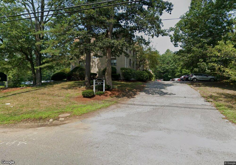
140 Swanson Rd Unit 419 Boxborough, MA 01719
Estimated Value: $220,000 - $242,000
2
Beds
1
Bath
802
Sq Ft
$287/Sq Ft
Est. Value
About This Home
This home is located at 140 Swanson Rd Unit 419, Boxborough, MA 01719 and is currently estimated at $229,941, approximately $286 per square foot. 140 Swanson Rd Unit 419 is a home located in Middlesex County with nearby schools including Acton-Boxborough Regional High School.
Ownership History
Date
Name
Owned For
Owner Type
Purchase Details
Closed on
Dec 10, 2010
Sold by
Pnc Bank Na
Bought by
Cho Chong M
Current Estimated Value
Purchase Details
Closed on
Apr 1, 2010
Sold by
Hansen Donald R
Bought by
Pnc Bk
Purchase Details
Closed on
Oct 28, 2005
Sold by
Eastham David J
Bought by
Hansen Donald R
Home Financials for this Owner
Home Financials are based on the most recent Mortgage that was taken out on this home.
Original Mortgage
$121,600
Interest Rate
5.79%
Mortgage Type
Purchase Money Mortgage
Purchase Details
Closed on
Mar 15, 2002
Sold by
Marfanning Christopher and Fanning Henry J
Bought by
Eastham David J
Home Financials for this Owner
Home Financials are based on the most recent Mortgage that was taken out on this home.
Original Mortgage
$121,700
Interest Rate
7.04%
Mortgage Type
Purchase Money Mortgage
Create a Home Valuation Report for This Property
The Home Valuation Report is an in-depth analysis detailing your home's value as well as a comparison with similar homes in the area
Home Values in the Area
Average Home Value in this Area
Purchase History
| Date | Buyer | Sale Price | Title Company |
|---|---|---|---|
| Cho Chong M | $70,000 | -- | |
| Pnc Bk | $95,000 | -- | |
| Hansen Donald R | $152,000 | -- | |
| Eastham David J | $125,500 | -- |
Source: Public Records
Mortgage History
| Date | Status | Borrower | Loan Amount |
|---|---|---|---|
| Previous Owner | Hansen Donald R | $121,600 | |
| Previous Owner | Eastham David J | $121,700 |
Source: Public Records
Tax History Compared to Growth
Tax History
| Year | Tax Paid | Tax Assessment Tax Assessment Total Assessment is a certain percentage of the fair market value that is determined by local assessors to be the total taxable value of land and additions on the property. | Land | Improvement |
|---|---|---|---|---|
| 2025 | $3,373 | $222,800 | $0 | $222,800 |
| 2024 | $2,655 | $177,100 | $0 | $177,100 |
| 2023 | $2,257 | $145,400 | $0 | $145,400 |
| 2022 | $2,350 | $134,900 | $0 | $134,900 |
| 2020 | $2,123 | $127,000 | $0 | $127,000 |
| 2019 | $1,928 | $117,400 | $0 | $117,400 |
| 2018 | $1,879 | $114,300 | $0 | $114,300 |
| 2017 | $1,841 | $109,500 | $0 | $109,500 |
| 2016 | $1,571 | $96,000 | $0 | $96,000 |
| 2015 | $1,380 | $82,900 | $0 | $82,900 |
| 2014 | $1,497 | $84,600 | $0 | $84,600 |
Source: Public Records
Map
Nearby Homes
- 176 Swanson Rd Unit 309
- 220 Swanson Rd Unit 605
- 220 Swanson Rd Unit 606
- 53 Swanson Ct Unit 36C
- 42 Swanson Ct Unit 14A
- 50 Spencer Rd Unit 36
- 58 Spencer Rd Unit 18K
- 310 Codman Hill Rd Unit 35D
- 1155 Burroughs Rd
- 89 School House Ln
- 139 Picnic St
- 4 Bolton Rd
- 24 Fairbanks St
- 166 Littleton Rd Unit 3
- 11 Fairbanks St Unit 2
- 5 Fairbank St
- 777 Depot Rd
- 63 Leonard Rd Unit 63
- 14 Pine Hill Way
- 13 Pine Hill Way
- 140 Swanson Rd Unit 424
- 140 Swanson Rd Unit 423
- 140 Swanson Rd Unit 422
- 140 Swanson Rd Unit 421
- 140 Swanson Rd Unit 420
- 140 Swanson Rd Unit 417
- 140 Swanson Rd Unit 416
- 140 Swanson Rd Unit 415
- 140 Swanson Rd Unit 414
- 140 Swanson Rd Unit 413
- 146 Swanson Rd Unit 412
- 146 Swanson Rd Unit 411
- 146 Swanson Rd Unit 410
- 146 Swanson Rd Unit 409
- 146 Swanson Rd Unit 408
- 146 Swanson Rd Unit 407
- 146 Swanson Rd Unit 406
- 146 Swanson Rd Unit 405
- 146 Swanson Rd Unit 404
- 146 Swanson Rd Unit 403
