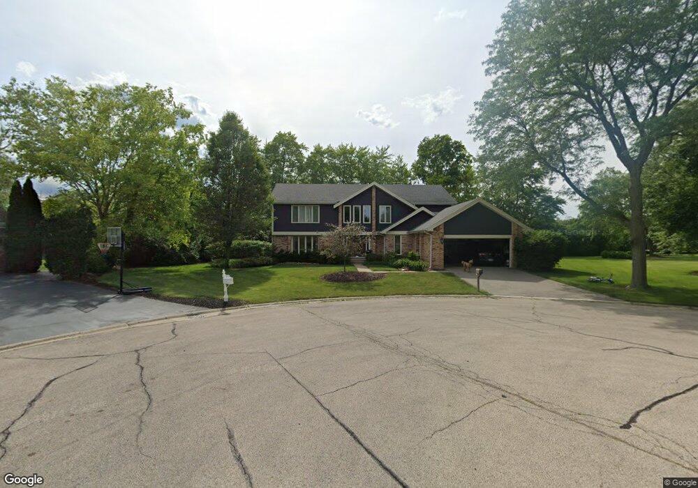
140 Tall Trees Cir Barrington, IL 60010
Estimated Value: $755,000 - $839,000
4
Beds
3
Baths
3,291
Sq Ft
$241/Sq Ft
Est. Value
About This Home
This home is located at 140 Tall Trees Cir, Barrington, IL 60010 and is currently estimated at $793,383, approximately $241 per square foot. 140 Tall Trees Cir is a home located in Lake County with nearby schools including Arnett C. Lines Elementary School, Barrington Middle School Station Campus, and Barrington High School.
Ownership History
Date
Name
Owned For
Owner Type
Purchase Details
Closed on
May 13, 2009
Sold by
Dominique Lance L
Bought by
Soward Justin and Soward Allison L
Current Estimated Value
Home Financials for this Owner
Home Financials are based on the most recent Mortgage that was taken out on this home.
Original Mortgage
$392,755
Outstanding Balance
$248,018
Interest Rate
4.84%
Mortgage Type
FHA
Estimated Equity
$545,365
Purchase Details
Closed on
Jul 11, 2002
Sold by
Dominique Karen N
Bought by
Dominique Lance L
Purchase Details
Closed on
May 24, 1996
Sold by
Tanner Carl and Tanner Gail
Bought by
Dominique Lance L and Dominique Karen N
Home Financials for this Owner
Home Financials are based on the most recent Mortgage that was taken out on this home.
Original Mortgage
$280,000
Interest Rate
7.37%
Purchase Details
Closed on
Dec 30, 1993
Sold by
Glassgow Judith A and Glassgow Willis A
Bought by
Tanner Carl and Tanner Gail
Home Financials for this Owner
Home Financials are based on the most recent Mortgage that was taken out on this home.
Original Mortgage
$260,000
Interest Rate
5.37%
Create a Home Valuation Report for This Property
The Home Valuation Report is an in-depth analysis detailing your home's value as well as a comparison with similar homes in the area
Home Values in the Area
Average Home Value in this Area
Purchase History
| Date | Buyer | Sale Price | Title Company |
|---|---|---|---|
| Soward Justin | $400,000 | Greater Illinois Title Comp | |
| Dominique Lance L | -- | -- | |
| Dominique Lance L | $350,000 | Chicago Title Insurance Co | |
| Tanner Carl | $226,666 | Chicago Title Insurance Co |
Source: Public Records
Mortgage History
| Date | Status | Borrower | Loan Amount |
|---|---|---|---|
| Open | Soward Justin | $392,755 | |
| Previous Owner | Dominique Lance L | $280,000 | |
| Previous Owner | Tanner Carl | $260,000 |
Source: Public Records
Tax History Compared to Growth
Tax History
| Year | Tax Paid | Tax Assessment Tax Assessment Total Assessment is a certain percentage of the fair market value that is determined by local assessors to be the total taxable value of land and additions on the property. | Land | Improvement |
|---|---|---|---|---|
| 2024 | $13,727 | $196,342 | $44,551 | $151,791 |
| 2023 | $10,633 | $191,068 | $43,354 | $147,714 |
| 2022 | $10,633 | $147,773 | $42,516 | $105,257 |
| 2021 | $10,409 | $143,986 | $41,426 | $102,560 |
| 2020 | $10,180 | $143,986 | $41,426 | $102,560 |
| 2019 | $13,002 | $184,416 | $41,065 | $143,351 |
| 2018 | $12,750 | $183,808 | $44,177 | $139,631 |
| 2017 | $12,828 | $181,593 | $43,645 | $137,948 |
| 2016 | $12,636 | $175,843 | $42,263 | $133,580 |
| 2015 | $12,135 | $167,485 | $40,254 | $127,231 |
| 2014 | $11,425 | $152,762 | $41,530 | $111,232 |
| 2012 | $11,860 | $153,083 | $41,617 | $111,466 |
Source: Public Records
Map
Nearby Homes
- 110 Tudor Dr
- 290 Cold Spring Rd
- 185 Cold Spring Rd
- 104 Howe Terrace
- 101 Surrey Ln
- 523 N Ela Rd
- 129 Roth Ave
- 104 Lois Ln
- 1312 Lake Shore Dr N Unit 7
- 1288 The Point St
- 175 Hilltop Ave
- 117 Beverly Rd
- 44 Oak Ridge Ln
- 216 Beverly Rd
- 248 Beverly Rd
- 169 Crestview Ct
- 432 Whitney Dr
- 1010 Oakland Dr
- 336 Eastern Ave Unit C4
- 319 S Glendale Ave Unit 204
- 130 Tall Trees Cir
- 150 Tall Trees Dr
- 120 Tall Trees Cir
- 160 Tall Trees Dr
- 170 Tall Trees Dr
- 110 Tall Trees Dr
- 1160 Tall Trees Dr
- 190 Birchwood Dr
- 101 Wyngate Dr
- 195 Birchwood Dr
- 225 Bellingham Dr
- 125 Tall Trees Dr
- 105 Tall Trees Dr
- 235 Bellingham Dr
- 115 Tall Trees Dr
- 190 Tall Trees Dr
- 200 Birchwood Dr
- 100 Wyngate Dr
- 130 Castle Ct
- 120 Castle Ct