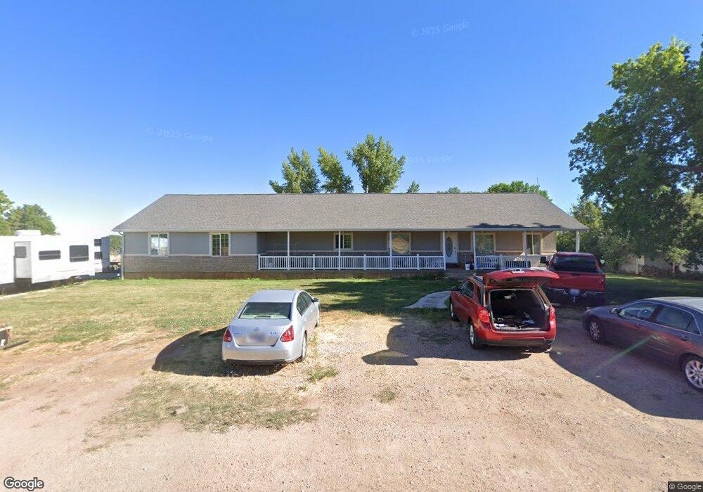
140 W 300 S Kanosh, UT 84637
Estimated Value: $445,000 - $506,000
--
Bed
--
Bath
--
Sq Ft
0.63
Acres
About This Home
This home is located at 140 W 300 S, Kanosh, UT 84637 and is currently estimated at $480,428. 140 W 300 S is a home.
Ownership History
Date
Name
Owned For
Owner Type
Purchase Details
Closed on
Feb 23, 2009
Sold by
Taylor Travis K
Bought by
Taylor Travis K and Taylor Sharon K
Current Estimated Value
Home Financials for this Owner
Home Financials are based on the most recent Mortgage that was taken out on this home.
Original Mortgage
$180,000
Interest Rate
5.08%
Mortgage Type
New Conventional
Create a Home Valuation Report for This Property
The Home Valuation Report is an in-depth analysis detailing your home's value as well as a comparison with similar homes in the area
Home Values in the Area
Average Home Value in this Area
Purchase History
| Date | Buyer | Sale Price | Title Company |
|---|---|---|---|
| Taylor Travis K | -- | -- | |
| Taylor Travis K | -- | -- |
Source: Public Records
Mortgage History
| Date | Status | Borrower | Loan Amount |
|---|---|---|---|
| Closed | Taylor Travis K | $180,000 |
Source: Public Records
Tax History Compared to Growth
Tax History
| Year | Tax Paid | Tax Assessment Tax Assessment Total Assessment is a certain percentage of the fair market value that is determined by local assessors to be the total taxable value of land and additions on the property. | Land | Improvement |
|---|---|---|---|---|
| 2025 | $2,265 | $296,667 | $32,981 | $263,686 |
| 2024 | $2,265 | $312,315 | $19,709 | $292,606 |
| 2023 | $2,728 | $312,315 | $19,709 | $292,606 |
| 2022 | $1,817 | $170,729 | $15,766 | $154,963 |
| 2021 | $1,859 | $168,396 | $13,710 | $154,686 |
| 2020 | $1,324 | $121,103 | $12,464 | $108,639 |
| 2019 | $1,193 | $109,751 | $11,435 | $98,316 |
| 2018 | $1,153 | $108,711 | $10,395 | $98,316 |
| 2017 | $1,206 | $108,711 | $10,395 | $98,316 |
| 2016 | $1,071 | $100,760 | $7,796 | $92,964 |
| 2015 | $1,072 | $100,760 | $7,796 | $92,964 |
| 2014 | -- | $100,760 | $7,796 | $92,964 |
| 2013 | -- | $100,760 | $7,796 | $92,964 |
Source: Public Records
Map
Nearby Homes
- 115 W 200 S
- 58 E 300 South St
- 8610 S Highway 91
- 135 E 200 N
- 5098 W Hatton Rd
- Parcel # 8816
- 145 N 200 E
- 60 W Center St
- 50 N 100 Rd E
- 0 Tbd Black Rock Rd Unit LotWP001
- 1565 W Sunflower Ln Unit 3
- 1615 W Sunflower Ln
- 1615 W Sunflower Ln Unit 4
- 1565 W Sunflower Ln
- 2000 N West Frontage I-15
- 1100 S 725 Rd W
- 310 S 500 West Rd
- 190 W 400 St S
- 760 E 700 St S
- 155 E 500 St S
- 110 W 300 S
- 160 W 300 S
- 285 S S 200 West St Rd
- 295 S 200 W Unit 2
- 95 W 300 S
- 90 W 300 S
- 265 S 200 W
- 175 W 200 S Unit 1
- 175 W 200 S Unit 2
- 175 W 200 S Unit 4
- 175 W 200 S Unit 7
- 175 W 200 S Unit 6
- 175 W 200 S
- 175 W 200 S
- 265 S 100 W
- 235 S 100 W
- 255 S S 200 West St St
- 145 W 200 S
- 175 W 200 S
- 240 W 200 S