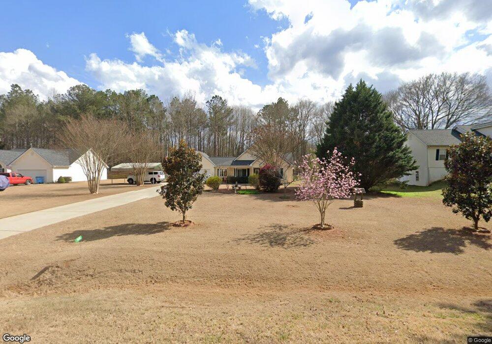
1400 Coan Dr Locust Grove, GA 30248
Estimated Value: $281,077 - $299,000
3
Beds
2
Baths
1,651
Sq Ft
$174/Sq Ft
Est. Value
About This Home
This home is located at 1400 Coan Dr, Locust Grove, GA 30248 and is currently estimated at $288,019, approximately $174 per square foot. 1400 Coan Dr is a home located in Henry County with nearby schools including Unity Grove Elementary School, Locust Grove Middle School, and Locust Grove High School.
Ownership History
Date
Name
Owned For
Owner Type
Purchase Details
Closed on
Mar 10, 2017
Sold by
Moody Ramona
Bought by
Simmons Mcclellen C and Simmons Virginia A
Current Estimated Value
Purchase Details
Closed on
Jan 23, 2009
Sold by
Moody Florence J
Bought by
Moody Florence J and Moody Ramona
Home Financials for this Owner
Home Financials are based on the most recent Mortgage that was taken out on this home.
Original Mortgage
$115,000
Interest Rate
5.23%
Mortgage Type
Stand Alone Second
Purchase Details
Closed on
Apr 30, 2002
Sold by
Easler Construction Co Llc
Bought by
Brannon Andrew and Brannon Kelly M
Home Financials for this Owner
Home Financials are based on the most recent Mortgage that was taken out on this home.
Original Mortgage
$126,454
Interest Rate
7.16%
Mortgage Type
FHA
Create a Home Valuation Report for This Property
The Home Valuation Report is an in-depth analysis detailing your home's value as well as a comparison with similar homes in the area
Home Values in the Area
Average Home Value in this Area
Purchase History
| Date | Buyer | Sale Price | Title Company |
|---|---|---|---|
| Simmons Mcclellen C | $145,000 | -- | |
| Moody Florence J | -- | -- | |
| Moody Florence J | $135,000 | -- | |
| Brannon Andrew | $128,500 | -- |
Source: Public Records
Mortgage History
| Date | Status | Borrower | Loan Amount |
|---|---|---|---|
| Previous Owner | Moody Florence J | $115,000 | |
| Previous Owner | Brannon Andrew | $126,454 |
Source: Public Records
Tax History Compared to Growth
Tax History
| Year | Tax Paid | Tax Assessment Tax Assessment Total Assessment is a certain percentage of the fair market value that is determined by local assessors to be the total taxable value of land and additions on the property. | Land | Improvement |
|---|---|---|---|---|
| 2025 | $780 | $121,960 | $14,000 | $107,960 |
| 2024 | $780 | $116,080 | $14,000 | $102,080 |
| 2023 | $510 | $115,440 | $14,000 | $101,440 |
| 2022 | $654 | $90,400 | $14,000 | $76,400 |
| 2021 | $654 | $75,960 | $14,000 | $61,960 |
| 2020 | $654 | $64,720 | $12,000 | $52,720 |
| 2019 | $654 | $62,920 | $12,000 | $50,920 |
| 2018 | $654 | $57,680 | $10,800 | $46,880 |
| 2016 | $568 | $53,880 | $10,000 | $43,880 |
| 2015 | $580 | $49,040 | $10,000 | $39,040 |
| 2014 | $557 | $46,720 | $10,000 | $36,720 |
Source: Public Records
Map
Nearby Homes
- 218 Baxter Ln
- 165 Caraway Rd
- 1850 Old Jackson Rd
- 601 Amerigo Ct
- 604 Onieda Dr
- 521 Deadwood Trail
- 1627 Leguin Mill Rd
- 143 Kimbell Farm Dr
- 305 Annie Ln Unit 2
- 108 Caraway Rd
- 1680 Leguin Mill Rd
- 100 Harbin Trail
- 1000 Coan Dr
- 705 Seabolt Rd
- 1126 Old Jackson Rd
- 230 Leguin Mill Rd
- 976 S Laney Rd
- 678 Seabolt Rd
- 121, 125, 129 Case Dr
- S S Laney Rd
- 1350 Coan Dr
- 1460 Coan Dr Unit IV
- 1300 Coan Dr
- 2038 Big Cypress Ln Unit IV
- 1490 Coan Dr Unit VI
- 2034 Big Cypress Ln Unit IV
- 2040 Big Cypress Ln
- 2040 Big Cypress Ln Unit IV
- 1379 Coan Dr Unit I
- 1280 Coan Dr
- 1280 Coan Dr Unit IV
- 1355 Coan Dr
- 1355 Coan Dr Unit 1
- 1355 Coan Dr Unit B
- 1355 Coan Dr Unit A
- 1451 Coan Dr
- 0 Big Cypress Ln Unit 7289157
- 0 Big Cypress Ln Unit 7069041
- 0 Big Cypress Ln Unit 3259482
- 0 Big Cypress Ln Unit 8721264