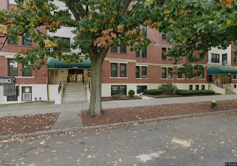
1400 Commonwealth Ave Unit 1 Allston, MA 02134
Commonwealth NeighborhoodEstimated Value: $484,000 - $530,000
2
Beds
1
Bath
850
Sq Ft
$601/Sq Ft
Est. Value
About This Home
This home is located at 1400 Commonwealth Ave Unit 1, Allston, MA 02134 and is currently estimated at $510,849, approximately $600 per square foot. 1400 Commonwealth Ave Unit 1 is a home located in Suffolk County with nearby schools including Boston Green Academy Horace Mann Charter School, St Columbkille Partnership School, and Mesivta High School of Greater Boston.
Ownership History
Date
Name
Owned For
Owner Type
Purchase Details
Closed on
Apr 14, 2006
Sold by
Besculides Melanie C and Memtsoudis Stavros G
Bought by
Yavarow Scott M
Current Estimated Value
Home Financials for this Owner
Home Financials are based on the most recent Mortgage that was taken out on this home.
Original Mortgage
$190,000
Interest Rate
6.28%
Mortgage Type
Purchase Money Mortgage
Purchase Details
Closed on
Feb 12, 2004
Sold by
Olson Kristine K
Bought by
Besculides Melanie C and Memtsoudis Stavros G
Home Financials for this Owner
Home Financials are based on the most recent Mortgage that was taken out on this home.
Original Mortgage
$213,750
Interest Rate
5.82%
Mortgage Type
Purchase Money Mortgage
Purchase Details
Closed on
Jul 31, 2001
Sold by
Abrams Ross M
Bought by
Olson Kristine K
Home Financials for this Owner
Home Financials are based on the most recent Mortgage that was taken out on this home.
Original Mortgage
$160,500
Interest Rate
7.18%
Mortgage Type
Purchase Money Mortgage
Purchase Details
Closed on
Nov 2, 1987
Sold by
Blanco Jose A
Bought by
Abrams R M
Home Financials for this Owner
Home Financials are based on the most recent Mortgage that was taken out on this home.
Original Mortgage
$93,600
Interest Rate
10.97%
Mortgage Type
Purchase Money Mortgage
Create a Home Valuation Report for This Property
The Home Valuation Report is an in-depth analysis detailing your home's value as well as a comparison with similar homes in the area
Home Values in the Area
Average Home Value in this Area
Purchase History
| Date | Buyer | Sale Price | Title Company |
|---|---|---|---|
| Yavarow Scott M | $237,500 | -- | |
| Besculides Melanie C | $225,000 | -- | |
| Olson Kristine K | $169,000 | -- | |
| Abrams R M | $104,000 | -- |
Source: Public Records
Mortgage History
| Date | Status | Borrower | Loan Amount |
|---|---|---|---|
| Open | Yavarow Scott M | $202,932 | |
| Closed | Yavarow Scott M | $219,000 | |
| Closed | Yavarow Scott M | $218,000 | |
| Closed | Yavarow Scott M | $190,000 | |
| Previous Owner | Abrams R M | $213,750 | |
| Previous Owner | Olson Kristine K | $160,500 | |
| Previous Owner | Abrams R M | $93,600 |
Source: Public Records
Property History
| Date | Event | Price | Change | Sq Ft Price |
|---|---|---|---|---|
| 08/23/2025 08/23/25 | Off Market | $2,650 | -- | -- |
| 08/18/2025 08/18/25 | Off Market | $2,350 | -- | -- |
| 07/15/2025 07/15/25 | For Rent | $2,350 | -11.3% | -- |
| 05/21/2025 05/21/25 | For Rent | $2,650 | +12.8% | -- |
| 03/06/2025 03/06/25 | Off Market | $2,350 | -- | -- |
| 01/30/2025 01/30/25 | For Rent | $2,350 | -6.0% | -- |
| 11/29/2024 11/29/24 | Off Market | $2,500 | -- | -- |
| 11/29/2024 11/29/24 | Off Market | $2,500 | -- | -- |
| 09/27/2024 09/27/24 | For Rent | $2,500 | 0.0% | -- |
| 09/27/2024 09/27/24 | For Rent | $2,500 | -- | -- |
Tax History Compared to Growth
Tax History
| Year | Tax Paid | Tax Assessment Tax Assessment Total Assessment is a certain percentage of the fair market value that is determined by local assessors to be the total taxable value of land and additions on the property. | Land | Improvement |
|---|---|---|---|---|
| 2025 | $4,830 | $417,100 | $0 | $417,100 |
| 2024 | $4,162 | $381,800 | $0 | $381,800 |
| 2023 | $4,101 | $381,800 | $0 | $381,800 |
| 2022 | $3,701 | $340,200 | $0 | $340,200 |
| 2021 | $3,630 | $340,200 | $0 | $340,200 |
| 2020 | $3,232 | $306,100 | $0 | $306,100 |
| 2019 | $3,163 | $300,100 | $0 | $300,100 |
| 2018 | $2,941 | $280,600 | $0 | $280,600 |
| 2017 | $2,751 | $259,800 | $0 | $259,800 |
| 2016 | $2,622 | $238,400 | $0 | $238,400 |
| 2015 | $2,904 | $239,800 | $0 | $239,800 |
| 2014 | $2,741 | $217,900 | $0 | $217,900 |
Source: Public Records
Map
Nearby Homes
- 194 Allston St Unit 2
- 161 Allston St
- 1404 Commonwealth Ave Unit 4-8
- 198 Allston St Unit 3
- 1408 Commonwealth Ave Unit 20
- 229 Kelton St Unit 1
- 147 Kelton St Unit 609
- 147 Kelton St Unit 312
- 152-156 Kelton St
- 130 Glenville Ave
- 245 Kelton St Unit 21
- 15 Walbridge St Unit 3
- 1411 Commonwealth Ave Unit 303
- 1411 Commonwealth Ave Unit 504
- 1472 Commonwealth Ave Unit A
- 285 Corey Rd Unit 7
- 4 Commonwealth Ct Unit 20
- 1486 Commonwealth Ave Unit 4
- 1486 Commonwealth Ave Unit 1
- 86 Glenville Ave Unit 2
- 1400 Commonwealth Ave Unit 16
- 1400 Commonwealth Ave Unit 18
- 1400 Commonwealth Ave Unit 17
- 1400 Commonwealth Ave Unit 16
- 1400 Commonwealth Ave Unit 15
- 1400 Commonwealth Ave Unit 14
- 1400 Commonwealth Ave Unit 12
- 1400 Commonwealth Ave Unit 11
- 1400 Commonwealth Ave Unit 10
- 1400 Commonwealth Ave Unit 9
- 1400 Commonwealth Ave Unit 8
- 1400 Commonwealth Ave Unit 7
- 1400 Commonwealth Ave Unit 5
- 1400 Commonwealth Ave Unit 4
- 1400 Commonwealth Ave Unit 3
- 1400 Commonwealth Ave Unit 2
- 1400 Commonwealth Ave Unit 1315-207
- 1400 Commonwealth Ave Unit 24
- 1400 Commonwealth Ave Unit 35
- 1400 Commonwealth Ave Unit 1315-301