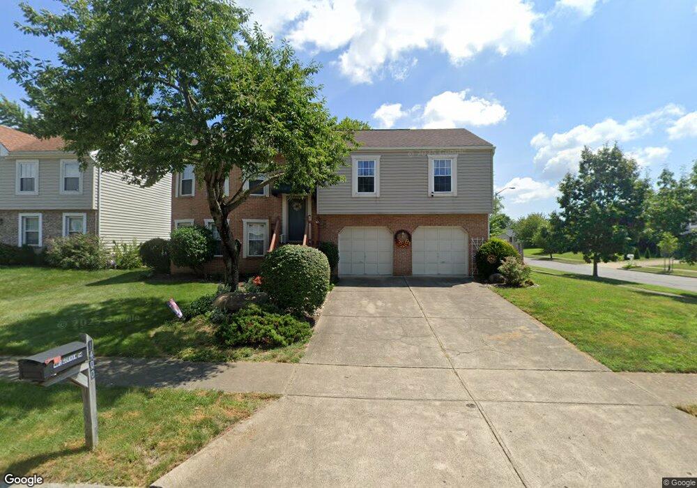
1400 Gorham Dr Columbus, OH 43223
Estimated Value: $255,195 - $284,000
3
Beds
3
Baths
1,554
Sq Ft
$171/Sq Ft
Est. Value
About This Home
This home is located at 1400 Gorham Dr, Columbus, OH 43223 and is currently estimated at $266,299, approximately $171 per square foot. 1400 Gorham Dr is a home located in Franklin County with nearby schools including Finland Elementary School, Franklin Woods Intermediate School, and Finland Middle School.
Ownership History
Date
Name
Owned For
Owner Type
Purchase Details
Closed on
Aug 11, 2000
Sold by
Shelton John S and Shelton Paula A
Bought by
Jarrett Jeff C and Jarrett Frances A
Current Estimated Value
Purchase Details
Closed on
Mar 22, 1993
Bought by
Shelton John S and Shelton Paula A
Purchase Details
Closed on
Sep 16, 1992
Create a Home Valuation Report for This Property
The Home Valuation Report is an in-depth analysis detailing your home's value as well as a comparison with similar homes in the area
Home Values in the Area
Average Home Value in this Area
Purchase History
| Date | Buyer | Sale Price | Title Company |
|---|---|---|---|
| Jarrett Jeff C | $102,500 | Midland Celtic Title | |
| Shelton John S | $83,600 | -- | |
| -- | $700,000 | -- |
Source: Public Records
Tax History
| Year | Tax Paid | Tax Assessment Tax Assessment Total Assessment is a certain percentage of the fair market value that is determined by local assessors to be the total taxable value of land and additions on the property. | Land | Improvement |
|---|---|---|---|---|
| 2025 | $2,387 | $75,260 | $22,090 | $53,170 |
| 2024 | $2,387 | $75,260 | $22,090 | $53,170 |
| 2023 | $2,367 | $75,250 | $22,085 | $53,165 |
| 2022 | $1,951 | $48,730 | $13,690 | $35,040 |
| 2021 | $1,990 | $48,730 | $13,690 | $35,040 |
| 2020 | $1,979 | $48,730 | $13,690 | $35,040 |
| 2019 | $1,685 | $38,790 | $10,960 | $27,830 |
| 2018 | $1,556 | $38,790 | $10,960 | $27,830 |
| 2017 | $1,670 | $38,790 | $10,960 | $27,830 |
| 2016 | $1,434 | $32,450 | $7,000 | $25,450 |
| 2015 | $1,434 | $32,450 | $7,000 | $25,450 |
| 2014 | $1,435 | $32,450 | $7,000 | $25,450 |
| 2013 | $762 | $34,125 | $7,350 | $26,775 |
Source: Public Records
Map
Nearby Homes
- 1372 Stanwix Ct
- 2072 Asher Ct
- 2210 October Ridge Dr
- 1543 Red Leaf Ln
- 1640 Butterfly Ct
- 1834 Saint Lawrence Dr
- 1521 October Ridge Ct
- 1696 Marsdale Ave
- 1122 Harrisburg Pike
- 1208 Woodbrook Ln Unit 307
- 1625 Eastfield Dr N
- 2180 Eakin Rd
- 0 S Central Ave
- 1657 Eastbrook Dr S
- 1295 Woodbrook Ln Unit 223
- 1258 Woodbrook Cir W Unit 199
- 2341 Woodbrook Cir N Unit 98
- 2375 Woodbrook Cir S Unit 167
- 2336 Woodbrook Cir N Unit 92 B
- 1657 Hopkins Ave
- 1392 Gorham Dr
- 1384 Gorham Dr
- 2073 Carrollton Dr
- 2065 Carrollton Dr
- 2020 McDowell Ridge Dr
- 2081 Carrollton Dr
- 1397 Gorham Dr
- 2039 McDowell Ridge Dr
- 1389 Gorham Dr
- 1376 Gorham Dr
- 2093 Carrollton Dr
- 0 Seiler Ct Unit L24
- 1381 Gorham Dr
- 1397 Seiler Ct
- 2043 Great Brook Dr
- 2105 Carrollton Dr
- 2035 Great Brook Dr
- 2063 Asher Ct
- 1401 Buffalo Creek Ct
- 1407 Buffalo Creek Ct
Your Personal Tour Guide
Ask me questions while you tour the home.