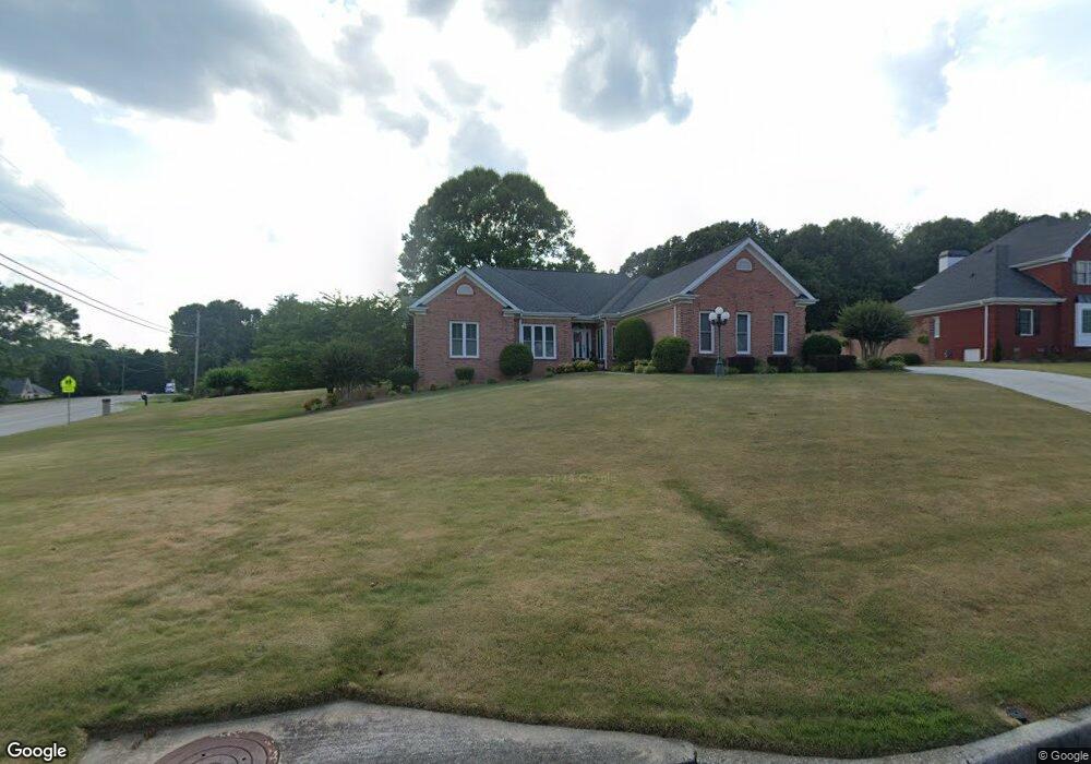
1400 Mourning Dove Dr SW Conyers, GA 30094
Estimated Value: $359,000 - $516,000
3
Beds
4
Baths
2,727
Sq Ft
$151/Sq Ft
Est. Value
About This Home
This home is located at 1400 Mourning Dove Dr SW, Conyers, GA 30094 and is currently estimated at $412,545, approximately $151 per square foot. 1400 Mourning Dove Dr SW is a home located in Rockdale County with nearby schools including Shoal Creek Elementary School, Edwards Middle School, and Rockdale County High School.
Ownership History
Date
Name
Owned For
Owner Type
Purchase Details
Closed on
Apr 2, 2004
Sold by
Sirva Relocation Llc
Bought by
Camp Lonnie and Camp Veronica
Current Estimated Value
Home Financials for this Owner
Home Financials are based on the most recent Mortgage that was taken out on this home.
Original Mortgage
$67,000
Interest Rate
5.54%
Mortgage Type
New Conventional
Purchase Details
Closed on
Aug 8, 2003
Sold by
Lusson Michael J and Lusson Mary M
Bought by
Lusson Mary M
Purchase Details
Closed on
May 31, 2002
Sold by
Pugh Ec and Pugh Grace
Bought by
Lusson Michael J and Lusson Mary M
Home Financials for this Owner
Home Financials are based on the most recent Mortgage that was taken out on this home.
Original Mortgage
$155,000
Interest Rate
6.92%
Mortgage Type
New Conventional
Create a Home Valuation Report for This Property
The Home Valuation Report is an in-depth analysis detailing your home's value as well as a comparison with similar homes in the area
Home Values in the Area
Average Home Value in this Area
Purchase History
| Date | Buyer | Sale Price | Title Company |
|---|---|---|---|
| Camp Lonnie | $232,500 | -- | |
| Sirva Relocation Llc | $240,100 | -- | |
| Lusson Mary M | -- | -- | |
| Lusson Michael J | $250,000 | -- |
Source: Public Records
Mortgage History
| Date | Status | Borrower | Loan Amount |
|---|---|---|---|
| Closed | Sirva Relocation Llc | $67,000 | |
| Previous Owner | Lusson Michael J | $155,000 |
Source: Public Records
Tax History Compared to Growth
Tax History
| Year | Tax Paid | Tax Assessment Tax Assessment Total Assessment is a certain percentage of the fair market value that is determined by local assessors to be the total taxable value of land and additions on the property. | Land | Improvement |
|---|---|---|---|---|
| 2024 | $3,543 | $169,480 | $25,000 | $144,480 |
| 2023 | $2,968 | $153,880 | $28,800 | $125,080 |
| 2022 | $2,532 | $124,640 | $23,600 | $101,040 |
| 2021 | $1,942 | $96,920 | $16,800 | $80,120 |
| 2020 | $1,989 | $96,920 | $16,800 | $80,120 |
| 2019 | $1,918 | $92,680 | $12,560 | $80,120 |
| 2018 | $1,472 | $77,880 | $8,200 | $69,680 |
| 2017 | $1,202 | $68,720 | $8,200 | $60,520 |
| 2016 | $1,579 | $68,720 | $8,200 | $60,520 |
| 2015 | $1,582 | $68,720 | $8,200 | $60,520 |
| 2014 | $1,415 | $68,720 | $8,200 | $60,520 |
| 2013 | -- | $84,000 | $18,000 | $66,000 |
Source: Public Records
Map
Nearby Homes
- 1509 Shoal Creek Dr SW
- 2095 Flat Shoals Rd SW
- 1700 Carissa Dr
- 2318 Hedgeview Rd
- 2194 Klondike Rd SW
- 2289 Amberbrook Dr SW
- 3250 Klondike Rd SW
- 0 Granade Rd SW Unit 10430605
- 0 Granade Rd SW Unit 10430608
- 0 Granade Rd SW Unit 23687414
- 0 Granade Rd SW Unit 10430607
- 0 Granade Rd SW Unit 10430610
- 0 Granade Rd SW Unit 10430604
- 1400 Ebenezer Rd SW
- 2477 Laurel Ridge Place SW
- 1377 Hill Dr SW
- 2505 Laurel Ridge Place SW
- 1841 Flat Shoals Rd SW
- 0 Klondike Rd SW Unit 7601318
- 0 Klondike Rd SW Unit 10547455
- 1396 Mourning Dove Dr SW
- 2269 Flat Shoals Rd SW
- 2294 Flat Shoals Rd SW
- 2304 Flat Shoals Rd SW
- 1392 Mourning Dove Dr SW
- 2284 Flat Shoals Rd SW
- 1401 Mourning Dove Dr SW Unit 2
- 1600 Flat Rock Dr SW
- 1388 Mourning Dove Dr SW
- 2279 Flat Shoals Rd SW
- 1395 Mourning Dove Dr SW
- 3350 Flat Shoals Rd
- 2210 Flat Shoals Rd SW
- 2403 Twin Creek Ct SW
- 2405 Twin Creek Ct SW
- 1400 Mcwilliams Rd SW
- 1384 Mourning Dove Dr SW Unit 3
- 1602 Flat Rock Dr SW
- 1391 Mourning Dove Dr SW
- 2191 Flat Shoals Rd SW