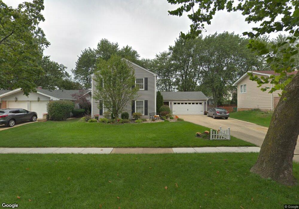
1400 Newcastle Ln Hoffman Estates, IL 60169
South Hoffman Estates NeighborhoodEstimated Value: $456,000 - $528,000
4
Beds
3
Baths
2,626
Sq Ft
$192/Sq Ft
Est. Value
About This Home
This home is located at 1400 Newcastle Ln, Hoffman Estates, IL 60169 and is currently estimated at $503,918, approximately $191 per square foot. 1400 Newcastle Ln is a home located in Cook County with nearby schools including Neil Armstrong Elementary School, Dwight D Eisenhower Junior High School, and Hoffman Estates High School.
Ownership History
Date
Name
Owned For
Owner Type
Purchase Details
Closed on
Sep 26, 1997
Sold by
Baltes Peter M and Baltes Gail R
Bought by
Cihock Robert T and Cihock Sally L
Current Estimated Value
Home Financials for this Owner
Home Financials are based on the most recent Mortgage that was taken out on this home.
Original Mortgage
$164,000
Outstanding Balance
$21,744
Interest Rate
7.12%
Estimated Equity
$482,174
Create a Home Valuation Report for This Property
The Home Valuation Report is an in-depth analysis detailing your home's value as well as a comparison with similar homes in the area
Home Values in the Area
Average Home Value in this Area
Purchase History
| Date | Buyer | Sale Price | Title Company |
|---|---|---|---|
| Cihock Robert T | $136,666 | -- |
Source: Public Records
Mortgage History
| Date | Status | Borrower | Loan Amount |
|---|---|---|---|
| Open | Cihock Robert T | $164,000 |
Source: Public Records
Tax History
| Year | Tax Paid | Tax Assessment Tax Assessment Total Assessment is a certain percentage of the fair market value that is determined by local assessors to be the total taxable value of land and additions on the property. | Land | Improvement |
|---|---|---|---|---|
| 2025 | $9,830 | $50,000 | $7,875 | $42,125 |
| 2024 | $9,830 | $38,001 | $6,563 | $31,438 |
| 2023 | $9,457 | $38,001 | $6,563 | $31,438 |
| 2022 | $9,457 | $38,001 | $6,563 | $31,438 |
| 2021 | $7,746 | $29,115 | $4,375 | $24,740 |
| 2020 | $7,699 | $29,115 | $4,375 | $24,740 |
| 2019 | $7,664 | $32,350 | $4,375 | $27,975 |
| 2018 | $8,711 | $32,897 | $3,718 | $29,179 |
| 2017 | $8,590 | $32,897 | $3,718 | $29,179 |
| 2016 | $8,525 | $32,897 | $3,718 | $29,179 |
| 2015 | $7,848 | $28,933 | $3,281 | $25,652 |
| 2014 | $7,739 | $28,933 | $3,281 | $25,652 |
| 2013 | $7,510 | $28,933 | $3,281 | $25,652 |
Source: Public Records
Map
Nearby Homes
- 1365 Newcastle Ln
- 1335 Blair Ln
- 1975 Leiter Way Unit 12002
- 1987 Leiter Way Unit 11003
- 1982 Leiter Way Unit 13004
- 1985 Leiter Way Unit 1102
- 1988 Leiter Way Unit 13001
- 1979 Leiter Way Unit 12004
- 1981 Leiter Way Unit 12005
- 1994 Leiter Way Unit 14003
- 1977 Leiter Way Unit 12003
- 1986 Leiter Way Unit 13002
- 1989 Leiter Way Unit 11004
- 1360 Devonshire Ln
- 1103 Southbridge Ln
- 1708 Southbridge Ct
- 1500 Robin Cir Unit 314
- 845 Harmon Blvd
- 1760 Bristol Walk Unit F
- 1300 Chatsworth Ln
- 1390 Newcastle Ln
- 1410 Newcastle Ln
- 1395 Blair Ln
- 1380 Newcastle Ln
- 1385 Blair Ln
- 1420 Newcastle Ln
- 1405 Blair Ln
- 1375 Blair Ln
- 1395 Newcastle Ln
- 1385 Newcastle Ln
- 1370 Newcastle Ln
- 1295 Kingsdale Rd
- 1375 Newcastle Ln
- 1360 Newcastle Ln
- 1275 Kingsdale Rd
- 1335 Kingsdale Rd
- 1402 W Oakmont Rd
- 1412 W Oakmont Rd
- 1392 W Oakmont Rd
- 1390 Blair Ln
Your Personal Tour Guide
Ask me questions while you tour the home.