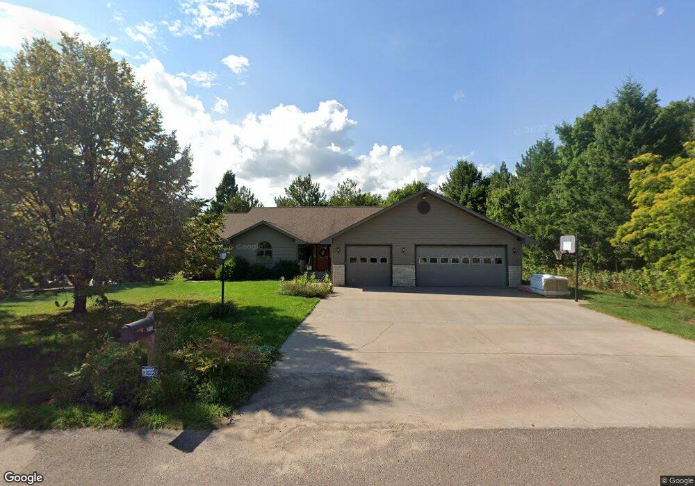
1400 Silver Dr Unit 15 Hancock, MI 49930
Estimated Value: $467,000 - $597,000
5
Beds
3
Baths
2,089
Sq Ft
$252/Sq Ft
Est. Value
About This Home
This home is located at 1400 Silver Dr Unit 15, Hancock, MI 49930 and is currently estimated at $527,101, approximately $252 per square foot. 1400 Silver Dr Unit 15 is a home located in Houghton County with nearby schools including Barkell Elementary School and Hancock Middle/High School.
Ownership History
Date
Name
Owned For
Owner Type
Purchase Details
Closed on
Jun 14, 2019
Sold by
Lark Zachary T and Lark Amy M
Bought by
Bouman Troy M and Bouman Andrea K
Current Estimated Value
Home Financials for this Owner
Home Financials are based on the most recent Mortgage that was taken out on this home.
Original Mortgage
$325,000
Outstanding Balance
$212,682
Interest Rate
4%
Mortgage Type
Construction
Estimated Equity
$314,419
Purchase Details
Closed on
May 2, 2014
Sold by
Schutte Paul and Schutte Maria
Bought by
Lark Zachary T and Lark Amy M
Create a Home Valuation Report for This Property
The Home Valuation Report is an in-depth analysis detailing your home's value as well as a comparison with similar homes in the area
Home Values in the Area
Average Home Value in this Area
Purchase History
| Date | Buyer | Sale Price | Title Company |
|---|---|---|---|
| Bouman Troy M | $325,000 | Attorney Only | |
| Lark Zachary T | $299,000 | -- |
Source: Public Records
Mortgage History
| Date | Status | Borrower | Loan Amount |
|---|---|---|---|
| Open | Bouman Troy M | $325,000 |
Source: Public Records
Tax History
| Year | Tax Paid | Tax Assessment Tax Assessment Total Assessment is a certain percentage of the fair market value that is determined by local assessors to be the total taxable value of land and additions on the property. | Land | Improvement |
|---|---|---|---|---|
| 2025 | $6,981 | $228,996 | $0 | $0 |
| 2024 | $68 | $219,317 | $0 | $0 |
| 2023 | $6,522 | $184,385 | $0 | $0 |
| 2022 | $7,295 | $163,224 | $0 | $0 |
| 2021 | $7,059 | $155,692 | $0 | $0 |
| 2020 | $7,379 | $162,500 | $0 | $0 |
| 2019 | $7,274 | $165,475 | $0 | $0 |
| 2018 | $6,891 | $155,110 | $0 | $0 |
| 2017 | $6,858 | $157,388 | $0 | $0 |
| 2016 | -- | $196,619 | $0 | $0 |
| 2015 | -- | $161,680 | $0 | $0 |
| 2014 | -- | $158,228 | $0 | $0 |
Source: Public Records
Map
Nearby Homes
- 1001 Prospect St
- 1105 Cottage Row
- 1028 Crestwood Dr
- 1035 Ethel Ave
- 726 N Lincoln Dr
- 19575 Ingot St
- 1115 Summit St
- Lot 11 Dolomite Dr
- 22089 River Trail
- TBD10 Dolomite Dr
- Unit 4 Greenway Dr Unit 4
- Unit 6 Greenway Dr
- TBD W Sharon Ave
- TBD Off Cedar St
- TBD Green Acres Rd
- TBD17 Dolomite Dr
- 414 Ryan St
- 1014 Minnesota St
- TBD18 Dolomite Dr
- TBD9 Dolomite Dr
Your Personal Tour Guide
Ask me questions while you tour the home.