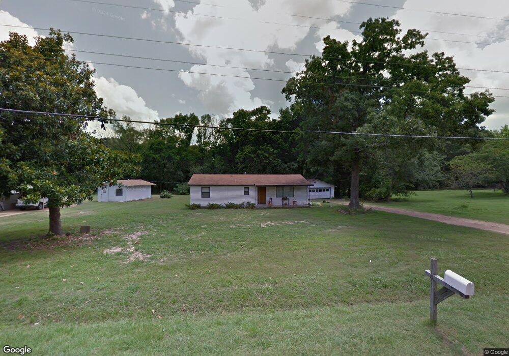
1400 W Ray Branum Rd Tishomingo, OK 73460
Estimated Value: $66,000 - $123,000
2
Beds
1
Bath
900
Sq Ft
$94/Sq Ft
Est. Value
About This Home
This home is located at 1400 W Ray Branum Rd, Tishomingo, OK 73460 and is currently estimated at $84,873, approximately $94 per square foot. 1400 W Ray Branum Rd is a home with nearby schools including Tishomingo Elementary School, Tishomingo Middle School, and Tishomingo High School.
Ownership History
Date
Name
Owned For
Owner Type
Purchase Details
Closed on
Apr 19, 2024
Sold by
Hiland Robert M
Bought by
Kemp Jennifer
Current Estimated Value
Purchase Details
Closed on
Oct 26, 2016
Sold by
Davis Carolyn
Bought by
Hiland Robert M
Home Financials for this Owner
Home Financials are based on the most recent Mortgage that was taken out on this home.
Original Mortgage
$44,500
Interest Rate
3.5%
Mortgage Type
New Conventional
Purchase Details
Closed on
May 25, 1994
Sold by
Ward Alma
Bought by
Deaton Henry and Deaton Lillian
Create a Home Valuation Report for This Property
The Home Valuation Report is an in-depth analysis detailing your home's value as well as a comparison with similar homes in the area
Home Values in the Area
Average Home Value in this Area
Purchase History
| Date | Buyer | Sale Price | Title Company |
|---|---|---|---|
| Kemp Jennifer | $65,000 | American Eagle Title | |
| Hiland Robert M | $50,000 | None Available | |
| Deaton Henry | $23,500 | -- |
Source: Public Records
Mortgage History
| Date | Status | Borrower | Loan Amount |
|---|---|---|---|
| Previous Owner | Hiland Robert M | $44,500 |
Source: Public Records
Tax History Compared to Growth
Tax History
| Year | Tax Paid | Tax Assessment Tax Assessment Total Assessment is a certain percentage of the fair market value that is determined by local assessors to be the total taxable value of land and additions on the property. | Land | Improvement |
|---|---|---|---|---|
| 2024 | $277 | $5,044 | $695 | $4,349 |
| 2023 | $360 | $5,981 | $695 | $5,286 |
| 2022 | $521 | $5,897 | $576 | $5,321 |
| 2021 | $415 | $5,896 | $576 | $5,320 |
| 2020 | $436 | $6,029 | $221 | $5,808 |
| 2019 | $447 | $6,029 | $221 | $5,808 |
| 2018 | $454 | $6,029 | $221 | $5,808 |
| 2017 | $452 | $6,000 | $554 | $5,446 |
| 2016 | $231 | $3,059 | $396 | $2,663 |
| 2015 | $237 | $3,059 | $396 | $2,663 |
| 2014 | $210 | $3,059 | $396 | $2,663 |
Source: Public Records
Map
Nearby Homes
- 9550 Us Hwy 377 S
- 1429 Easy St
- 1427 Easy St
- 1431 Easy St
- 501 N Western
- 6 Brandy Ln
- 5 Brandy Ln
- 0 Elks Rd Unit 2525848
- 0 Elk Rd Unit 2525852
- 1500 E Hankins Ln
- 306 S Kemp Ave
- 108 Deadwood Dr
- 55 Tumbleweed Trail
- 59 Tombstone Trail
- 203 N Broadway St
- 104 N Johnston St
- 0000 N 3550 Rd
- 207 Faculty Dr
- 301 N Maytubby St
- 5200 W Wildlife Ln
- 1308 W Ray Branum Rd
- 1309 W Ray Branum Rd
- 1410 W Ray Branum Rd
- 1401 W Ray Branum Rd
- 1300 W Ray Branum Rd
- 1301 W Ray Branum Rd
- 1201 W Kingsberry Ln
- 211 Hurst Ln
- 1212 W Ray Branum Rd
- 1420 W Ray Branum Rd
- 210 Hurst Ln
- 1200 W Kingsberry Ln
- 1210 W Ray Branum Rd
- 1314 W Main St
- 1109 W Kingsberry Ln
- 1209 W Ray Branum Rd
- 1208 W Ray Branum Rd
- 9550 Us Highway 377 S
- 1206 W Ray Branum Rd
- 1539 Industrial Ln