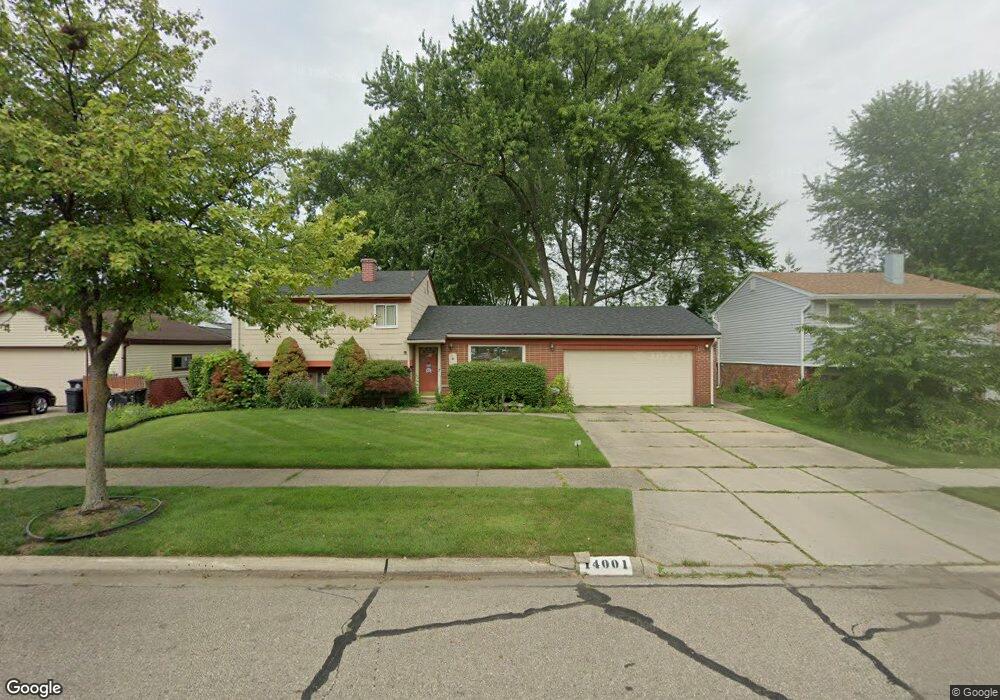
14001 Brentwood St Livonia, MI 48154
Estimated Value: $305,610 - $322,000
3
Beds
2
Baths
1,536
Sq Ft
$202/Sq Ft
Est. Value
About This Home
This home is located at 14001 Brentwood St, Livonia, MI 48154 and is currently estimated at $310,403, approximately $202 per square foot. 14001 Brentwood St is a home located in Wayne County with nearby schools including Roosevelt Elementary School, Emerson Middle School, and Cooper Upper Elementary School.
Ownership History
Date
Name
Owned For
Owner Type
Purchase Details
Closed on
Mar 26, 2018
Sold by
National Faith Homebuyers
Bought by
Huizar Irasema
Current Estimated Value
Purchase Details
Closed on
Jan 19, 2018
Sold by
Wayne County Land Bank Corporation
Bought by
National Faith Homebuyers
Purchase Details
Closed on
Aug 30, 2017
Sold by
County Of Wayne
Bought by
Wayne County Land Bank Corporatip
Purchase Details
Closed on
Aug 29, 2017
Sold by
Sabree Eric R
Bought by
County Of Wayne
Purchase Details
Closed on
Oct 15, 2004
Sold by
Huizar Julian L and Huizar Irasema
Bought by
Huizar Irasema
Create a Home Valuation Report for This Property
The Home Valuation Report is an in-depth analysis detailing your home's value as well as a comparison with similar homes in the area
Home Values in the Area
Average Home Value in this Area
Purchase History
| Date | Buyer | Sale Price | Title Company |
|---|---|---|---|
| Huizar Irasema | -- | None Available | |
| National Faith Homebuyers | -- | None Available | |
| Wayne County Land Bank Corporatip | -- | None Available | |
| County Of Wayne | $4,987 | None Available | |
| Huizar Irasema | -- | -- |
Source: Public Records
Tax History Compared to Growth
Tax History
| Year | Tax Paid | Tax Assessment Tax Assessment Total Assessment is a certain percentage of the fair market value that is determined by local assessors to be the total taxable value of land and additions on the property. | Land | Improvement |
|---|---|---|---|---|
| 2025 | $2,094 | $134,200 | $0 | $0 |
| 2024 | $2,094 | $127,400 | $0 | $0 |
| 2023 | $1,998 | $117,200 | $0 | $0 |
| 2022 | $3,581 | $101,900 | $0 | $0 |
| 2021 | $3,480 | $97,200 | $0 | $0 |
| 2019 | $3,354 | $80,500 | $0 | $0 |
| 2018 | $86 | $0 | $0 | $0 |
| 2017 | $2,300 | $71,200 | $0 | $0 |
| 2016 | $2,323 | $71,200 | $0 | $0 |
| 2015 | $5,239 | $56,770 | $0 | $0 |
| 2012 | -- | $50,010 | $16,500 | $33,510 |
Source: Public Records
Map
Nearby Homes
- 29109 Perth St
- 14334 Sunbury St
- 14483 Garden St
- 14488 Summerside St
- 27674 Western Golf Dr
- 27407 Buckingham St
- 29631 Lyndon St
- 13968 Inkster Rd
- LOT 149 Seminole
- LOT 147 Seminole
- 14907 Taylor Blvd
- 14068 Mercedes
- 14008 Mercedes
- 29831 Oakley St
- 14920 Taylor Blvd
- 14962 Beatrice St
- 30261 Buckingham St
- 14174 San Jose
- 13111 Sioux
- 14844 Inkster Rd
- 14015 Brentwood St
- 28634 Buckingham St
- 28646 Buckingham St
- 14042 Sunbury St
- 14030 Sunbury St
- 14029 Brentwood St Unit Bldg-Unit
- 14029 Brentwood St
- 28658 Buckingham St
- 14054 Sunbury St
- 14016 Brentwood St
- 14066 Sunbury St
- 28672 Buckingham St
- 28519 Gita St
- 14043 Brentwood St
- 14034 Brentwood St
- 14108 Sunbury St
- 14046 Brentwood St
- 14107 Brentwood St
- 14011 Harrison St
- 28507 Gita St