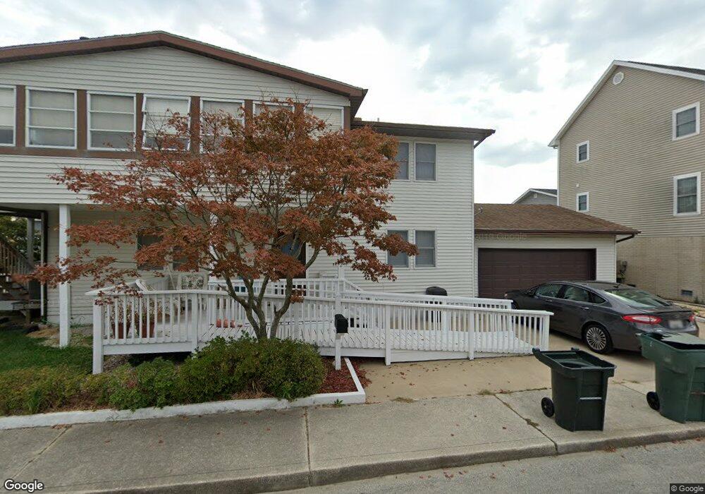
14002 Loop Rd Ocean City, MD 21842
Estimated Value: $633,000 - $692,000
4
Beds
4
Baths
2,352
Sq Ft
$281/Sq Ft
Est. Value
About This Home
This home is located at 14002 Loop Rd, Ocean City, MD 21842 and is currently estimated at $660,732, approximately $280 per square foot. 14002 Loop Rd is a home located in Worcester County with nearby schools including Ocean City Elementary School, Stephen Decatur Middle School, and Berlin Intermediate School.
Ownership History
Date
Name
Owned For
Owner Type
Purchase Details
Closed on
Feb 9, 2010
Sold by
Coleman Mary E
Bought by
Coleman Family Trust
Current Estimated Value
Purchase Details
Closed on
May 14, 2009
Sold by
Mountzalia Gregory J
Bought by
Coleman Mary E
Purchase Details
Closed on
Mar 17, 1981
Sold by
Malinowski Walter
Bought by
Mountzalia Gregory J
Home Financials for this Owner
Home Financials are based on the most recent Mortgage that was taken out on this home.
Original Mortgage
$6,000
Interest Rate
15.4%
Create a Home Valuation Report for This Property
The Home Valuation Report is an in-depth analysis detailing your home's value as well as a comparison with similar homes in the area
Home Values in the Area
Average Home Value in this Area
Purchase History
| Date | Buyer | Sale Price | Title Company |
|---|---|---|---|
| Coleman Family Trust | -- | -- | |
| Coleman Mary E | $350,000 | -- | |
| Mountzalia Gregory J | $16,000 | -- |
Source: Public Records
Mortgage History
| Date | Status | Borrower | Loan Amount |
|---|---|---|---|
| Previous Owner | Mountzalia Gregory J | $6,000 |
Source: Public Records
Tax History
| Year | Tax Paid | Tax Assessment Tax Assessment Total Assessment is a certain percentage of the fair market value that is determined by local assessors to be the total taxable value of land and additions on the property. | Land | Improvement |
|---|---|---|---|---|
| 2025 | $5,215 | $381,900 | $0 | $0 |
| 2024 | $4,687 | $335,900 | $0 | $0 |
| 2023 | $4,074 | $289,900 | $142,700 | $147,200 |
| 2022 | $4,017 | $285,800 | $0 | $0 |
| 2021 | $3,981 | $281,700 | $0 | $0 |
| 2020 | $3,922 | $277,600 | $142,700 | $134,900 |
| 2019 | $3,905 | $274,467 | $0 | $0 |
| 2018 | $3,822 | $271,333 | $0 | $0 |
| 2017 | $3,789 | $268,200 | $0 | $0 |
| 2016 | -- | $265,067 | $0 | $0 |
| 2015 | $3,891 | $261,933 | $0 | $0 |
| 2014 | $3,891 | $258,800 | $0 | $0 |
Source: Public Records
Map
Nearby Homes
- 14104 Dukes Ave
- 13487 Bella Vista Ln Unit 9
- 13463 Madison Ave
- 14125 Sea Captain Rd
- 13506 Yellow Banks Ct
- 14109 Dukes Ave
- 817 Gulf Stream Dr
- 13444 Madison Ave
- 13204 Stone Harbor Ln
- 13022 Wilson Ave
- 14009 N Ocean Rd
- 717 142nd St
- 14211 Dukes Ave Unit 203
- 13801 Barge Rd
- 709 Gulf Stream Dr
- 13410 Madison Ave
- 13908 N Ocean Rd Unit 10A
- 14201 Tunnel Ave Unit 16C
- 14300 Jarvis Ave Unit A202
- 14300 Jarvis Ave Unit B
Your Personal Tour Guide
Ask me questions while you tour the home.