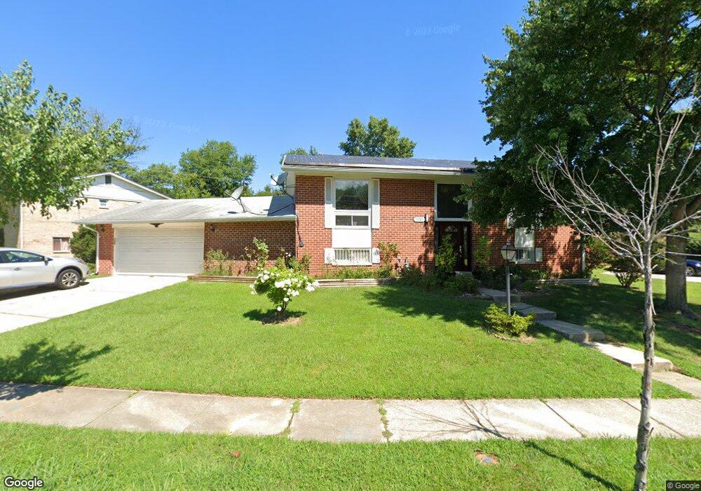
14005 Adkins Rd Laurel, MD 20708
South Laurel NeighborhoodEstimated Value: $429,000 - $500,000
--
Bed
2
Baths
1,120
Sq Ft
$409/Sq Ft
Est. Value
About This Home
This home is located at 14005 Adkins Rd, Laurel, MD 20708 and is currently estimated at $458,473, approximately $409 per square foot. 14005 Adkins Rd is a home located in Prince George's County with nearby schools including Oaklands Elementary School, Laurel High School, and Julia Brown Montessori Schools.
Ownership History
Date
Name
Owned For
Owner Type
Purchase Details
Closed on
Mar 15, 2007
Sold by
Dones Pedro
Bought by
Dones Pedro B
Current Estimated Value
Home Financials for this Owner
Home Financials are based on the most recent Mortgage that was taken out on this home.
Original Mortgage
$250,000
Outstanding Balance
$142,214
Interest Rate
6.34%
Mortgage Type
Stand Alone Refi Refinance Of Original Loan
Estimated Equity
$316,259
Purchase Details
Closed on
Jan 13, 2006
Sold by
Dones Pedro
Bought by
Dones Pedro B
Home Financials for this Owner
Home Financials are based on the most recent Mortgage that was taken out on this home.
Original Mortgage
$250,000
Interest Rate
6.34%
Mortgage Type
New Conventional
Purchase Details
Closed on
Dec 7, 2004
Sold by
Dones Pedro
Bought by
Dones Pedro
Purchase Details
Closed on
Nov 19, 2001
Sold by
Dones Pedro
Bought by
Dones Pedro and Anecita Etal
Purchase Details
Closed on
Jul 11, 1997
Sold by
Boldt John H
Bought by
Dones Pedro and Anecita Etal
Create a Home Valuation Report for This Property
The Home Valuation Report is an in-depth analysis detailing your home's value as well as a comparison with similar homes in the area
Home Values in the Area
Average Home Value in this Area
Purchase History
| Date | Buyer | Sale Price | Title Company |
|---|---|---|---|
| Dones Pedro B | -- | -- | |
| Dones Pedro B | -- | -- | |
| Dones Pedro | -- | -- | |
| Dones Pedro | -- | -- | |
| Dones Pedro | $152,500 | -- |
Source: Public Records
Mortgage History
| Date | Status | Borrower | Loan Amount |
|---|---|---|---|
| Open | Dones Pedro | $250,000 | |
| Previous Owner | Dones Pedro B | $250,000 |
Source: Public Records
Tax History Compared to Growth
Tax History
| Year | Tax Paid | Tax Assessment Tax Assessment Total Assessment is a certain percentage of the fair market value that is determined by local assessors to be the total taxable value of land and additions on the property. | Land | Improvement |
|---|---|---|---|---|
| 2025 | $4,765 | $355,900 | $110,900 | $245,000 |
| 2024 | $4,765 | $343,067 | $0 | $0 |
| 2023 | $4,623 | $330,233 | $0 | $0 |
| 2022 | $4,436 | $317,400 | $100,900 | $216,500 |
| 2021 | $4,288 | $311,400 | $0 | $0 |
| 2020 | $4,235 | $305,400 | $0 | $0 |
| 2019 | $4,160 | $299,400 | $100,400 | $199,000 |
| 2018 | $4,013 | $282,967 | $0 | $0 |
| 2017 | $3,889 | $266,533 | $0 | $0 |
| 2016 | -- | $250,100 | $0 | $0 |
| 2015 | $3,377 | $247,300 | $0 | $0 |
| 2014 | $3,377 | $244,500 | $0 | $0 |
Source: Public Records
Map
Nearby Homes
- 0 Railroad Ave
- 9254 Cherry Ln Unit 17
- 9274 Cherry Ln Unit 82
- 9264 Cherry Ln Unit 47
- 0 Chestnut Ridge Dr
- 8700 Kiama Rd
- 9268 Cherry Ln Unit 62
- 183 Lyons Creek Dr
- 14604 Bowie Rd
- 149 Lyons Creek Dr
- 13401 Kiama Ct
- Monaco Plan at Patuxent Greens - Singles
- Dresden Plan at Patuxent Greens - Singles
- Lisbon Plan at Patuxent Greens - Singles
- Carmel Homesite Special Plan at Patuxent Greens - Singles
- Treviso Plan at Patuxent Greens - Singles
- 1760 Mill Branch Dr
- 1221 Bear Branch Rd
- Serenade Plan at Patuxent Greens - Townhomes
- 1219 Bear Branch Rd
- 14007 Adkins Rd
- 14100 Dub Dr
- 14009 Adkins Rd
- 8907 Mark Place
- 8909 Mark Place
- 14002 Adkins Rd
- 14004 Adkins Rd
- 14006 Adkins Rd
- 14008 Adkins Rd
- 8905 Mark Place
- 14013 Adkins Rd
- 14101 Dub Dr
- 14010 Adkins Rd
- 14000 Adkins Rd
- 14012 Adkins Rd
- 14105 Dub Dr
- 14017 Adkins Rd
- 8908 Mark Place
- 14108 Dub Dr
- 8906 Mark Place