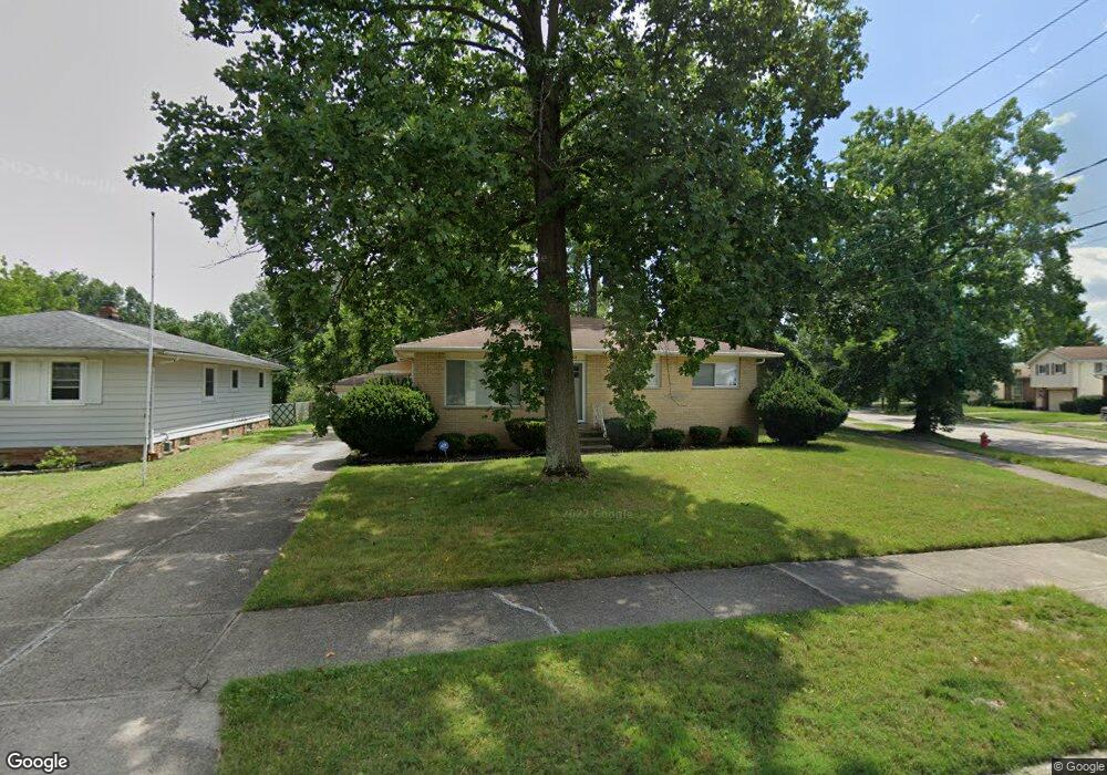
14006 Lisa Dr Maple Heights, OH 44137
Estimated Value: $156,646 - $198,000
3
Beds
3
Baths
962
Sq Ft
$181/Sq Ft
Est. Value
About This Home
This home is located at 14006 Lisa Dr, Maple Heights, OH 44137 and is currently estimated at $173,662, approximately $180 per square foot. 14006 Lisa Dr is a home located in Cuyahoga County with nearby schools including Abraham Lincoln Elementary School, Rockside/ J.F. Kennedy School, and Barack Obama School.
Ownership History
Date
Name
Owned For
Owner Type
Purchase Details
Closed on
Apr 24, 2018
Sold by
Estate Of Walter S Bonner Iii
Bought by
Andesite Residential Opportunity Fund Ll
Current Estimated Value
Purchase Details
Closed on
Apr 20, 2011
Sold by
Schneider Thelma Jean
Bought by
Bonner Walter S
Home Financials for this Owner
Home Financials are based on the most recent Mortgage that was taken out on this home.
Original Mortgage
$81,870
Interest Rate
5.5%
Mortgage Type
FHA
Purchase Details
Closed on
Jan 1, 1975
Bought by
Schneider Raymond R
Create a Home Valuation Report for This Property
The Home Valuation Report is an in-depth analysis detailing your home's value as well as a comparison with similar homes in the area
Home Values in the Area
Average Home Value in this Area
Purchase History
| Date | Buyer | Sale Price | Title Company |
|---|---|---|---|
| Andesite Residential Opportunity Fund Ll | $42,000 | None Available | |
| Bonner Walter S | $84,000 | Guardian Title | |
| Schneider Raymond R | -- | -- |
Source: Public Records
Mortgage History
| Date | Status | Borrower | Loan Amount |
|---|---|---|---|
| Previous Owner | Bonner Walter S | $81,870 |
Source: Public Records
Tax History Compared to Growth
Tax History
| Year | Tax Paid | Tax Assessment Tax Assessment Total Assessment is a certain percentage of the fair market value that is determined by local assessors to be the total taxable value of land and additions on the property. | Land | Improvement |
|---|---|---|---|---|
| 2024 | $4,539 | $50,085 | $9,555 | $40,530 |
| 2023 | $3,589 | $34,100 | $8,160 | $25,940 |
| 2022 | $3,576 | $34,090 | $8,160 | $25,940 |
| 2021 | $3,824 | $34,090 | $8,160 | $25,940 |
| 2020 | $3,475 | $27,930 | $6,690 | $21,250 |
| 2019 | $3,459 | $79,800 | $19,100 | $60,700 |
| 2018 | $3,215 | $27,930 | $6,690 | $21,250 |
| 2017 | $3,895 | $26,610 | $4,730 | $21,880 |
| 2016 | $3,957 | $26,610 | $4,730 | $21,880 |
| 2015 | $3,150 | $26,610 | $4,730 | $21,880 |
| 2014 | $3,150 | $28,600 | $5,080 | $23,520 |
Source: Public Records
Map
Nearby Homes
- 13835 Milo Rd
- 13732 Carpenter Rd
- 13804 Rockside Rd
- 13712 Rockside Rd
- 6318 Valley Ranch Dr
- 13578 Foxcroft Dr
- SL15 Rocky Top Ct
- 12955 Milo Rd
- 13577 Robinhood Dr
- 14775 Lisa Dr
- 6437 Kimberly Dr
- TBD Meadowbrook Rd
- 14917 Summit Ave
- 6378 Valley Ranch Dr
- 6372 Valley Ranch Dr
- 12940 Fruitside Rd
- 14916 Summit Ave
- 14106 Tabor Ave
- 14214 Tabor Ave
- 13304 Orme Rd
- 14014 Lisa Dr
- 13900 Grove Dr
- 14008 Rochelle Dr
- 13850 Martin Dr
- 13901 Grove Dr
- 14022 Lisa Dr
- 14013 Lisa Dr
- 13891 Grove Dr
- 14025 Lisa Dr
- 14024 Rochelle Dr
- 14067 Rochelle Dr
- 13955 Grove Dr
- 13830 Martin Dr
- 14037 Lisa Dr
- 14036 Lisa Dr
- 13831 Grove Dr
- 14083 Rochelle Dr
- 14051 Lisa Dr
- 14038 Rochelle Dr
- 13734 Rybak Ave