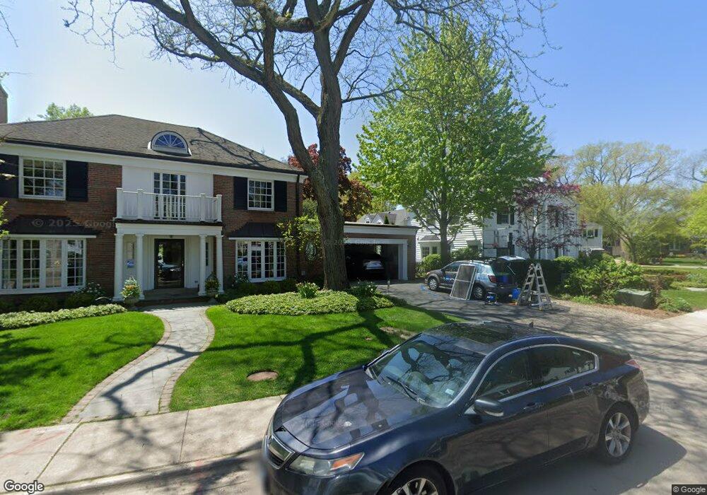
1401 Ashland Ln Wilmette, IL 60091
Estimated Value: $1,595,155 - $1,842,000
--
Bed
3
Baths
3,217
Sq Ft
$534/Sq Ft
Est. Value
About This Home
This home is located at 1401 Ashland Ln, Wilmette, IL 60091 and is currently estimated at $1,717,039, approximately $533 per square foot. 1401 Ashland Ln is a home located in Cook County with nearby schools including Central Elementary School, Highcrest Middle School, and Wilmette Junior High School.
Ownership History
Date
Name
Owned For
Owner Type
Purchase Details
Closed on
May 28, 2002
Sold by
Jadel John C
Bought by
Snell Robert J and Snell Christine Z
Current Estimated Value
Home Financials for this Owner
Home Financials are based on the most recent Mortgage that was taken out on this home.
Original Mortgage
$680,000
Outstanding Balance
$232,555
Interest Rate
4.12%
Estimated Equity
$1,484,484
Purchase Details
Closed on
Dec 1, 1999
Sold by
Jadel John C
Bought by
Jadel John C and John C Jadel Trust
Create a Home Valuation Report for This Property
The Home Valuation Report is an in-depth analysis detailing your home's value as well as a comparison with similar homes in the area
Home Values in the Area
Average Home Value in this Area
Purchase History
| Date | Buyer | Sale Price | Title Company |
|---|---|---|---|
| Snell Robert J | $850,000 | -- | |
| Jadel John C | -- | -- |
Source: Public Records
Mortgage History
| Date | Status | Borrower | Loan Amount |
|---|---|---|---|
| Open | Snell Robert J | $680,000 |
Source: Public Records
Tax History Compared to Growth
Tax History
| Year | Tax Paid | Tax Assessment Tax Assessment Total Assessment is a certain percentage of the fair market value that is determined by local assessors to be the total taxable value of land and additions on the property. | Land | Improvement |
|---|---|---|---|---|
| 2024 | $21,927 | $99,944 | $32,381 | $67,563 |
| 2023 | $25,683 | $99,944 | $32,381 | $67,563 |
| 2022 | $25,683 | $123,000 | $32,381 | $90,619 |
| 2021 | $23,284 | $92,954 | $28,260 | $64,694 |
| 2020 | $24,721 | $99,838 | $28,260 | $71,578 |
| 2019 | $28,275 | $127,376 | $28,260 | $99,116 |
| 2018 | $25,910 | $112,342 | $23,550 | $88,792 |
| 2017 | $27,216 | $121,025 | $23,550 | $97,475 |
| 2016 | $26,627 | $125,000 | $23,550 | $101,450 |
| 2015 | $22,540 | $93,419 | $19,428 | $73,991 |
| 2014 | $24,292 | $102,005 | $19,428 | $82,577 |
| 2013 | $23,185 | $102,005 | $19,428 | $82,577 |
Source: Public Records
Map
Nearby Homes
- 1245 Richmond Ln
- 1227 16th St
- 507 Kenilworth Ave
- 330 Abbotsford Rd
- 1606 Forest Ave
- 1617 Forest Ave
- 1241 Forest Ave
- 517 Cumnor Rd
- 1120 Chestnut Ave
- 622 Melrose Ave
- 1118 Forest Ave
- 621 Green Bay Rd
- 530 Essex Rd
- 321 Leicester Rd
- 159 Abingdon Ave
- 145 Oxford Rd
- 149 Kenilworth Ave
- 724 12th St Unit 105
- 527 Warwick Rd
- 1947 Kenilworth Ave
- 1415 Ashland Ln
- 1373 Ashland Ln
- 1360 Ashland Ave
- 1372 Ashland Ave
- 1369 Ashland Ave
- 1406 Ashland Ln
- 1249 Richmond Ln
- 1412 Ashland Ln
- 1384 Ashland Ln
- 1224 Richmond Ln
- 1241 Richmond Ln
- 1253 Richmond Ln
- 1237 Richmond Ln
- 1300 Richmond Ln
- 1257 Richmond Ln
- 1363 Ashland Ln
- 1378 Ashland Ave
- 1358 Ashland Ave
- 1400 Ashland Ln
- 1233 Richmond Ln