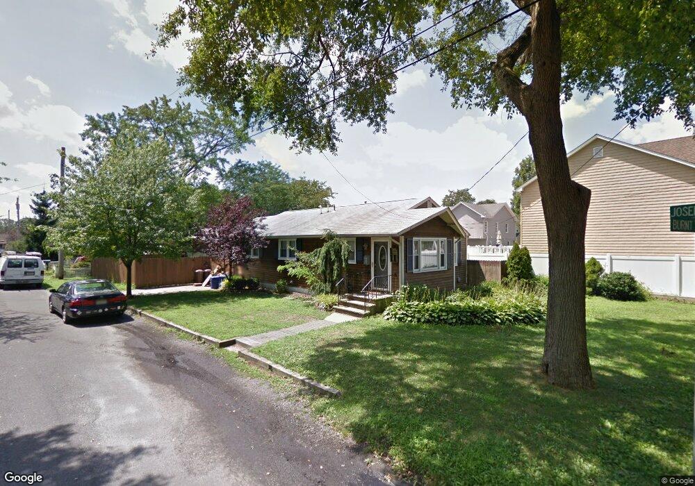
1401 Joseph St Point Pleasant Boro, NJ 08742
Estimated Value: $606,175 - $690,000
3
Beds
1
Bath
960
Sq Ft
$662/Sq Ft
Est. Value
About This Home
This home is located at 1401 Joseph St, Point Pleasant Boro, NJ 08742 and is currently estimated at $635,544, approximately $662 per square foot. 1401 Joseph St is a home located in Ocean County with nearby schools including Chillicothe Primary School, Point Pleasant High School, and St. Peter School.
Ownership History
Date
Name
Owned For
Owner Type
Purchase Details
Closed on
Feb 19, 2021
Sold by
Fream Rory and Fream Elizabeth
Bought by
Hawthorne William and Hawthorne Cynthia
Current Estimated Value
Home Financials for this Owner
Home Financials are based on the most recent Mortgage that was taken out on this home.
Original Mortgage
$337,000
Outstanding Balance
$301,409
Interest Rate
2.7%
Mortgage Type
New Conventional
Estimated Equity
$334,135
Purchase Details
Closed on
Jan 13, 2011
Sold by
Sharp Brian W and Sharp Mary J
Bought by
Fream Rory and Fream Elizabeth
Home Financials for this Owner
Home Financials are based on the most recent Mortgage that was taken out on this home.
Original Mortgage
$221,210
Interest Rate
4.75%
Mortgage Type
FHA
Purchase Details
Closed on
Jan 21, 2010
Sold by
Sharp Mary J
Bought by
Sharp Brian W and Sharp Mary J
Create a Home Valuation Report for This Property
The Home Valuation Report is an in-depth analysis detailing your home's value as well as a comparison with similar homes in the area
Home Values in the Area
Average Home Value in this Area
Purchase History
| Date | Buyer | Sale Price | Title Company |
|---|---|---|---|
| Hawthorne William | $367,000 | R W Schrader Title Agcy Llc | |
| Fream Rory | $227,000 | First American Title Ins Co | |
| Sharp Brian W | -- | None Available |
Source: Public Records
Mortgage History
| Date | Status | Borrower | Loan Amount |
|---|---|---|---|
| Open | Hawthorne William | $337,000 | |
| Previous Owner | Fream Rory | $221,210 |
Source: Public Records
Tax History Compared to Growth
Tax History
| Year | Tax Paid | Tax Assessment Tax Assessment Total Assessment is a certain percentage of the fair market value that is determined by local assessors to be the total taxable value of land and additions on the property. | Land | Improvement |
|---|---|---|---|---|
| 2025 | $5,990 | $261,900 | $187,100 | $74,800 |
| 2024 | $5,725 | $261,900 | $187,100 | $74,800 |
| 2023 | $5,607 | $261,900 | $187,100 | $74,800 |
| 2022 | $5,607 | $261,900 | $187,100 | $74,800 |
| 2021 | $5,521 | $261,900 | $187,100 | $74,800 |
| 2020 | $5,463 | $261,900 | $187,100 | $74,800 |
| 2019 | $5,390 | $261,900 | $187,100 | $74,800 |
| 2018 | $5,230 | $261,900 | $187,100 | $74,800 |
| 2017 | $5,115 | $261,900 | $187,100 | $74,800 |
| 2016 | $5,076 | $261,900 | $187,100 | $74,800 |
| 2015 | $5,015 | $261,900 | $187,100 | $74,800 |
| 2014 | $4,900 | $261,900 | $187,100 | $74,800 |
Source: Public Records
Map
Nearby Homes
- 821 South St
- 1325 Bay Ave
- 1501 Hulse Rd Unit 3
- 1501 Hulse Rd Unit 22
- 1301 Bay Ave
- 1107 Hollywood Blvd
- 709 Howe St
- 230 Bridge Ave
- 2119 Foster Rd
- 1001 Patterson Rd
- 909 Ocean Rd Unit 4
- 528 Delaware Ave
- 212 Howe St
- 2107 Beach Blvd
- 1215 Johnson Ave
- 2142 Beach Blvd
- 2230 Bridge Ave Unit 19
- 713 Beaver Dam Rd
- 320 Maryland Ave Unit 12J
- 1501 Bel Aire Ct W
- 726 Burnt Tavern Rd
- 1407 Joseph St
- 1408 Charles St
- 1400 Joseph St
- 1409 Joseph St
- 728 Burnt Tavern Rd
- 1410 Charles St
- 718 Burnt Tavern Rd
- 721 Burnt Tavern Rd
- 721 Burnt Tavern Rd Unit D
- 721 Burnt Tavern Rd Unit B
- 1412 Charles St
- 1411 Joseph St
- 719 Burnt Tavern Rd
- 0 Joseph St
- 1412 Joseph St
- 725 Burnt Tavern Rd
- 716 Burnt Tavern Rd
- 723 Burnt Tavern Rd
- 1414 Charles St