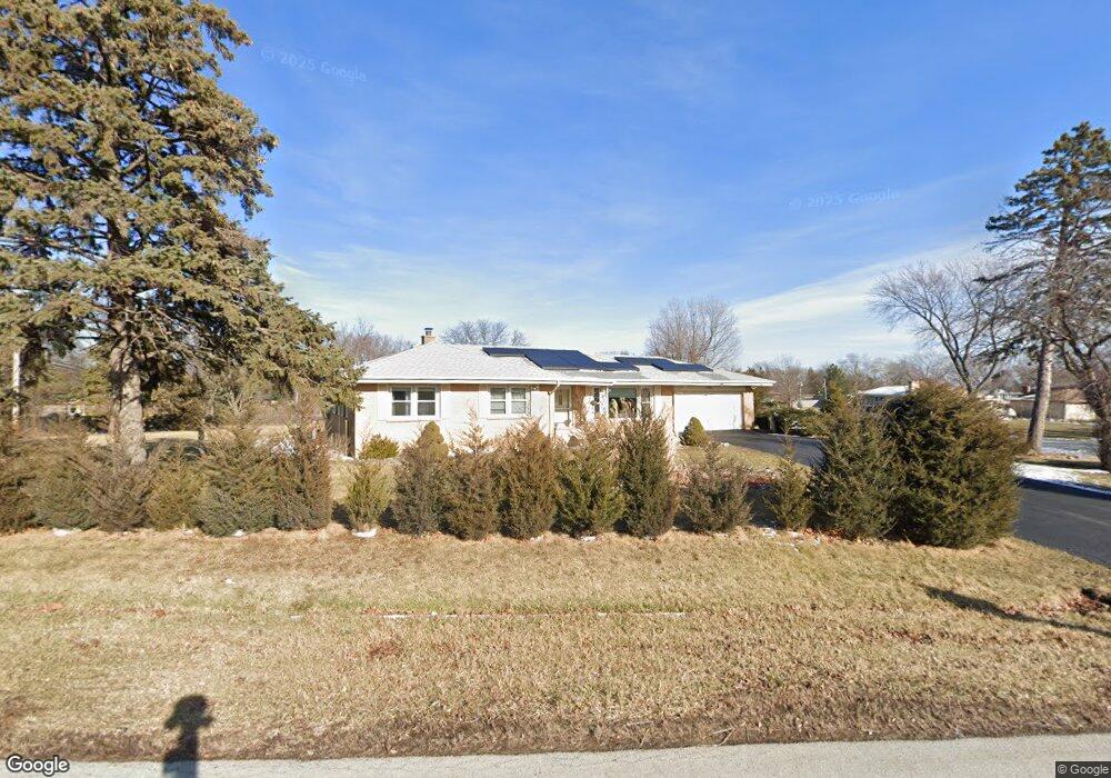
1401 Laurel Ln Schaumburg, IL 60193
South Schaumburg NeighborhoodEstimated Value: $417,000 - $504,000
3
Beds
2
Baths
1,420
Sq Ft
$319/Sq Ft
Est. Value
About This Home
This home is located at 1401 Laurel Ln, Schaumburg, IL 60193 and is currently estimated at $453,175, approximately $319 per square foot. 1401 Laurel Ln is a home located in Cook County with nearby schools including Frederick Nerge Elementary School, Margaret Mead Junior High School, and J B Conant High School.
Ownership History
Date
Name
Owned For
Owner Type
Purchase Details
Closed on
Aug 30, 2005
Sold by
Odonoghue Mark J and Odonoghue Cheryl J
Bought by
Patel Paresh M and Patel Renuka P
Current Estimated Value
Home Financials for this Owner
Home Financials are based on the most recent Mortgage that was taken out on this home.
Original Mortgage
$296,640
Outstanding Balance
$173,770
Interest Rate
7.82%
Mortgage Type
Unknown
Estimated Equity
$279,405
Purchase Details
Closed on
Jul 29, 1996
Sold by
Cole Taylor Bank
Bought by
Odonoghue Mark J and Odonoghue Cheryl J
Home Financials for this Owner
Home Financials are based on the most recent Mortgage that was taken out on this home.
Original Mortgage
$135,000
Interest Rate
8.18%
Create a Home Valuation Report for This Property
The Home Valuation Report is an in-depth analysis detailing your home's value as well as a comparison with similar homes in the area
Home Values in the Area
Average Home Value in this Area
Purchase History
| Date | Buyer | Sale Price | Title Company |
|---|---|---|---|
| Patel Paresh M | $371,000 | Premier Title | |
| Odonoghue Mark J | $173,500 | Ticor Title Insurance |
Source: Public Records
Mortgage History
| Date | Status | Borrower | Loan Amount |
|---|---|---|---|
| Open | Patel Paresh M | $296,640 | |
| Previous Owner | Odonoghue Mark J | $135,000 |
Source: Public Records
Tax History
| Year | Tax Paid | Tax Assessment Tax Assessment Total Assessment is a certain percentage of the fair market value that is determined by local assessors to be the total taxable value of land and additions on the property. | Land | Improvement |
|---|---|---|---|---|
| 2025 | $7,258 | $37,000 | $9,000 | $28,000 |
| 2024 | $7,258 | $29,000 | $8,000 | $21,000 |
| 2023 | $6,990 | $29,000 | $8,000 | $21,000 |
| 2022 | $6,990 | $29,000 | $8,000 | $21,000 |
| 2021 | $6,142 | $23,368 | $22,500 | $868 |
| 2020 | $6,097 | $23,368 | $22,500 | $868 |
| 2019 | $6,108 | $25,965 | $22,500 | $3,465 |
| 2018 | $6,001 | $23,445 | $19,000 | $4,445 |
| 2017 | $5,908 | $23,445 | $19,000 | $4,445 |
| 2016 | $6,530 | $26,233 | $19,000 | $7,233 |
| 2015 | $5,433 | $20,828 | $16,000 | $4,828 |
| 2014 | $5,376 | $20,828 | $16,000 | $4,828 |
| 2013 | $6,174 | $24,135 | $16,000 | $8,135 |
Source: Public Records
Map
Nearby Homes
- 1326 Summit Dr
- 206 Nantucket Harbor Unit 200
- 1516 Sunset Dr
- 1630 Myrtle Park St
- 100 Pratt Blvd
- 1500 Illinois St
- 134 Lunt Ave
- 518 E Niagara Ave
- 207 Mountain Interval Rd Unit 7230
- 213 Mountain Interval Rd Unit 7331
- 232 Warren Ln Unit 11546
- 20 Shore Dr
- 240 Warren Ln Unit 11348
- 411 Drake Cir Unit 401B
- 1064 Hampton Harbor Unit 1064
- 620 S Point Dr
- 1055 Hampton Harbor Unit 1055
- 974 Westchester Cir Unit 602A
- 235 Quincy Ct
- 721 Tipperary Ct Unit 1A
- 126 Blackhawk Dr
- 108 Blackhawk Dr
- 132 Blackhawk Dr
- 1333 Laurel Ln
- 123 E Monterey Ave
- 125 Blackhawk Dr
- 131 Blackhawk Dr
- 115 Blackhawk Dr
- 107 E Monterey Ave
- 100 Blackhawk Dr
- 200 Blackhawk Dr
- 129 E Monterey Ave
- 109 Blackhawk Dr
- 101 E Monterey Ave
- 38 Blackhawk Dr
- 1428 Roslyn Rd
- 1428 Roslyn Rd
- 1428 Roslyn Rd Unit 1
- 135 E Monterey Ave
Your Personal Tour Guide
Ask me questions while you tour the home.