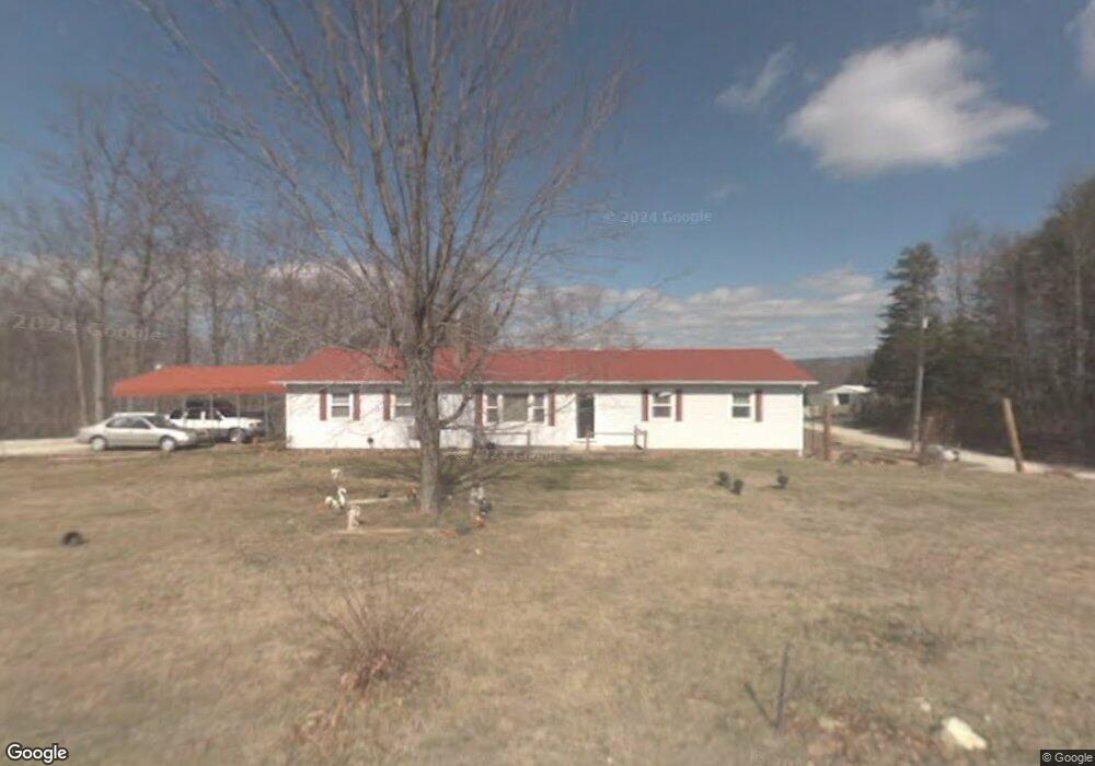
1401 Mcbride Rd Mount Airy, NC 27030
Estimated Value: $122,000 - $372,000
3
Beds
1
Bath
1,932
Sq Ft
$108/Sq Ft
Est. Value
About This Home
This home is located at 1401 Mcbride Rd, Mount Airy, NC 27030 and is currently estimated at $209,222, approximately $108 per square foot. 1401 Mcbride Rd is a home located in Surry County with nearby schools including Flat Rock Elementary School, Meadowview Magnet Middle School, and North Surry High School.
Ownership History
Date
Name
Owned For
Owner Type
Purchase Details
Closed on
Sep 10, 2013
Sold by
Marshall Betty G and Marshall Roger D
Bought by
Shoemaker Hannah
Current Estimated Value
Home Financials for this Owner
Home Financials are based on the most recent Mortgage that was taken out on this home.
Original Mortgage
$20,274
Outstanding Balance
$15,077
Interest Rate
4.39%
Mortgage Type
Commercial
Estimated Equity
$194,145
Purchase Details
Closed on
Jun 1, 1986
Create a Home Valuation Report for This Property
The Home Valuation Report is an in-depth analysis detailing your home's value as well as a comparison with similar homes in the area
Home Values in the Area
Average Home Value in this Area
Purchase History
| Date | Buyer | Sale Price | Title Company |
|---|---|---|---|
| Shoemaker Hannah | $20,527 | None Available | |
| -- | -- | -- |
Source: Public Records
Mortgage History
| Date | Status | Borrower | Loan Amount |
|---|---|---|---|
| Open | Shoemaker Hannah | $20,274 |
Source: Public Records
Tax History Compared to Growth
Tax History
| Year | Tax Paid | Tax Assessment Tax Assessment Total Assessment is a certain percentage of the fair market value that is determined by local assessors to be the total taxable value of land and additions on the property. | Land | Improvement |
|---|---|---|---|---|
| 2025 | $910 | $138,910 | $10,000 | $128,910 |
| 2024 | $812 | $114,950 | $10,000 | $104,950 |
| 2023 | $199 | $114,950 | $10,000 | $104,950 |
| 2022 | $799 | $114,950 | $10,000 | $104,950 |
| 2021 | $812 | $114,950 | $10,000 | $104,950 |
| 2020 | $795 | $107,580 | $10,000 | $97,580 |
| 2019 | $792 | $107,580 | $10,000 | $97,580 |
| 2018 | $779 | $107,580 | $0 | $0 |
| 2017 | $775 | $107,580 | $0 | $0 |
| 2016 | $767 | $107,580 | $0 | $0 |
| 2013 | -- | $118,490 | $0 | $0 |
Source: Public Records
Map
Nearby Homes
- xx 44.93 Acres Stardust Trail
- 1970 Mcbride Rd
- 335 Badgett Ave
- 109 Dorothy Ln
- 0 NE Pine St
- 185 Glen Terrace
- 663 Mcbride Rd
- 2638 Riverside Dr
- 0000 Ararat
- 00 Paynetown Rd
- 0 Blue Hollow Rd Unit 33 1176021
- 0 Blue Hollow Rd Unit 23105199
- 000 Blue Hollow Rd Unit 27
- 124 Rocky Ln
- 00 Blue Hollow Rd Unit 5
- 759 Cameron Ln
- 00 Jackson Rd Unit 8.64 Ac
- 583 Snody Rd
- 0 Jackson Rd
- 107 Cory Trail
- 1402 Mcbride Rd
- 109 Auto Mart Ln
- 1353 Mcbride Rd
- 5 Silver Hill Ln
- 1 Silver Hill Ln
- 6 Silver Hill Ln
- 4 Silver Hill Ln
- 7 Silver Hill Ln
- 3 Silver Hill Ln
- 0 Silver Hill Ln
- 221 Silver Hill Ln
- 198 Silver Hill Ln
- 120 Silver Hill Ln
- 121 Paisley Dr
- 179 Paisley Dr
- 201 Paisley Dr
- 1301 Mcbride Rd
- 1302 Mcbride Rd
- 1497 Mcbride Rd
- 198 Paisley Dr