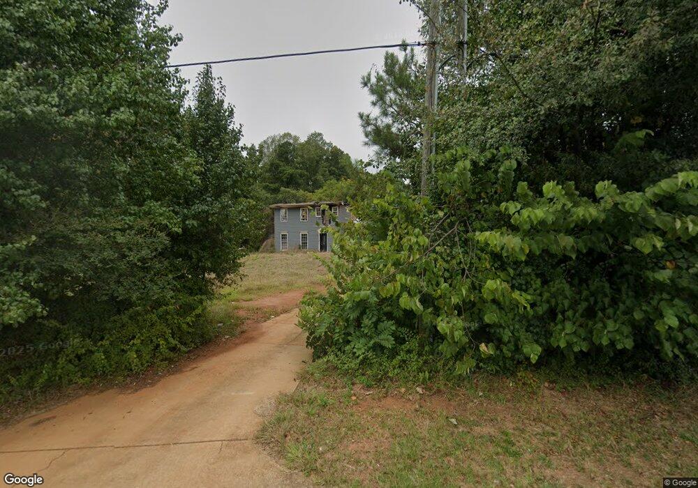
1401 New Franklin Rd Lagrange, GA 30240
Estimated Value: $249,000 - $293,000
3
Beds
3
Baths
1,797
Sq Ft
$146/Sq Ft
Est. Value
About This Home
This home is located at 1401 New Franklin Rd, Lagrange, GA 30240 and is currently estimated at $262,446, approximately $146 per square foot. 1401 New Franklin Rd is a home located in Troup County with nearby schools including Franklin Forest Elementary School, Hillcrest Elementary School, and Hollis Hand Elementary School.
Ownership History
Date
Name
Owned For
Owner Type
Purchase Details
Closed on
Jun 25, 2024
Sold by
Jackson Santana Marie
Bought by
Jackson Ronald Earl
Current Estimated Value
Purchase Details
Closed on
May 20, 2016
Sold by
Wyke Christopher G
Bought by
Jackson Ronald Earl and Jackson Santana Marie
Home Financials for this Owner
Home Financials are based on the most recent Mortgage that was taken out on this home.
Original Mortgage
$112,917
Interest Rate
3.5%
Mortgage Type
FHA
Purchase Details
Closed on
Sep 30, 1981
Sold by
Chapelgate Properties Inc
Bought by
Wyke Christopher
Purchase Details
Closed on
Sep 29, 1981
Sold by
Commercial Bank & Trust Co
Bought by
Chapelgate Properties Inc
Purchase Details
Closed on
Jun 29, 1981
Sold by
Family Properties Inc
Bought by
Commercial Bank & Trust Co
Purchase Details
Closed on
Sep 30, 1980
Sold by
Waugh H
Bought by
Family Properties Inc
Create a Home Valuation Report for This Property
The Home Valuation Report is an in-depth analysis detailing your home's value as well as a comparison with similar homes in the area
Home Values in the Area
Average Home Value in this Area
Purchase History
| Date | Buyer | Sale Price | Title Company |
|---|---|---|---|
| Jackson Ronald Earl | -- | -- | |
| Jackson Ronald Earl | $115,000 | -- | |
| Wyke Christopher | $52,800 | -- | |
| Chapelgate Properties Inc | -- | -- | |
| Commercial Bank & Trust Co | -- | -- | |
| Family Properties Inc | $45,800 | -- |
Source: Public Records
Mortgage History
| Date | Status | Borrower | Loan Amount |
|---|---|---|---|
| Previous Owner | Jackson Ronald Earl | $112,917 |
Source: Public Records
Tax History Compared to Growth
Tax History
| Year | Tax Paid | Tax Assessment Tax Assessment Total Assessment is a certain percentage of the fair market value that is determined by local assessors to be the total taxable value of land and additions on the property. | Land | Improvement |
|---|---|---|---|---|
| 2024 | $1,830 | $69,080 | $14,000 | $55,080 |
| 2023 | $1,613 | $61,120 | $10,000 | $51,120 |
| 2022 | $1,549 | $57,480 | $10,000 | $47,480 |
| 2021 | $1,580 | $54,360 | $10,000 | $44,360 |
| 2020 | $1,580 | $54,360 | $10,000 | $44,360 |
| 2019 | $1,537 | $52,960 | $10,000 | $42,960 |
| 2018 | $1,359 | $47,040 | $8,000 | $39,040 |
| 2017 | $1,181 | $41,160 | $2,800 | $38,360 |
| 2016 | $828 | $34,453 | $2,800 | $31,653 |
| 2015 | $830 | $34,453 | $2,800 | $31,653 |
| 2014 | $781 | $32,787 | $2,800 | $29,987 |
| 2013 | -- | $30,875 | $2,800 | $28,075 |
Source: Public Records
Map
Nearby Homes
- 89 Chase Rd
- 91 Richmond Dr
- 127 Oakmont Dr
- 127 Ashling Dr
- 104 Hidden Branches Ln
- 1784 New Franklin Rd
- 107 Dixie Creek Dr
- LOT 106 River Oaks Dr
- 100 Creekside Dr Unit LOT 60A
- 105 Ridgeview Dr
- 209 River Oaks Dr
- 118 Moss Creek Dr
- 200 Crestwood Dr
- 134 S Page St
- 519 Tradition Place
- 517 Tradition Place
- 400 S Page St
- 107 Windridge
- 109 Windridge
- 114 Crestwood Dr
- 1387 New Franklin Rd
- 99 Meadowland Trail
- 1377 New Franklin Rd
- 101 Meadowland Trail
- 1365 New Franklin Rd
- 103 Meadowland Trail
- 1374 New Franklin Rd
- 100 Meadowland Trail
- 1366 New Franklin Rd
- 1460 New Franklin Rd
- 1357 New Franklin Rd
- 105 Meadowland Trail
- 1403 New Franklin Rd
- 1347 New Franklin Rd
- 1347 New Franklin Rd Unit 1347-1351
- 146 Whiterock Rd
- 107 Meadowland Trail
- 102 Meadowland Trail
- 1352 New Franklin Rd
- 104 Meadowland Trail