Estimated Value: $163,000 - $186,000
3
Beds
1
Bath
1,026
Sq Ft
$173/Sq Ft
Est. Value
About This Home
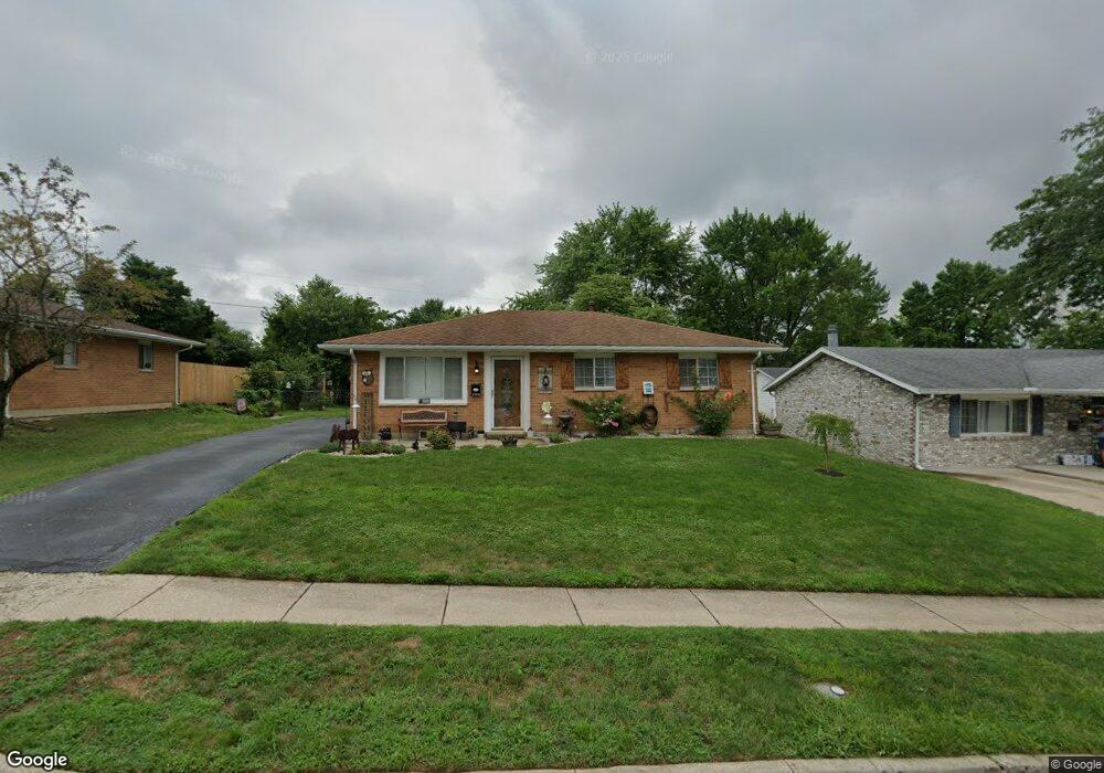
This home is located at 1401 Peacepipe Trail, Xenia, OH 45385 and is currently estimated at $177,166, approximately $172 per square foot. 1401 Peacepipe Trail is a home located in Greene County with nearby schools including Xenia High School, Summit Academy Community School for Alternative Learners - Xenia, and Legacy Christian Academy.
Ownership History
Date
Name
Owned For
Owner Type
Purchase Details
Closed on
Jul 26, 2019
Sold by
Davis Cody R and Davis Heather L
Bought by
Deboard Sonia M
Current Estimated Value
Home Financials for this Owner
Home Financials are based on the most recent Mortgage that was taken out on this home.
Original Mortgage
$82,353
Outstanding Balance
$72,170
Interest Rate
3.73%
Mortgage Type
New Conventional
Estimated Equity
$104,996
Purchase Details
Closed on
Nov 10, 2016
Sold by
Chasteen Katherine J
Bought by
Davis Cody R and Davis Heather L
Home Financials for this Owner
Home Financials are based on the most recent Mortgage that was taken out on this home.
Original Mortgage
$71,700
Interest Rate
3.47%
Mortgage Type
Future Advance Clause Open End Mortgage
Purchase Details
Closed on
Mar 14, 2011
Sold by
Archer Janice M
Bought by
Chasteen Katherine J
Create a Home Valuation Report for This Property
The Home Valuation Report is an in-depth analysis detailing your home's value as well as a comparison with similar homes in the area
Home Values in the Area
Average Home Value in this Area
Purchase History
| Date | Buyer | Sale Price | Title Company |
|---|---|---|---|
| Deboard Sonia M | $84,900 | None Available | |
| Davis Cody R | $75,500 | Attorney | |
| Chasteen Katherine J | $60,000 | Attorney |
Source: Public Records
Mortgage History
| Date | Status | Borrower | Loan Amount |
|---|---|---|---|
| Open | Deboard Sonia M | $82,353 | |
| Previous Owner | Davis Cody R | $71,700 |
Source: Public Records
Tax History Compared to Growth
Tax History
| Year | Tax Paid | Tax Assessment Tax Assessment Total Assessment is a certain percentage of the fair market value that is determined by local assessors to be the total taxable value of land and additions on the property. | Land | Improvement |
|---|---|---|---|---|
| 2024 | $1,757 | $42,140 | $11,140 | $31,000 |
| 2023 | $1,757 | $42,140 | $11,140 | $31,000 |
| 2022 | $1,451 | $29,660 | $6,550 | $23,110 |
| 2021 | $1,470 | $29,660 | $6,550 | $23,110 |
| 2020 | $1,407 | $29,660 | $6,550 | $23,110 |
| 2019 | $1,268 | $24,510 | $6,370 | $18,140 |
| 2018 | $1,273 | $24,510 | $6,370 | $18,140 |
| 2017 | $1,134 | $24,510 | $6,370 | $18,140 |
| 2016 | $1,134 | $21,430 | $6,370 | $15,060 |
| 2015 | $1,138 | $21,430 | $6,370 | $15,060 |
| 2014 | $1,089 | $21,430 | $6,370 | $15,060 |
Source: Public Records
Map
Nearby Homes
- 1208 Bellbrook Ave
- 1272 Bellbrook Ave
- 1144 Rockwell Dr
- 1618 Navajo Dr
- 1454 Kylemore Dr
- 1342 Kylemore Dr
- 1708 Ottawa Dr
- 1568 Cheyenne Dr
- 1653 Seneca Dr
- 1223 June Dr
- 1283 June Dr
- 1391 June Dr
- 646 Glady Ave
- 1881 Commonwealth Dr
- 305-325 Bellbrook Ave
- 1829 Gayhart Dr
- 530 Cincinnati Ave
- 2105 Drake Dr
- 1908 Whitt St
- 121 S Progress Dr
- 1387 Peacepipe Trail
- 1415 Peacepipe Trail
- 1414 Arrowhead Trail
- 1375 Peacepipe Trail
- 1402 Arrowhead Trail
- 1428 Arrowhead Trail
- 1404 Peacepipe Trail
- 1390 Peacepipe Trail
- 1388 Arrowhead Trail
- 1416 Peacepipe Trail
- 1361 Peacepipe Trail
- 1378 Peacepipe Trail
- 1454 Arrowhead Trail
- 1376 Arrowhead Trail
- 884 Buckskin Trail
- 874 Buckskin Trail
- 860 Buckskin Trail
- 833 Buckskin Trail
- 1349 Peacepipe Trail
- 1462 Arrowhead Trail