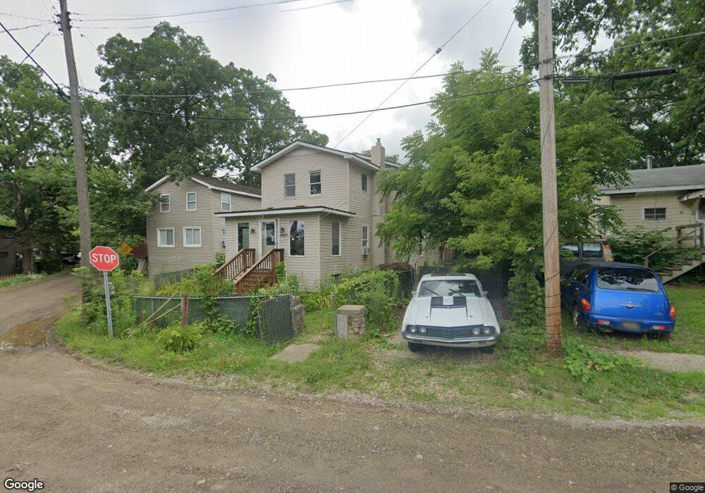
1401 Roy Rd Oxford, MI 48371
Estimated Value: $198,000 - $300,000
3
Beds
2
Baths
1,429
Sq Ft
$176/Sq Ft
Est. Value
About This Home
This home is located at 1401 Roy Rd, Oxford, MI 48371 and is currently estimated at $250,990, approximately $175 per square foot. 1401 Roy Rd is a home located in Oakland County with nearby schools including Oxford Elementary School, Daniel Axford Elementary School, and Oxford Middle School.
Ownership History
Date
Name
Owned For
Owner Type
Purchase Details
Closed on
Jun 20, 2017
Sold by
Smelser Brent and Federal National Mortgage Asso
Bought by
Aursam Property Services Llc
Current Estimated Value
Purchase Details
Closed on
Aug 30, 2005
Sold by
Onnela Brian and Onnela Threasa M
Bought by
Smelser Brent
Home Financials for this Owner
Home Financials are based on the most recent Mortgage that was taken out on this home.
Original Mortgage
$127,720
Interest Rate
5.87%
Mortgage Type
Fannie Mae Freddie Mac
Create a Home Valuation Report for This Property
The Home Valuation Report is an in-depth analysis detailing your home's value as well as a comparison with similar homes in the area
Home Values in the Area
Average Home Value in this Area
Purchase History
| Date | Buyer | Sale Price | Title Company |
|---|---|---|---|
| Aursam Property Services Llc | $84,393 | None Available | |
| Smelser Brent | $159,650 | Philip R Seaver Title Co Inc |
Source: Public Records
Mortgage History
| Date | Status | Borrower | Loan Amount |
|---|---|---|---|
| Previous Owner | Smelser Brent | $127,720 |
Source: Public Records
Tax History Compared to Growth
Tax History
| Year | Tax Paid | Tax Assessment Tax Assessment Total Assessment is a certain percentage of the fair market value that is determined by local assessors to be the total taxable value of land and additions on the property. | Land | Improvement |
|---|---|---|---|---|
| 2024 | $2,881 | $84,260 | $0 | $0 |
| 2023 | $2,747 | $80,670 | $0 | $0 |
| 2022 | $3,537 | $71,550 | $0 | $0 |
| 2021 | $3,402 | $68,880 | $0 | $0 |
| 2020 | $2,567 | $63,940 | $0 | $0 |
| 2019 | $3,225 | $61,350 | $0 | $0 |
| 2018 | $3,184 | $60,380 | $0 | $0 |
| 2017 | $3,212 | $61,530 | $0 | $0 |
| 2016 | $3,192 | $60,940 | $0 | $0 |
| 2015 | -- | $0 | $0 | $0 |
Source: Public Records
Map
Nearby Homes
- 1400 Ora Rd
- 1465 Roy Rd
- 1170 Glass Lake Cir
- 224 Stony Lake Dr Unit 57
- 372 Overlook Dr
- 994 Chelsea Blvd
- 822 Westlake Ave
- 778 W Peninsula Ct
- 600 Cornerstone Dr
- 0000 Brauer Rd
- 690 Brookstone Dr
- 710 Brookstone Dr Unit 20
- 182 E Market St Unit 53
- 682 Westlake Ave
- 720 Marlayna Dr
- 622 Westlake Ave
- 65 1st St
- 861 Seymour Lake Rd
- 990 N Oxford Rd
- 68 N Washington St