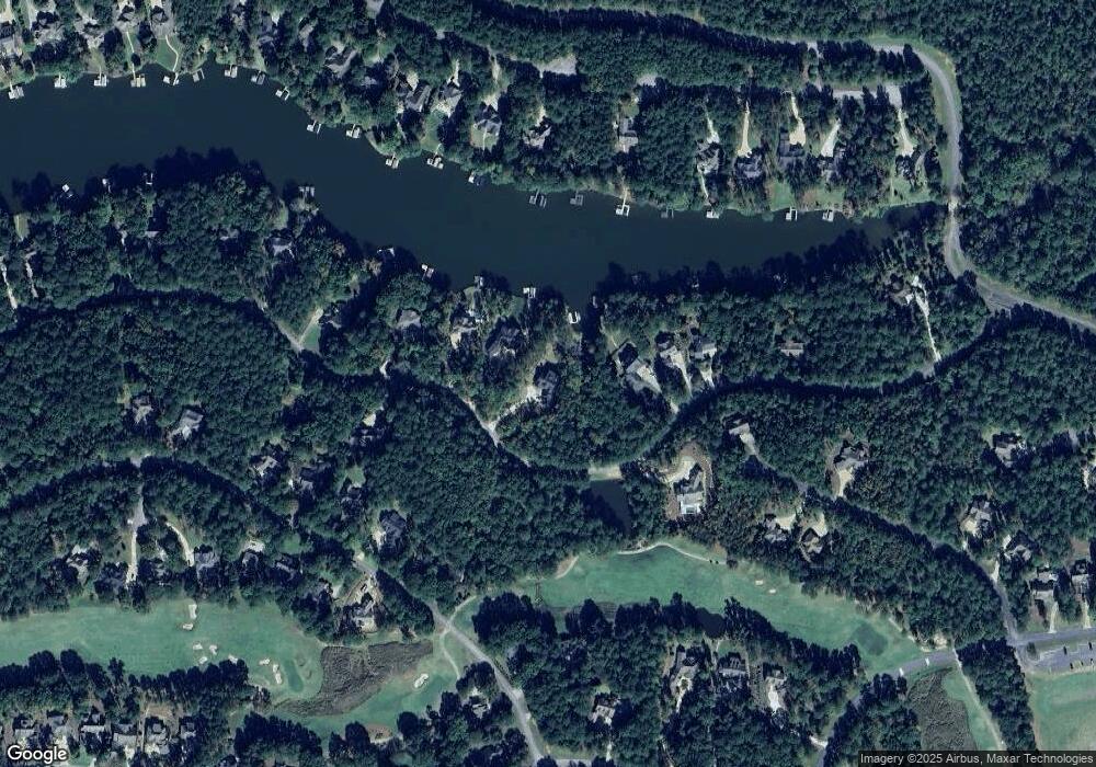
1401 Snug Harbor Dr Unit 21 Greensboro, GA 30642
Estimated Value: $1,831,000 - $2,760,000
--
Bed
1
Bath
2,265
Sq Ft
$1,033/Sq Ft
Est. Value
About This Home
This home is located at 1401 Snug Harbor Dr Unit 21, Greensboro, GA 30642 and is currently estimated at $2,340,437, approximately $1,033 per square foot. 1401 Snug Harbor Dr Unit 21 is a home located in Greene County with nearby schools including Greene County High School, Lake Oconee Academy Elementary, and Lake Oconee Academy High School.
Ownership History
Date
Name
Owned For
Owner Type
Purchase Details
Closed on
Aug 28, 2020
Sold by
Buzaki Michael
Bought by
Buzaki Michael and Imrie Meghan
Current Estimated Value
Home Financials for this Owner
Home Financials are based on the most recent Mortgage that was taken out on this home.
Original Mortgage
$178,500
Interest Rate
2.9%
Mortgage Type
Commercial
Purchase Details
Closed on
Feb 13, 2002
Sold by
Pittard Robert and Pittard Pamela
Bought by
Spinney David M and Spinney Denise J
Purchase Details
Closed on
Sep 20, 1990
Sold by
Citizen Union Bank
Bought by
Pittard Robert and Pittard Pamela
Purchase Details
Closed on
Jul 7, 1990
Sold by
Operation Crime Fight
Bought by
Citizen Union Bank
Purchase Details
Closed on
Jan 1, 1988
Sold by
Hawk Inc
Bought by
Operation Crime Fight
Purchase Details
Closed on
Jan 1, 1987
Sold by
Port Armor Inc
Bought by
Hawk Inc
Purchase Details
Closed on
Jan 1, 1985
Bought by
Port Armor Inc
Create a Home Valuation Report for This Property
The Home Valuation Report is an in-depth analysis detailing your home's value as well as a comparison with similar homes in the area
Home Values in the Area
Average Home Value in this Area
Purchase History
| Date | Buyer | Sale Price | Title Company |
|---|---|---|---|
| Buzaki Michael | -- | -- | |
| Buzaki Michael | $238,000 | -- | |
| Spinney David M | $110,000 | -- | |
| Pittard Robert | -- | -- | |
| Citizen Union Bank | $38,300 | -- | |
| Operation Crime Fight | $47,000 | -- | |
| Hawk Inc | -- | -- | |
| Port Armor Inc | -- | -- |
Source: Public Records
Mortgage History
| Date | Status | Borrower | Loan Amount |
|---|---|---|---|
| Closed | Buzaki Michael | $178,500 |
Source: Public Records
Tax History Compared to Growth
Tax History
| Year | Tax Paid | Tax Assessment Tax Assessment Total Assessment is a certain percentage of the fair market value that is determined by local assessors to be the total taxable value of land and additions on the property. | Land | Improvement |
|---|---|---|---|---|
| 2024 | $10,546 | $676,760 | $162,000 | $514,760 |
| 2023 | $9,788 | $95,200 | $95,200 | $0 |
| 2022 | $1,725 | $95,200 | $95,200 | $0 |
| 2021 | $1,567 | $97,480 | $97,480 | $0 |
| 2020 | $1,101 | $51,000 | $51,000 | $0 |
| 2019 | $1,120 | $51,000 | $51,000 | $0 |
| 2018 | $1,120 | $51,000 | $51,000 | $0 |
| 2017 | $1,053 | $51,000 | $51,000 | $0 |
| 2016 | $1,053 | $51,000 | $51,000 | $0 |
| 2015 | $1,014 | $51,000 | $51,000 | $0 |
| 2014 | $937 | $45,900 | $45,900 | $0 |
Source: Public Records
Map
Nearby Homes
- 1811 Snug Harbor Dr
- 1041 Fairway Ridge Rd
- 1281 Snug Harbor Dr
- 1780 Snug Harbor Dr
- 1520 Snug Harbor Dr
- 1011 Ridge Terrace
- 1010 Snug Harbor Ct
- 1041 Lake Pointe S
- 1320 Fairway Ridge Dr
- 1020 Fairway Ridge Cir
- 1021 Emerald View Dr
- 1041 Fairway Ridge Cir
- 1201 Lakeview Ct
- 1071 Big Water Cir
- 1080 Water Front Rd
- 1151 Crooked Creek Rd
- 1010 Overlook Cove
- 1060 Lone Oak Rd
- 1041 Lone Oak Rd
- 1401 Snug Harbor Dr
- 1411 Snug Harbor Dr
- 1381 Snug Harbor Dr
- 1381 Snug Harbor Dr Unit Lot 22
- 0 Snug Harbor Dr Unit 30 8256835
- 0 Snug Harbor Dr Unit 7232242
- 0 Snug Harbor Dr Unit 7108470
- 0 Snug Harbor Dr Unit 7050436
- 0 Snug Harbor Dr Unit 7585278
- 0 Snug Harbor Dr Unit 7585276
- 0 Snug Harbor Dr Unit 7585271
- 0 Snug Harbor Dr Unit 8018523
- 0 Snug Harbor Dr Unit 7550946
- 0 Snug Harbor Dr Unit 7362880
- 0 Snug Harbor Dr Unit 3244604
- 0 Snug Harbor Dr Unit 9000440
- 0 Snug Harbor Dr Unit 9004336
- 0 Snug Harbor Dr Unit 9076886
- 0 Snug Harbor Dr Unit 8072859
- 0 Snug Harbor Dr Unit 8156703
