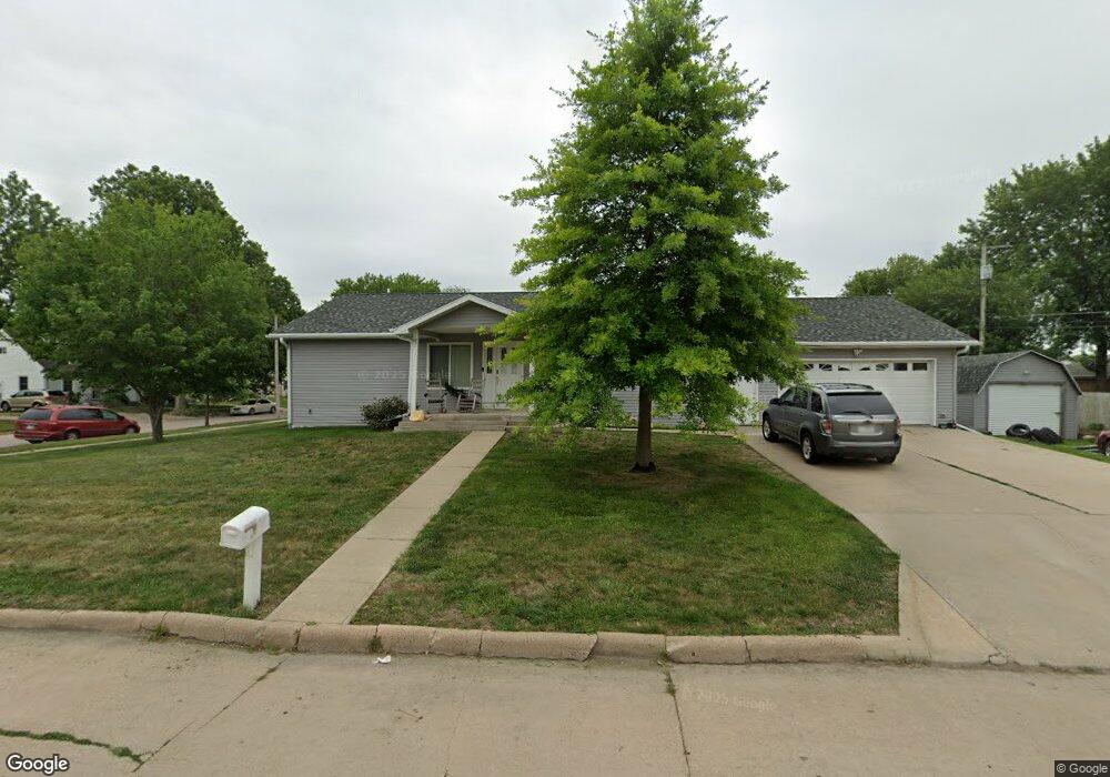
1401 W 11th St Hastings, NE 68901
Estimated Value: $299,000 - $326,623
3
Beds
4
Baths
1,536
Sq Ft
$202/Sq Ft
Est. Value
About This Home
This home is located at 1401 W 11th St, Hastings, NE 68901 and is currently estimated at $310,541, approximately $202 per square foot. 1401 W 11th St is a home located in Adams County with nearby schools including Hastings Senior High School, St. Michael's Preschool & Elementary School, and St. Cecilia High School.
Ownership History
Date
Name
Owned For
Owner Type
Purchase Details
Closed on
Nov 30, 2021
Sold by
Hogan Marcia D and The Neumiller Family Revocable
Bought by
Neumiller Megan L
Current Estimated Value
Home Financials for this Owner
Home Financials are based on the most recent Mortgage that was taken out on this home.
Original Mortgage
$100,000
Outstanding Balance
$91,949
Interest Rate
3.09%
Mortgage Type
Commercial
Estimated Equity
$218,592
Purchase Details
Closed on
Feb 16, 2005
Sold by
Neimiller Lester and Neimiller Arlene
Bought by
Neumiller Lester and Neumiller Arlene
Create a Home Valuation Report for This Property
The Home Valuation Report is an in-depth analysis detailing your home's value as well as a comparison with similar homes in the area
Home Values in the Area
Average Home Value in this Area
Purchase History
| Date | Buyer | Sale Price | Title Company |
|---|---|---|---|
| Neumiller Megan L | $95,000 | Prairie Title | |
| Neumiller Lester | -- | None Available |
Source: Public Records
Mortgage History
| Date | Status | Borrower | Loan Amount |
|---|---|---|---|
| Open | Neumiller Megan L | $100,000 |
Source: Public Records
Tax History Compared to Growth
Tax History
| Year | Tax Paid | Tax Assessment Tax Assessment Total Assessment is a certain percentage of the fair market value that is determined by local assessors to be the total taxable value of land and additions on the property. | Land | Improvement |
|---|---|---|---|---|
| 2024 | $4,788 | $298,707 | $23,807 | $274,900 |
| 2023 | $5,723 | $277,359 | $23,807 | $253,552 |
| 2022 | $3,996 | $177,396 | $23,807 | $153,589 |
| 2021 | $3,538 | $161,354 | $19,142 | $142,212 |
| 2020 | $3,333 | $154,582 | $19,142 | $135,440 |
| 2019 | $3,160 | $148,132 | $19,142 | $128,990 |
| 2018 | $3,016 | $140,650 | $11,660 | $128,990 |
| 2017 | $3,014 | $140,650 | $0 | $0 |
| 2016 | $2,788 | $130,000 | $11,660 | $118,340 |
| 2011 | -- | $0 | $0 | $0 |
Source: Public Records
Map
Nearby Homes
- 1108 N Baltimore Ave
- 1001 N Webster Ave
- 904 N Washington Ave
- 1334 W 12th St
- 1619 Boyce St
- 1223 Westwood Terrace
- 714 N Baltimore Ave
- 1201 Pershing Rd
- 1011 N Bellevue Ave
- 1814 Boyce St
- 1123-1125 N Bellevue Ave
- 1127 N Bellevue Ave
- 727 N Williams Ave
- 619 N Briggs Ave
- 1615 W 7th St
- 1911 W 11th St
- 618 N Saunders Ave
- 1330 Heritage Dr
- 1225 Heritage Dr
- 1801 W 7th St
- 1011 N Hewett Ave
- 1105 N Hewett Ave
- 1016 N Hewett Ave
- 1009 N Hewett Ave
- 1106 N Hewett Ave
- 1018 N Baltimore Ave
- 1012 N Hewett Ave
- 1111 N Hewett Ave
- 1005 N Hewett Ave
- 1008 N Hewett Ave
- 1010 N Baltimore Ave
- 1104 N Baltimore Ave
- 1110 N Hewett Ave
- 1115 N Hewett Ave
- 1004 N Hewett Ave
- 1001 N Hewett Ave
- 1000 N Baltimore Ave
- 1114 N Hewett Ave
- 1015 N Webster Ave
- 1000 N Hewett Ave