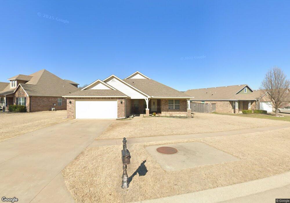
1401 W Burnham Ave Sapulpa, OK 74066
Estimated Value: $263,000 - $314,203
3
Beds
2
Baths
1,524
Sq Ft
$184/Sq Ft
Est. Value
About This Home
This home is located at 1401 W Burnham Ave, Sapulpa, OK 74066 and is currently estimated at $280,401, approximately $183 per square foot. 1401 W Burnham Ave is a home with nearby schools including Sapulpa Middle School, Sapulpa Junior High School, and Sapulpa High School.
Ownership History
Date
Name
Owned For
Owner Type
Purchase Details
Closed on
Aug 22, 2011
Sold by
Investors Financial Limited Partnership
Bought by
Watson Vincent B
Current Estimated Value
Purchase Details
Closed on
May 14, 2010
Sold by
Freedom Homes Oklahoma Llc
Bought by
Muscogee Creek Nation
Purchase Details
Closed on
Mar 2, 2010
Sold by
The Lakes At Jefferson Height Llc
Bought by
Freedom Homes Oklahoma Llc
Home Financials for this Owner
Home Financials are based on the most recent Mortgage that was taken out on this home.
Original Mortgage
$123,250
Interest Rate
4.97%
Mortgage Type
Commercial
Create a Home Valuation Report for This Property
The Home Valuation Report is an in-depth analysis detailing your home's value as well as a comparison with similar homes in the area
Home Values in the Area
Average Home Value in this Area
Purchase History
| Date | Buyer | Sale Price | Title Company |
|---|---|---|---|
| Watson Vincent B | -- | None Listed On Document | |
| Muscogee Creek Nation | $141,500 | -- | |
| Freedom Homes Oklahoma Llc | $25,000 | -- |
Source: Public Records
Mortgage History
| Date | Status | Borrower | Loan Amount |
|---|---|---|---|
| Previous Owner | Freedom Homes Oklahoma Llc | $123,250 |
Source: Public Records
Tax History Compared to Growth
Tax History
| Year | Tax Paid | Tax Assessment Tax Assessment Total Assessment is a certain percentage of the fair market value that is determined by local assessors to be the total taxable value of land and additions on the property. | Land | Improvement |
|---|---|---|---|---|
| 2024 | -- | $0 | $0 | $0 |
| 2023 | $0 | $0 | $0 | $0 |
| 2022 | $0 | $0 | $0 | $0 |
| 2021 | $0 | $0 | $0 | $0 |
| 2020 | $0 | $0 | $0 | $0 |
| 2019 | $0 | $0 | $0 | $0 |
| 2018 | $0 | $0 | $0 | $0 |
| 2017 | $0 | $0 | $0 | $0 |
| 2016 | -- | $0 | $0 | $0 |
| 2015 | -- | $0 | $0 | $0 |
| 2014 | -- | $0 | $0 | $0 |
Source: Public Records
Map
Nearby Homes
- 1401 Panther Ln
- 1330 Panther Ln
- 1755 S Stephanie St
- 1160 W Keeling Ave
- 1120 W Keeling Ave
- 2000 W Taft Ave
- 1915 S Muskogee St
- 1836 S Oklahoma St
- 605 W Mockingbird Ln
- 21 Johnson Dr
- 1203 Johnson Dr
- 10 Sahoma Lake Rd
- 920 S Oklahoma St
- 925 S Oklahoma St
- 909 S Oklahoma St
- 1965 S Scott St
- 215 S Hawthorne St
- 706 S Oklahoma St
- 408 S Muskogee St
- 1220 S Cedar St
- 1415 W Burnham Ave
- 1391 W Burnham Ave
- 1425 W Burnham Ave
- 1381 W Burnham Ave
- 1400 W Burnham Ave
- 1435 W Burnham Ave
- 1420 W Burnham Ave
- 1396 W Burnham Ave
- 1426 W Burnham Ave
- 1410 W Burnham Ave
- 1384 W Burnham Ave
- 1430 W Burnham Ave
- 1371 W Burnham Ave
- 1380 Panther Ln
- 1445 W Burnham Ave
- 1374 W Burnham Ave
- 1370 Panther Ln
- 1440 W Burnham Ave
- 1361 W Burnham Ave
- 1350 Panther Ln