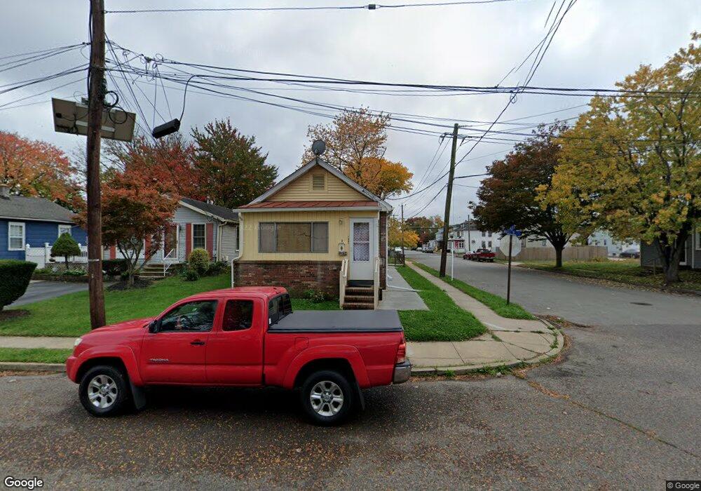
1401 William St Trenton, NJ 08610
Estimated Value: $153,000 - $258,000
--
Bed
--
Bath
704
Sq Ft
$276/Sq Ft
Est. Value
About This Home
This home is located at 1401 William St, Trenton, NJ 08610 and is currently estimated at $194,046, approximately $275 per square foot. 1401 William St is a home located in Mercer County with nearby schools including George E. Wilson Elementary School, Albert E. Grice Middle School, and Hamilton West-Watson High School.
Ownership History
Date
Name
Owned For
Owner Type
Purchase Details
Closed on
Jun 11, 2021
Sold by
Laster Rosalind A and Mccoy Taura
Bought by
Shapiro Lester and Shapiro Victoria
Current Estimated Value
Home Financials for this Owner
Home Financials are based on the most recent Mortgage that was taken out on this home.
Original Mortgage
$91,125
Interest Rate
2.8%
Mortgage Type
New Conventional
Purchase Details
Closed on
Dec 18, 2007
Sold by
Laster Rosalind A
Bought by
Laster Rosalind A and Mccoy Taura
Home Financials for this Owner
Home Financials are based on the most recent Mortgage that was taken out on this home.
Original Mortgage
$147,175
Interest Rate
6.27%
Mortgage Type
New Conventional
Purchase Details
Closed on
Nov 2, 2000
Sold by
Nalfam Llc
Bought by
Laster Michael
Create a Home Valuation Report for This Property
The Home Valuation Report is an in-depth analysis detailing your home's value as well as a comparison with similar homes in the area
Home Values in the Area
Average Home Value in this Area
Purchase History
| Date | Buyer | Sale Price | Title Company |
|---|---|---|---|
| Shapiro Lester | $121,500 | River Edge Title Agency | |
| Shapiro Lester | $121,500 | River Edge Title | |
| Laster Rosalind A | -- | -- | |
| Laster Michael | $25,000 | -- |
Source: Public Records
Mortgage History
| Date | Status | Borrower | Loan Amount |
|---|---|---|---|
| Previous Owner | Shapiro Lester | $91,125 | |
| Previous Owner | Laster Rosalind A | $147,175 |
Source: Public Records
Tax History Compared to Growth
Tax History
| Year | Tax Paid | Tax Assessment Tax Assessment Total Assessment is a certain percentage of the fair market value that is determined by local assessors to be the total taxable value of land and additions on the property. | Land | Improvement |
|---|---|---|---|---|
| 2025 | $3,013 | $85,500 | $25,000 | $60,500 |
| 2024 | $2,824 | $85,500 | $25,000 | $60,500 |
| 2023 | $2,824 | $85,500 | $25,000 | $60,500 |
| 2022 | $2,780 | $85,500 | $25,000 | $60,500 |
| 2021 | $3,440 | $85,500 | $25,000 | $60,500 |
| 2020 | $3,132 | $85,500 | $25,000 | $60,500 |
| 2019 | $3,040 | $85,500 | $25,000 | $60,500 |
| 2018 | $2,999 | $85,500 | $25,000 | $60,500 |
| 2017 | $2,866 | $85,500 | $25,000 | $60,500 |
| 2016 | $2,312 | $85,500 | $25,000 | $60,500 |
| 2015 | $2,427 | $46,600 | $17,000 | $29,600 |
| 2014 | $2,396 | $46,600 | $17,000 | $29,600 |
Source: Public Records
Map
Nearby Homes
- 429 Wilfred Ave
- 1961 S Broad St
- 238 Grand Ave
- 323 Wilfred Ave
- 229 Parkinson Ave
- 604 Schiller Ave
- 1857 S Broad St
- 235 Wilfred Ave
- 408 Berg Ave
- 229 Wilfred Ave
- 1816 Chambers St
- 525 Lafayette Ave
- 314 Joseph St
- 256 Field Ave
- 34 Sewell Ave
- 2325 S Broad St
- 624 Hunt Ave
- 316 W Park Ave
- 218 Sewell Ave
- 164 Lillian Ave
- 1407 William St
- 1411 William St
- 2610 S Clinton Ave
- 1331 William St
- 314 Mary St
- 2542 S Clinton Ave
- 1329 William St
- 2618 S Clinton Ave
- 316 Mary St
- 1327 William St
- 2534 S Clinton Ave
- 1325 William St
- 1416 William St
- 1328 William St
- 320 Mary St
- 1323 William St
- 2528 S Clinton Ave
- 1321 William St
- 122 Mary St
- 1326 William St