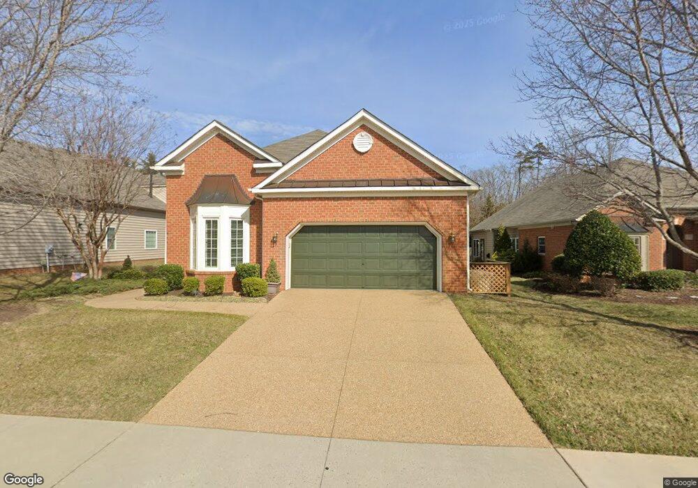
14012 Abrahams Ln Midlothian, VA 23114
Estimated Value: $594,618 - $673,000
2
Beds
2
Baths
2,129
Sq Ft
$293/Sq Ft
Est. Value
About This Home
This home is located at 14012 Abrahams Ln, Midlothian, VA 23114 and is currently estimated at $623,655, approximately $292 per square foot. 14012 Abrahams Ln is a home located in Chesterfield County with nearby schools including J B Watkins Elementary School, Midlothian Middle School, and Midlothian High School.
Ownership History
Date
Name
Owned For
Owner Type
Purchase Details
Closed on
Feb 21, 2018
Sold by
Ebert Richard G and Ebert Marlene I
Bought by
Ebert Richard G and Ebert Marlene I
Current Estimated Value
Purchase Details
Closed on
Nov 16, 2016
Sold by
White John R and White Sandra H
Bought by
Ebert Richard G and Ebert Mariene L
Home Financials for this Owner
Home Financials are based on the most recent Mortgage that was taken out on this home.
Original Mortgage
$100,000
Outstanding Balance
$80,409
Interest Rate
3.47%
Mortgage Type
New Conventional
Estimated Equity
$543,246
Purchase Details
Closed on
Nov 10, 2006
Sold by
Boone Homes Inc
Bought by
White John
Home Financials for this Owner
Home Financials are based on the most recent Mortgage that was taken out on this home.
Original Mortgage
$165,000
Interest Rate
6.33%
Mortgage Type
New Conventional
Create a Home Valuation Report for This Property
The Home Valuation Report is an in-depth analysis detailing your home's value as well as a comparison with similar homes in the area
Home Values in the Area
Average Home Value in this Area
Purchase History
| Date | Buyer | Sale Price | Title Company |
|---|---|---|---|
| Ebert Richard G | -- | None Available | |
| Ebert Richard G | $400,000 | Attorney | |
| White John | $409,957 | -- |
Source: Public Records
Mortgage History
| Date | Status | Borrower | Loan Amount |
|---|---|---|---|
| Open | Ebert Richard G | $100,000 | |
| Previous Owner | White John | $165,000 |
Source: Public Records
Tax History
| Year | Tax Paid | Tax Assessment Tax Assessment Total Assessment is a certain percentage of the fair market value that is determined by local assessors to be the total taxable value of land and additions on the property. | Land | Improvement |
|---|---|---|---|---|
| 2025 | $5,127 | $573,300 | $85,000 | $488,300 |
| 2024 | $5,127 | $515,000 | $85,000 | $430,000 |
| 2023 | $4,025 | $442,300 | $85,000 | $357,300 |
| 2022 | $4,021 | $437,100 | $82,000 | $355,100 |
| 2021 | $3,939 | $412,000 | $80,000 | $332,000 |
| 2020 | $3,796 | $399,600 | $80,000 | $319,600 |
| 2019 | $3,796 | $399,600 | $80,000 | $319,600 |
| 2018 | $3,728 | $393,800 | $80,000 | $313,800 |
| 2017 | $3,703 | $381,800 | $80,000 | $301,800 |
| 2016 | $3,657 | $380,900 | $80,000 | $300,900 |
| 2015 | $3,550 | $369,800 | $80,000 | $289,800 |
| 2014 | $3,489 | $363,400 | $74,000 | $289,400 |
Source: Public Records
Map
Nearby Homes
- 14300 Charter Landing Dr
- 14316 Garnett Ln
- 526 Aldengate Terrace
- 14000 Briars Cir Unit 304
- 14011 Briars Cir Unit 104
- 14384 Charter Landing Dr
- 426 Coalfield Rd
- 1111 Briars Ct Unit 303
- 1201 Westwood Village Ln Unit 402
- 1220 Westwood Village Ln Unit 404
- 1003 Westwood Village Ln Unit 303
- 1003 Westwood Village Ln Unit 201
- 1119 Ashton Village Ln
- 604 Bristol Village Dr Unit 303
- 604 Bristol Village Dr Unit 104
- 614 Bristol Village Dr Unit 203
- 450 Coalfield Rd
- 600 Fern Meadow Loop Unit 304
- Woolridge - Heritage Balcony Plan at Midlothian West
- Woolridge - Heritage Piazza Plan at Midlothian West
- 14012 Abrahams Ln
- 14006 Abrahams Ln
- 14006 Abrahams Ln
- 14018 Abrahams Ln
- 14000 Abrahams Ln
- 14024 Abrahams Ln
- 14101 Charter Landing Ct
- Lot 47 A - Abrahams Ln
- 14019 Abrahams Ln
- 14013 Abrahams Ln
- 14100 Abrahams Ln
- 14107 Charter Landing Ct
- 14025 Abrahams Ln
- 14007 Abrahams Ln
- 14007 Abrahams Ln
- 14106 Abrahams Ln
- 14001 Abrahams Ln
- 14101 Abrahams Ln
- 14113 Charter Landing Ct
- 14112 Abrahams Ln