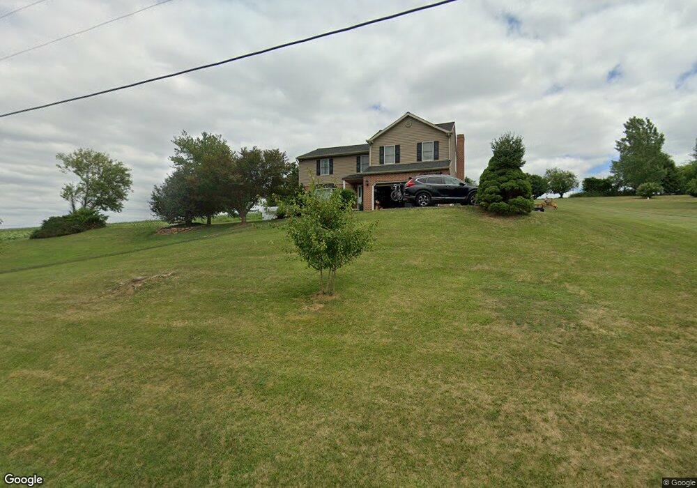
14013 Line Rd New Freedom, PA 17349
Estimated Value: $395,666 - $486,000
3
Beds
3
Baths
1,964
Sq Ft
$227/Sq Ft
Est. Value
About This Home
This home is located at 14013 Line Rd, New Freedom, PA 17349 and is currently estimated at $445,417, approximately $226 per square foot. 14013 Line Rd is a home located in York County with nearby schools including North Hopewell-Winterstown Elementary School, Red Lion Area Junior High School, and Red Lion Area Senior High School.
Ownership History
Date
Name
Owned For
Owner Type
Purchase Details
Closed on
Jun 29, 2002
Sold by
Newcomb Robert L and Newcomb Monica L
Bought by
Ferrell Michael L and Ferrell Loretta A
Current Estimated Value
Home Financials for this Owner
Home Financials are based on the most recent Mortgage that was taken out on this home.
Original Mortgage
$195,300
Outstanding Balance
$83,261
Interest Rate
6.79%
Mortgage Type
VA
Estimated Equity
$362,156
Purchase Details
Closed on
Nov 3, 1993
Bought by
Newcomb Robert L and Newcomb Monica L
Create a Home Valuation Report for This Property
The Home Valuation Report is an in-depth analysis detailing your home's value as well as a comparison with similar homes in the area
Home Values in the Area
Average Home Value in this Area
Purchase History
| Date | Buyer | Sale Price | Title Company |
|---|---|---|---|
| Ferrell Michael L | $191,500 | -- | |
| Newcomb Robert L | $170,000 | -- |
Source: Public Records
Mortgage History
| Date | Status | Borrower | Loan Amount |
|---|---|---|---|
| Open | Ferrell Michael L | $195,300 |
Source: Public Records
Tax History Compared to Growth
Tax History
| Year | Tax Paid | Tax Assessment Tax Assessment Total Assessment is a certain percentage of the fair market value that is determined by local assessors to be the total taxable value of land and additions on the property. | Land | Improvement |
|---|---|---|---|---|
| 2025 | $6,547 | $207,790 | $45,320 | $162,470 |
| 2024 | $6,343 | $207,790 | $45,320 | $162,470 |
| 2023 | $6,343 | $207,790 | $45,320 | $162,470 |
| 2022 | $6,343 | $207,790 | $45,320 | $162,470 |
| 2021 | $6,136 | $207,790 | $45,320 | $162,470 |
| 2020 | $6,136 | $207,790 | $45,320 | $162,470 |
| 2019 | $6,115 | $207,790 | $45,320 | $162,470 |
| 2018 | $6,115 | $207,790 | $45,320 | $162,470 |
| 2017 | $6,115 | $207,790 | $45,320 | $162,470 |
| 2016 | $0 | $207,790 | $45,320 | $162,470 |
| 2015 | -- | $207,790 | $45,320 | $162,470 |
| 2014 | -- | $207,790 | $45,320 | $162,470 |
Source: Public Records
Map
Nearby Homes
- 28 Valley Rd
- 23 Clear Run Dr
- Lot #1 Bowman School Rd
- 0 Lot 6 Harambe Overlook Unit PAYK2092222
- 0 Lot 7 Harambe Overlook Unit PAYK2092224
- 0 Lot 8 Harambe Overlook Unit PAYK2092226
- 0 Lot 10 Harambe Overlook Unit PAYK2092216
- 13859 Ebaugh Rd
- 52 N Main St
- 0 Kreutz Creek Off Unit PAYK2094814
- 12 S Main St
- 2 S Hill St
- 14 Kratz Rd
- 11 Bridle Rd
- Augusta Plan at Foxhaven
- Devonshire Plan at Foxhaven
- Kipling Plan at Foxhaven
- Addison Plan at Foxhaven
- Nottingham Plan at Foxhaven
- Woodford Plan at Foxhaven