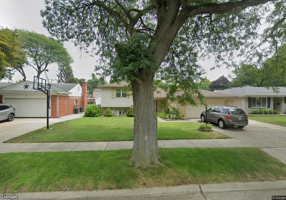
14016 Cranston St Livonia, MI 48154
Estimated Value: $371,664 - $422,000
3
Beds
3
Baths
2,139
Sq Ft
$185/Sq Ft
Est. Value
About This Home
This home is located at 14016 Cranston St, Livonia, MI 48154 and is currently estimated at $396,666, approximately $185 per square foot. 14016 Cranston St is a home located in Wayne County with nearby schools including Kennedy Elementary School, Johnson Upper Elementary School, and Frost Middle School.
Ownership History
Date
Name
Owned For
Owner Type
Purchase Details
Closed on
May 16, 2018
Sold by
Porter Adam
Bought by
Porter Sara
Current Estimated Value
Home Financials for this Owner
Home Financials are based on the most recent Mortgage that was taken out on this home.
Original Mortgage
$138,380
Outstanding Balance
$119,640
Interest Rate
4.58%
Mortgage Type
FHA
Estimated Equity
$277,026
Purchase Details
Closed on
Dec 29, 2010
Sold by
Mulligan Michele and Mulligan Keith
Bought by
Porter Adam T
Purchase Details
Closed on
Oct 31, 2003
Sold by
Sackett Gary L and Sackett Susan J
Bought by
Mulligan Keith
Purchase Details
Closed on
Jun 28, 2003
Sold by
Sackett Susan J and Hooker Clifford H
Bought by
Sackett Gary L
Create a Home Valuation Report for This Property
The Home Valuation Report is an in-depth analysis detailing your home's value as well as a comparison with similar homes in the area
Home Values in the Area
Average Home Value in this Area
Purchase History
| Date | Buyer | Sale Price | Title Company |
|---|---|---|---|
| Porter Sara | -- | None Available | |
| Porter Adam T | $149,900 | Devon Title Agency | |
| Mulligan Keith | $215,000 | Multiple | |
| Sackett Gary L | -- | -- |
Source: Public Records
Mortgage History
| Date | Status | Borrower | Loan Amount |
|---|---|---|---|
| Open | Porter Sara | $138,380 |
Source: Public Records
Tax History Compared to Growth
Tax History
| Year | Tax Paid | Tax Assessment Tax Assessment Total Assessment is a certain percentage of the fair market value that is determined by local assessors to be the total taxable value of land and additions on the property. | Land | Improvement |
|---|---|---|---|---|
| 2025 | $2,034 | $165,000 | $0 | $0 |
| 2024 | $2,034 | $157,400 | $0 | $0 |
| 2023 | $1,940 | $139,700 | $0 | $0 |
| 2022 | $3,407 | $127,800 | $0 | $0 |
| 2021 | $3,309 | $117,500 | $0 | $0 |
| 2019 | $3,175 | $114,600 | $0 | $0 |
| 2018 | $1,640 | $104,900 | $0 | $0 |
| 2017 | -- | $101,400 | $0 | $0 |
| 2016 | -- | $101,400 | $0 | $0 |
| 2015 | -- | $0 | $0 | $0 |
| 2012 | -- | $70,570 | $16,070 | $54,500 |
Source: Public Records
Map
Nearby Homes
- 14214 Cranston St
- 32950 Perth St
- 32136 Lyndon St
- 14327 Arden St
- 33025 Martin St
- 14563 Melrose St
- 33040 Allen St
- 14677 Auburndale St
- 14164 Bainbridge St
- 31126 Grennada St
- 14154 Hubbell St
- 14879 Fairfield St
- 31221 Lyndon St
- 14292 Hubbell St
- 15075 Hubbard St Unit 5
- 15040 Berwick St
- 14127 Hillcrest St
- 30831 Lyndon St
- 32651 5 Mile Rd Unit 15
- 30261 Buckingham St
- 13998 Cranston St
- 14034 Cranston St
- 14013 Blackburn St
- 13980 Cranston St
- 14052 Cranston St
- 13995 Blackburn St
- 14031 Blackburn St
- 13977 Blackburn St
- 14049 Blackburn St
- 14070 Cranston St
- 14015 Cranston St
- 13962 Cranston St
- 14035 Cranston St
- 13999 Cranston St
- 14067 Blackburn St
- 14053 Cranston St
- 13959 Blackburn St
- 13981 Cranston St
- 14088 Cranston St
- 14071 Cranston St