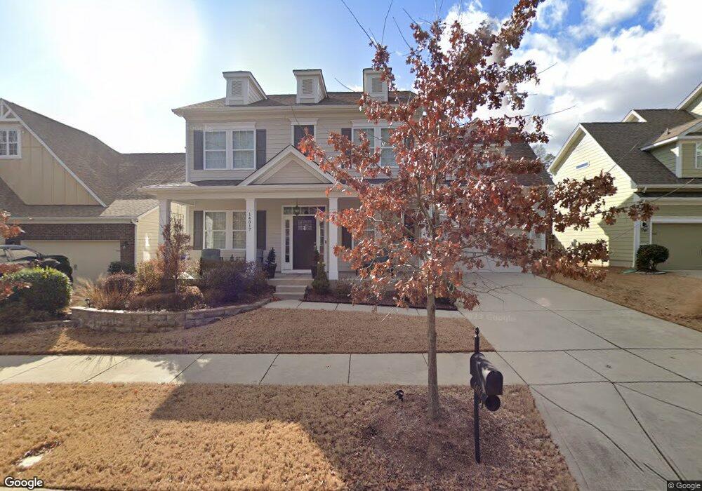
14017 Wyncrest Dr Unit 264 Huntersville, NC 28078
Estimated Value: $581,254 - $600,000
4
Beds
3
Baths
2,815
Sq Ft
$210/Sq Ft
Est. Value
About This Home
This home is located at 14017 Wyncrest Dr Unit 264, Huntersville, NC 28078 and is currently estimated at $590,064, approximately $209 per square foot. 14017 Wyncrest Dr Unit 264 is a home located in Mecklenburg County with nearby schools including Barnette Elementary School, Francis Bradley Middle School, and Hopewell High.
Ownership History
Date
Name
Owned For
Owner Type
Purchase Details
Closed on
Sep 30, 2015
Sold by
D R Horton Inc
Bought by
Bronson Robin R
Current Estimated Value
Home Financials for this Owner
Home Financials are based on the most recent Mortgage that was taken out on this home.
Original Mortgage
$286,900
Outstanding Balance
$225,802
Interest Rate
3.97%
Mortgage Type
New Conventional
Estimated Equity
$364,262
Create a Home Valuation Report for This Property
The Home Valuation Report is an in-depth analysis detailing your home's value as well as a comparison with similar homes in the area
Home Values in the Area
Average Home Value in this Area
Purchase History
| Date | Buyer | Sale Price | Title Company |
|---|---|---|---|
| Bronson Robin R | $302,000 | Attorney |
Source: Public Records
Mortgage History
| Date | Status | Borrower | Loan Amount |
|---|---|---|---|
| Open | Bronson Robin R | $286,900 |
Source: Public Records
Tax History Compared to Growth
Tax History
| Year | Tax Paid | Tax Assessment Tax Assessment Total Assessment is a certain percentage of the fair market value that is determined by local assessors to be the total taxable value of land and additions on the property. | Land | Improvement |
|---|---|---|---|---|
| 2025 | $3,683 | $489,600 | $125,000 | $364,600 |
| 2024 | $3,683 | $489,600 | $125,000 | $364,600 |
| 2023 | $3,377 | $489,600 | $125,000 | $364,600 |
| 2022 | $3,032 | $334,500 | $75,000 | $259,500 |
| 2021 | $3,015 | $334,500 | $75,000 | $259,500 |
| 2020 | $2,990 | $334,500 | $75,000 | $259,500 |
| 2019 | $2,984 | $334,500 | $75,000 | $259,500 |
| 2018 | $3,107 | $265,500 | $40,000 | $225,500 |
| 2017 | $3,071 | $265,500 | $40,000 | $225,500 |
| 2016 | $3,068 | $40,000 | $40,000 | $0 |
| 2015 | $448 | $0 | $0 | $0 |
Source: Public Records
Map
Nearby Homes
- 9304 Rayneridge Dr
- 15925 Foreleigh Rd
- 9104 Cantrell Way
- 9619 Rayneridge Dr
- 15513 Foreleigh Rd
- 8123 Kalson St
- 13723 Baytown Ct
- 6729 Garden Hill Dr
- 7006 Garden Hill Dr
- 6412 Myston Ln
- 6836 Olmsford Dr
- 6901 Dunton St
- 7400 Gilead Rd
- 11110 Grenfell Ave
- 3938 Conner Glenn Dr
- 8017 Baylis Dr
- 7334 Henderson Park Rd
- 5112 Ingleburn Ln
- 8428 Bramfield Dr
- 14520 Beatties Ford Rd
- 14013 Wyncrest Dr
- 14013 Wyncrest Dr Unit 263
- 14021 Wyncrest Dr Unit 265
- 9325 Rayneridge Dr Unit 266
- 14009 Wyncrest Dr Unit 262
- 9403 Rayneridge Dr Unit 268
- 14005 Wyncrest Dr
- 14005 Wyncrest Dr Unit 261
- 9333 Rayneridge Dr
- 9310 Rayneridge Dr
- 9407 Rayneridge Dr Unit 269
- 9316 Rayneridge Dr
- 14001 Wyncrest Dr
- 9322 Rayneridge Dr
- 14102 Malford Rd
- 9411 Rayneridge Dr Unit 270
- 9411 Rayneridge Dr
- 13927 Wyncrest Dr Unit 259
- 14108 Malford Rd
- 8001 Rayneridge Dr