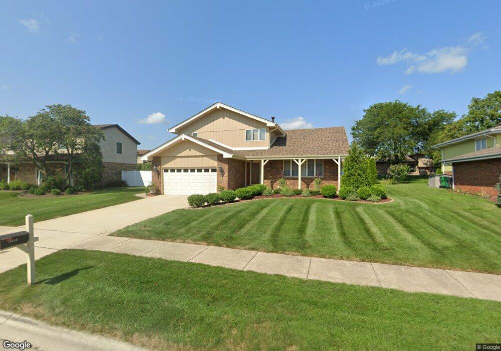
14018 Charleston Dr Orland Park, IL 60462
Silver Lake North NeighborhoodEstimated Value: $449,540 - $499,000
4
Beds
2
Baths
2,382
Sq Ft
$200/Sq Ft
Est. Value
About This Home
This home is located at 14018 Charleston Dr, Orland Park, IL 60462 and is currently estimated at $476,885, approximately $200 per square foot. 14018 Charleston Dr is a home located in Cook County with nearby schools including Orland Park Elementary School, High Point Elementary School, and Orland Jr High School.
Ownership History
Date
Name
Owned For
Owner Type
Purchase Details
Closed on
Jun 26, 2001
Sold by
Founders Bank
Bought by
Monaco Anthony J
Current Estimated Value
Home Financials for this Owner
Home Financials are based on the most recent Mortgage that was taken out on this home.
Original Mortgage
$140,000
Interest Rate
7.22%
Create a Home Valuation Report for This Property
The Home Valuation Report is an in-depth analysis detailing your home's value as well as a comparison with similar homes in the area
Home Values in the Area
Average Home Value in this Area
Purchase History
| Date | Buyer | Sale Price | Title Company |
|---|---|---|---|
| Monaco Anthony J | -- | Lakeshore Title Agency |
Source: Public Records
Mortgage History
| Date | Status | Borrower | Loan Amount |
|---|---|---|---|
| Previous Owner | Monaco Anthony J | $140,000 |
Source: Public Records
Tax History Compared to Growth
Tax History
| Year | Tax Paid | Tax Assessment Tax Assessment Total Assessment is a certain percentage of the fair market value that is determined by local assessors to be the total taxable value of land and additions on the property. | Land | Improvement |
|---|---|---|---|---|
| 2024 | $8,517 | $40,000 | $5,601 | $34,399 |
| 2023 | $7,033 | $40,000 | $5,601 | $34,399 |
| 2022 | $7,033 | $29,634 | $4,837 | $24,797 |
| 2021 | $6,839 | $29,633 | $4,836 | $24,797 |
| 2020 | $6,697 | $29,633 | $4,836 | $24,797 |
| 2019 | $6,633 | $30,338 | $4,327 | $26,011 |
| 2018 | $6,448 | $30,338 | $4,327 | $26,011 |
| 2017 | $6,331 | $30,338 | $4,327 | $26,011 |
| 2016 | $6,207 | $26,524 | $3,818 | $22,706 |
| 2015 | $6,087 | $26,524 | $3,818 | $22,706 |
| 2014 | $6,522 | $26,524 | $3,818 | $22,706 |
| 2013 | $6,538 | $28,140 | $3,818 | $24,322 |
Source: Public Records
Map
Nearby Homes
- 14037 Catherine Dr
- 14121 John Humphrey Dr
- 13904 Virginia Ct
- 9146 W 140th St Unit 3NE
- 9130 W 140th St Unit 2NW
- 9245 Harlowe Ln
- 9114 W 140th St Unit 204
- 14340 Mason Ln
- 9000 W 140th St Unit 90003B
- 14350 Mason Ln
- 14402 S 90th Ct Unit 1A
- 14304 Clearview Ct Unit 8904
- 14445 S La Grange Rd
- 14325 Clearview Dr Unit 14325
- 8820 W 140th St Unit 2A
- 9750 Ravinia Ln Unit 303
- 14540 Birch St
- 13520 Idlewild Dr
- 14656 Green St
- 14040 Boxwood Ln
- 14024 Charleston Dr
- 14012 Charleston Dr
- 14019 Thomas Dr
- 14025 Thomas Dr
- 14013 Thomas Dr
- 14006 Charleston Dr
- 14030 Charleston Dr Unit 3
- 14019 Charleston Dr
- 14031 Thomas Dr
- 14013 Charleston Dr
- 14007 Thomas Dr
- 14025 Charleston Dr
- 14000 Charleston Dr
- 14007 Charleston Dr
- 14036 Charleston Dr
- 14037 Thomas Dr
- 14031 Charleston Dr
- 14022 Thomas Dr
- 14022 Thomas Dr Unit 1