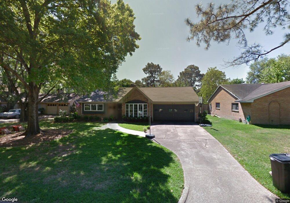
14019 Kingsride Ln Houston, TX 77079
Energy Corridor NeighborhoodEstimated Value: $555,000 - $617,647
3
Beds
2
Baths
1,766
Sq Ft
$334/Sq Ft
Est. Value
About This Home
This home is located at 14019 Kingsride Ln, Houston, TX 77079 and is currently estimated at $590,662, approximately $334 per square foot. 14019 Kingsride Ln is a home located in Harris County with nearby schools including Wilchester Elementary School, Spring Forest Middle School, and Stratford High School.
Ownership History
Date
Name
Owned For
Owner Type
Purchase Details
Closed on
Jul 9, 2012
Sold by
Stinson James I and Stinson Samantha T
Bought by
Hawkins Michael D
Current Estimated Value
Home Financials for this Owner
Home Financials are based on the most recent Mortgage that was taken out on this home.
Original Mortgage
$238,000
Outstanding Balance
$165,218
Interest Rate
3.79%
Mortgage Type
New Conventional
Estimated Equity
$425,444
Purchase Details
Closed on
Dec 21, 2001
Sold by
Pouw King T and Pouw Susan L
Bought by
Stinson James L and Stinson Samantha T
Home Financials for this Owner
Home Financials are based on the most recent Mortgage that was taken out on this home.
Original Mortgage
$131,920
Interest Rate
6.41%
Purchase Details
Closed on
Sep 5, 1996
Sold by
Kerr Deborah Shores and Wommack Deborah Shores
Bought by
Pouw King T and Pouw Susan L
Home Financials for this Owner
Home Financials are based on the most recent Mortgage that was taken out on this home.
Original Mortgage
$81,500
Interest Rate
7.74%
Create a Home Valuation Report for This Property
The Home Valuation Report is an in-depth analysis detailing your home's value as well as a comparison with similar homes in the area
Home Values in the Area
Average Home Value in this Area
Purchase History
| Date | Buyer | Sale Price | Title Company |
|---|---|---|---|
| Hawkins Michael D | -- | Stewart Title Houston Divisi | |
| Stinson James L | -- | Stewart Title | |
| Pouw King T | -- | Texas American Title Company |
Source: Public Records
Mortgage History
| Date | Status | Borrower | Loan Amount |
|---|---|---|---|
| Open | Hawkins Michael D | $238,000 | |
| Previous Owner | Stinson James L | $131,920 | |
| Previous Owner | Pouw King T | $81,500 |
Source: Public Records
Tax History Compared to Growth
Tax History
| Year | Tax Paid | Tax Assessment Tax Assessment Total Assessment is a certain percentage of the fair market value that is determined by local assessors to be the total taxable value of land and additions on the property. | Land | Improvement |
|---|---|---|---|---|
| 2025 | $8,484 | $582,673 | $375,100 | $207,573 |
| 2024 | $8,484 | $542,154 | $375,100 | $167,054 |
| 2023 | $8,484 | $654,226 | $375,100 | $279,126 |
| 2022 | $11,904 | $509,158 | $337,590 | $171,568 |
| 2021 | $12,873 | $528,809 | $315,084 | $213,725 |
| 2020 | $12,010 | $479,334 | $315,084 | $164,250 |
| 2019 | $11,980 | $479,334 | $315,084 | $164,250 |
| 2018 | $4,072 | $416,000 | $315,084 | $100,916 |
| 2017 | $10,883 | $416,000 | $315,084 | $100,916 |
| 2016 | $10,079 | $475,479 | $315,084 | $160,395 |
| 2015 | $6,571 | $475,479 | $315,084 | $160,395 |
| 2014 | $6,571 | $391,047 | $270,072 | $120,975 |
Source: Public Records
Map
Nearby Homes
- 13931 Kingsride Ln
- 14122 Barryknoll Ln
- 14123 Misty Meadow Ln
- 14143 Lost Meadow Ln
- 14151 Lost Meadow Ln
- 14171 Misty Meadow Ln
- 14226 Misty Meadow Ln
- 14228 Misty Meadow Ln
- 14135 Kimberley Ln
- 14213 Lost Meadow Ln
- 14325 Lost Meadow Ln
- 807 Patchester Dr
- 14311 Misty Meadow Ln
- 14322 Misty Meadow Ln
- 1334 Country Place Dr
- 14387 Misty Meadow Ln
- 710 Patchester Dr
- 1310 Country Place Dr
- 1110 W Tri Oaks Ln Unit 157
- 11731 Wickchester Ln
- 14023 Kingsride Ln
- 14015 Kingsride Ln
- 14014 Barryknoll Ln
- 14018 Barryknoll Ln
- 14027 Kingsride Ln
- 14011 Kingsride Ln
- 14010 Barryknoll Ln
- 14022 Barryknoll Ln
- 14022 Kingsride Ln
- 14018 Kingsride Ln
- 14031 Kingsride Ln
- 14007 Kingsride Ln
- 14014 Kingsride Ln
- 14006 Barryknoll Ln
- 14026 Barryknoll Ln
- 14030 Kingsride Ln
- 14010 Kingsride Ln
- 14035 Kingsride Ln
- 14034 Kingsride Ln
- 14030 Barryknoll Ln