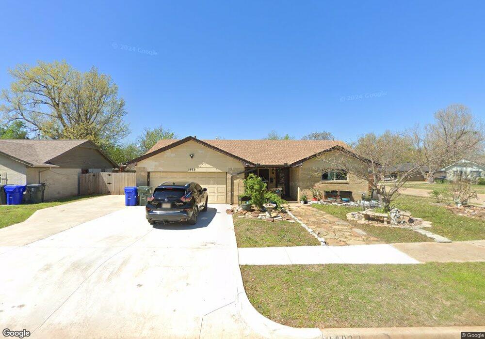
1402 Amhurst Ave Norman, OK 73071
Southeast Norman NeighborhoodEstimated Value: $150,291 - $192,000
3
Beds
2
Baths
1,037
Sq Ft
$158/Sq Ft
Est. Value
About This Home
This home is located at 1402 Amhurst Ave, Norman, OK 73071 and is currently estimated at $163,823, approximately $157 per square foot. 1402 Amhurst Ave is a home located in Cleveland County with nearby schools including Kennedy Elementary School, Irving Middle School, and Norman High School.
Ownership History
Date
Name
Owned For
Owner Type
Purchase Details
Closed on
Oct 24, 2005
Sold by
Moulton Thomas L and Moulton Penelope S
Bought by
Cody Lori M
Current Estimated Value
Home Financials for this Owner
Home Financials are based on the most recent Mortgage that was taken out on this home.
Original Mortgage
$81,307
Outstanding Balance
$42,256
Interest Rate
5.69%
Mortgage Type
FHA
Estimated Equity
$121,567
Create a Home Valuation Report for This Property
The Home Valuation Report is an in-depth analysis detailing your home's value as well as a comparison with similar homes in the area
Home Values in the Area
Average Home Value in this Area
Purchase History
| Date | Buyer | Sale Price | Title Company |
|---|---|---|---|
| Cody Lori M | $82,000 | None Available |
Source: Public Records
Mortgage History
| Date | Status | Borrower | Loan Amount |
|---|---|---|---|
| Open | Cody Lori M | $81,307 |
Source: Public Records
Tax History
| Year | Tax Paid | Tax Assessment Tax Assessment Total Assessment is a certain percentage of the fair market value that is determined by local assessors to be the total taxable value of land and additions on the property. | Land | Improvement |
|---|---|---|---|---|
| 2025 | $1,134 | $10,446 | $2,637 | $7,809 |
| 2023 | $1,031 | $9,585 | $2,675 | $6,910 |
| 2022 | $957 | $9,306 | $1,800 | $7,506 |
| 2021 | $1,009 | $9,306 | $1,800 | $7,506 |
| 2020 | $987 | $9,306 | $1,800 | $7,506 |
| 2019 | $1,004 | $9,306 | $1,800 | $7,506 |
| 2018 | $973 | $9,306 | $1,800 | $7,506 |
| 2017 | $981 | $9,306 | $0 | $0 |
| 2016 | $965 | $9,015 | $1,744 | $7,271 |
| 2015 | $906 | $8,752 | $1,246 | $7,506 |
| 2014 | $914 | $8,752 | $1,246 | $7,506 |
Source: Public Records
Map
Nearby Homes
- 2125 Allenhurst St
- 1515 Oakhurst Ave
- 1603 Oakcrest Ave
- 1301 Whippoorwill Dr
- 3810 Muir Forest Way
- 1409 Castlebay St
- 1404 Peach Tree Ln
- 931 Beaumont Square
- 2613 Glen Oaks Dr
- 2608 Briar Patch Way
- 1711 E Lindsey St Unit 3
- 1723 E Lindsey St Unit 2
- 1723 E Lindsey St Unit 4
- 1725 E Lindsey St Unit 1
- 1715 E Lindsey St Unit 2
- 810 Beaumont Square
- 1301 Hollow Tree Terrace
- 1806 23rd St SE
- 1301 Briar Patch Way
- 1209 Briar Patch Way
- 1406 Amhurst Ave
- 1401 Oakcrest Ave
- 1405 Oakcrest Ave
- 1410 Amhurst Ave
- 2125 Elmhurst Dr
- 2119 Elmhurst Dr
- 1407 Amhurst Ave
- 1403 Amhurst Ave
- 1409 Oakcrest Ave
- 2111 Elmhurst Dr
- 1321 Amhurst Ave
- 1414 Amhurst Ave
- 2105 Elmhurst Dr
- 1317 Amhurst Ave
- 1413 Oakcrest Ave
- 1415 Amhurst Ave
- 1418 Amhurst Ave
- 1313 Amhurst Ave
- 2140 Allenhurst St
Your Personal Tour Guide
Ask me questions while you tour the home.