1402 Roy Malcom Rd Social Circle, GA 30025
Estimated Value: $581,000 - $1,211,778
--
Bed
--
Bath
2,406
Sq Ft
$416/Sq Ft
Est. Value
About This Home
This home is located at 1402 Roy Malcom Rd, Social Circle, GA 30025 and is currently estimated at $1,001,259, approximately $416 per square foot. 1402 Roy Malcom Rd is a home with nearby schools including Harmony Elementary School, Carver Middle School, and Monroe Area High School.
Ownership History
Date
Name
Owned For
Owner Type
Purchase Details
Closed on
Sep 29, 2016
Sold by
Johnie H
Bought by
Brooklyn Jonathan A
Current Estimated Value
Home Financials for this Owner
Home Financials are based on the most recent Mortgage that was taken out on this home.
Original Mortgage
$505,102
Outstanding Balance
$236,743
Interest Rate
3.46%
Mortgage Type
New Conventional
Estimated Equity
$764,516
Purchase Details
Closed on
Sep 27, 2016
Sold by
Ernest C
Bought by
Robinson Johnie H and Robinson Judy
Home Financials for this Owner
Home Financials are based on the most recent Mortgage that was taken out on this home.
Original Mortgage
$505,102
Outstanding Balance
$236,743
Interest Rate
3.46%
Mortgage Type
New Conventional
Estimated Equity
$764,516
Create a Home Valuation Report for This Property
The Home Valuation Report is an in-depth analysis detailing your home's value as well as a comparison with similar homes in the area
Home Values in the Area
Average Home Value in this Area
Purchase History
| Date | Buyer | Sale Price | Title Company |
|---|---|---|---|
| Brooklyn Jonathan A | $555,102 | -- | |
| Robinson Johnie H | $498,095 | -- |
Source: Public Records
Mortgage History
| Date | Status | Borrower | Loan Amount |
|---|---|---|---|
| Open | Brooklyn Jonathan A | $505,102 |
Source: Public Records
Tax History Compared to Growth
Tax History
| Year | Tax Paid | Tax Assessment Tax Assessment Total Assessment is a certain percentage of the fair market value that is determined by local assessors to be the total taxable value of land and additions on the property. | Land | Improvement |
|---|---|---|---|---|
| 2024 | $3,942 | $510,080 | $412,760 | $97,320 |
| 2023 | $3,926 | $483,040 | $392,440 | $90,600 |
| 2022 | $3,926 | $448,880 | $367,160 | $81,720 |
| 2021 | $3,833 | $358,960 | $285,520 | $73,440 |
| 2020 | $3,837 | $319,480 | $247,880 | $71,600 |
| 2019 | $3,699 | $280,400 | $220,200 | $60,200 |
| 2018 | $3,487 | $280,400 | $220,200 | $60,200 |
| 2017 | $8,610 | $249,880 | $191,080 | $58,800 |
| 2016 | $6,741 | $198,520 | $168,200 | $30,320 |
| 2015 | $5,771 | $167,240 | $138,360 | $28,880 |
| 2014 | $5,275 | $149,080 | $0 | $0 |
Source: Public Records
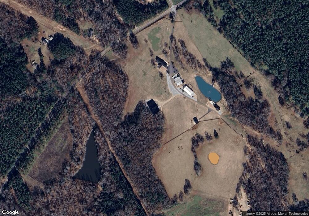
Map
Nearby Homes
- 0 Social Circle Fairplay Rd Unit 7662271
- 0 Social Circle Fairplay Rd Unit 10620284
- 1526 N Cherokee Rd
- 180 River Meadow
- 342 Orwell Drive Lot 95
- 190 Orwell Dr
- 190 Orwell Dr Unit 102
- 4685 Hawkins Academy Rd
- 1302 N Cherokee Rd
- 4841 Partee Trail
- 539 Meadows Ln
- 1013 Amber Stapp Studdard Rd
- 4601 Parkwood Rd
- 684 N Cherokee Rd
- 0 Thurman Baccus Rd Unit 10438526
- 1310 Knox Chapel Rd
- 341 Boxwood St
- 487 N Cherokee Rd
- 4967 Hawkins Academy Rd
- 690 Park Place Way
- 3961 Roy Malcom Spur
- 1429 Roy Malcom Rd
- 0 Roy Malcom Rd Unit 7515590
- 0 Roy Malcom Rd Unit 7445263
- 0 Roy Malcom Rd Unit 7598516
- 0 Roy Malcom Rd Unit 8520407
- 1419 Roy Malcom Rd
- 1431 Roy Malcom Rd
- 3921 Roy Malcom Spur
- 3951 Roy Malcom Spur
- 1338 Social Circle Fairplay Rd
- LOT 1 Social Circle Fairplay Rd
- Track2 Social Circle Fairplay Rd
- Lot 2A Social Circle Fairplay Rd
- Lot 5A Social Circle Fairplay Rd
- LOT 5 Social Circle Fairplay Rd
- Lot 3B Social Circle Fairplay Rd
- Lot 3A Social Circle Fairplay Rd
- Lot 2 Social Circle Fairplay Rd
- 1382 Social Circle Fairplay Rd